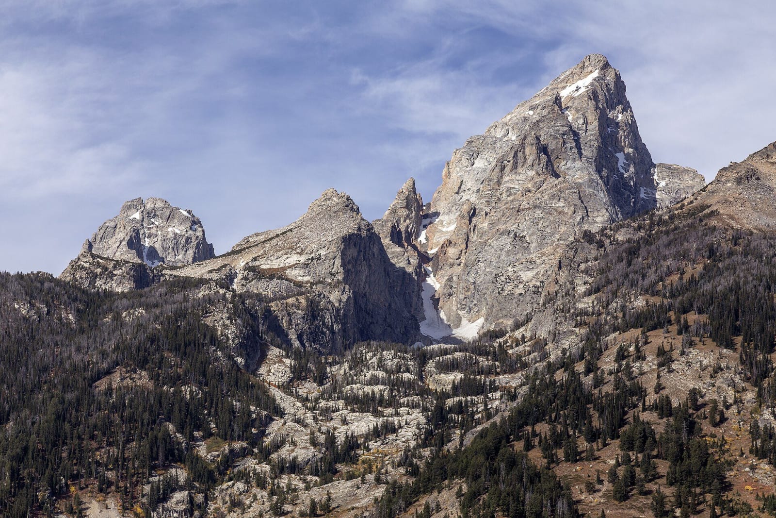
The central Teton Range from below, the Grand Teton rising in a grey granite spire beside Teepe Pillar, Disappointment Peak and Middle Teton, snow in the gullies and forest on the lower slopes
Acroterion / CC BY-SA 4.0 via Wikimedia Commons
A Road Trip Guide

Wyoming

From the geysers of Yellowstone out onto the shortgrass plains — the Tetons standing straight up out of Jackson Hole, Bear Lodge, which the maps call Devils Tower, Oregon Trail ruts cut into the sandstone at Guernsey, the first government anywhere to give women the vote, and the Wind River homeland of the Eastern Shoshone and Northern Arapaho.

45 places · 9 regions · 9 stories · 5 drives · 1 itinerary

All of Wyoming, One Map

Tap any dot to discover what makes a place worth the stop.

Architectural
Cultural
Geological
Historical
Industrial
Natural

Plan a Trip

Day-by-day plans — real drive times, honest overnights, and the permit fine print sorted before you leave.

4-Day Itinerary

Jackson Hole, Yellowstone and Cody in 4 Days

From Jackson up the valley floor and through Yellowstone's geyser country to Cody: a refuge built by photographs, a mountain that fell into a river, a porch where wilderness law was argued, a lobby built in one winter, and the town Buffalo Bill laid out.

Days
4
Distance
341 mi
Best
summer · fall
See the day-by-day →

Scenic Drives

The roads themselves — traced end to end, with the stops worth making along the way.

Scenic Byway

Teton Park Road: Jackson to Moran

Up the valley under the Tetons: Bill Menor's ferry and Maud Noble's chapel at Moose, the lake named for a Newe woman, and the dam that made Jackson Lake a reservoir for Idaho.

Distance
37 mi
Drive
1.5 hrs
Best
Spring · Summer · Fall
Plan this drive →
Scenic Byway

The Emigrant Road: Fort Laramie to South Pass

About three hundred miles of the Oregon, California and Mormon trails across Wyoming, from the fort on the North Platte up the Sweetwater to the crest of the continent.

Distance
305 mi
Drive
6.5 hrs
Best
Spring · Summer · Fall
Plan this drive →
Scenic Byway

US-212: The Beartooth Highway, Red Lodge to Yellowstone

Sixty-eight miles from Red Lodge over the Beartooth Plateau to Yellowstone's northeast gate, half of them in Wyoming: the road's one store, the first national forest, and the river the Nimiipuu reached in 1877.

Distance
68 mi
Drive
2.5 hrs
Best
Summer · Fall
Plan this drive →
Scenic Byway

WY-22 and ID-33: Teton Pass to Teton Valley

The only paved road over the Teton Range: up a ten percent grade from Wilson, past the hairpin that slid off the mountain in 2024, and down into the old Pierre's Hole on the back side of the peaks.

Distance
33 mi
Drive
1 hrs
Best
Spring · Summer · Fall
Plan this drive →
Scenic Byway

WY-530 and UT-44: Green River to Flaming Gorge Dam

South from the railroad town where Powell launched in 1869, along a reservoir that drowned a state-line town and the floors of the first canyons he named, to the dam that made the lake.

Distance
82 mi
Drive
2 hrs
Best
Spring · Summer · Fall
Plan this drive →

Regions of Wyoming

Each region gathers the parks, towns, drives, and roadside stops that define one corner of the state.

Region

Casper & the Oregon Trail

Fort Laramie and the cow that started a generation of war, the ruts worn into Guernsey's sandstone, the Great Register of the Desert, and the lieutenant Casper misspells.

6 places to explore
Explore region →
Region

Cheyenne, Laramie & the Snowy Range

The Union Pacific's summit and the Ames pyramid, Laramie's first women jurors and first woman voter, and the territorial prison that held Butch Cassidy.

5 places to explore
Explore region →
Region

Cody & the Bighorn Basin

The Medicine Wheel on Medicine Mountain, the hot springs Washakie sold on condition they stay free, Buffalo Bill's town and dam, and Heart Mountain's draft resisters.

5 places to explore
Explore region →
Region

Devils Tower & the Black Hills

Bear Lodge, renamed by a mistranslation and made the first national monument, the June climbing closure, Inyan Kara's summit, and the jail that named the Sundance Kid.

4 places to explore
Explore region →
Region

Green River Country & the Red Desert

Bridger and Vasquez's trading post and the fort the Mormons burned, the Rock Springs massacre of 1885, and the pronghorn's six-thousand-year road to the Tetons.

5 places to explore
Explore region →
Region

Jackson Hole & the Tetons

Summer country for five nations, the 1920 town council of women, the valley Rockefeller bought through a front company, and the peaks that rise with no foothills at all.

6 places to explore
Explore region →
Region

Sheridan, Buffalo & the Bighorns

Red Cloud's War on the Bozeman Trail and the forts burned in 1868, the Cheyenne village destroyed on the Red Fork, and the cattlemen's invasion of Johnson County.

5 places to explore
Explore region →
Region

Wind River Country

The reservation the Eastern Shoshone and Northern Arapaho share, the cession of 1905, South Pass and its wagon road, and the gold camp that sent the suffrage bill to Cheyenne.

4 places to explore
Explore region →
Region

Yellowstone

Tukudika country and a quarry whose obsidian reached Ontario, the first national park, the Nimiipuu crossing of 1877, the Army years at Mammoth, and the summer of 1988.

5 places to explore
Explore region →

Stories from Wyoming

The histories behind the places — the people, the disasters, the inventions, and the long memory of the land.

Two spawning Yellowstone cutthroat trout underwater over a bed of rounded stream stones, the nearer one flushed red along its side
Nature

The Fish in the Wrong Lake

Someone moved lake trout into Yellowstone Lake in the 1980s, and they nearly ate out the native cutthroat that bears, ospreys and otters depended on. Three decades of gillnetting are bringing the cutthroat back.

Open Road Guide · Oct 11, 2026 · 4 min read
The Grand Teton and its neighbors in the Cathedral Group seen from the air to the east, snowfields in the high gullies above the forested base
History

The Argument at the Top of the Grand

Two survey men said they reached the summit of the Grand Teton in 1872. A Laramie surveyor said they had not, climbed it himself in 1898, and spent thirty years making the state agree.

Open Road Guide · Oct 11, 2026 · 4 min read
A slab of fibrous grey trona from the Blacks Fork Mine near Granger, its crystals running in fine parallel streaks
Geology

The Dry Lake Under Green River

Beneath the sagebrush west of Green River lie forty-two beds of trona, left by a lake that dried out again and again fifty million years ago. A wildcat oil well found them by accident, and they now supply most of the nation's soda ash.

Open Road Guide · Oct 11, 2026 · 3 min read
The high crest of the Wind River Range white with snow and ice around Gannett Peak, seen across golden autumn grassland in the Green River Basin
Nature

The Ice Above Dinwoody Creek

The Wind River Range holds the largest glaciers in the American Rockies, and their melt runs down through the Wind River Reservation in late summer, when little else does. Every measurement for seventy years says they are shrinking.

Open Road Guide · Oct 11, 2026 · 4 min read
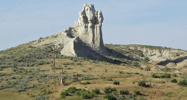
Teapot Rock, a weathered white sandstone knob above sagebrush hills north of Casper, its spout long since broken away
History

The Rock That Named a Scandal

A sandstone knob north of Casper gave its name to an oil reserve set aside for the Navy, and the reserve gave its name to the worst federal scandal of the 1920s.

Open Road Guide · Oct 11, 2026 · 4 min read
The Shoshone River running green through its steep-walled canyon below Buffalo Bill Dam, upstream of the springs the trappers called Colter's Hell
Geology

The Real Colter's Hell

Most people think Colter's Hell is Yellowstone. The trappers' Colter's Hell is a warm, sulfurous stretch of the Shoshone River just west of Cody, and it was never the geyser field its own marker describes.

Open Road Guide · Oct 11, 2026 · 4 min read
All 9 stories from Wyoming →
← Explore another state