
Cody & the Bighorn Basin
The Medicine Wheel on Medicine Mountain, the hot springs Washakie sold on condition they stay free, Buffalo Bill's town and dam, and Heart Mountain's draft resisters.
Near the crest of the Bighorn Mountains, 9,642 feet up on Medicine Mountain east of Lovell, limestone boulders laid in a ring about eighty feet across run in twenty-eight spokes to a central cairn. No one knows who built it or when; pottery found in it has been tied to the Shoshone and the Crow, and the Arapaho call it Hiieeinoonotii. It is a place of ceremony for many nations still, and visitors leave offerings on the fence around it. Designated a National Historic Landmark in 1970, it was renamed the Medicine Wheel/Medicine Mountain National Historic Landmark in 2011 to take in the sacred mountain around it.
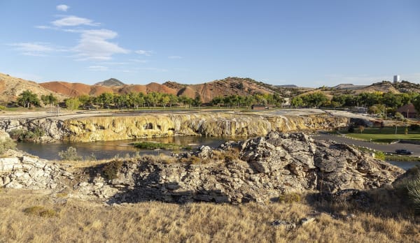
The hot springs at Thermopolis lay inside the Wind River Reservation until 1896, when the Eastern Shoshone and Northern Arapaho, hungry with the bison gone, sold them to the United States for cattle and supplies. Washakie for the Shoshone and Sharp Nose for the Arapaho made the sale, and Washakie's condition was that the water stay free to everyone; the State Bath House still charges nothing. That same year William F. Cody laid out the town that bears his name on the Shoshone River. The federal dam in the canyon above it, finished in 1910 at 325 feet, was the tallest in the world. It was the Shoshone Dam until 1946 and has carried Buffalo Bill's name since.
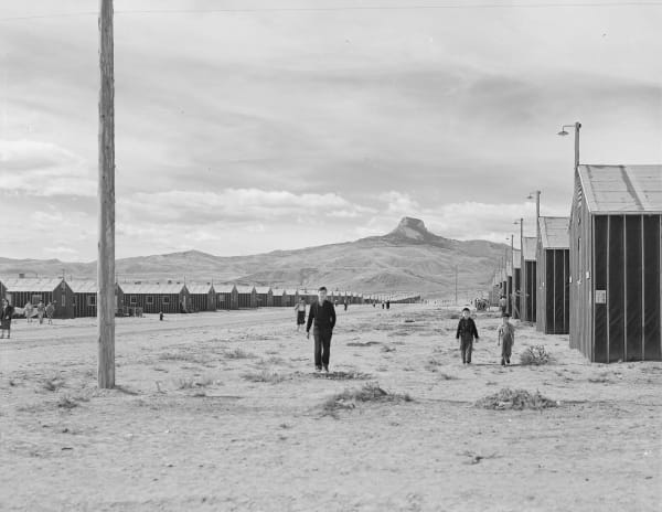
Between August 1942 and November 1945 the War Relocation Authority held 13,997 Japanese Americans behind barbed wire at Heart Mountain, between Cody and Powell; at its peak its 10,767 people made it the third-largest town in Wyoming. When the draft was opened to the camps in 1944, the Heart Mountain Fair Play Committee urged young men to refuse induction from behind the wire to test the government's right to draft them. In June 1944 sixty-three of them were tried together in Cheyenne, the largest mass trial in Wyoming's history, and sentenced to three years in federal prison. President Truman pardoned them in 1947. An interpretive center opened on the camp site in 2011.
What to See in Cody & the Bighorn Basin
5 places across the region, grouped by what they are.
Natural Areas
Historic Sites
Towns & Gateways
Stories from Cody & the Bighorn Basin
Cody & the Bighorn Basin rewards the unhurried. Pick a base, fan out, and let the country between the headline stops surprise you.
← Explore more of Open Road Guide