Two anglers wading the shallow North Platte River below a dry, sage-covered bluff, green brush on the near bank
Bureau of Land Management / CC BY 2.0 via Wikimedia Commons
Wyoming · Region

Casper & the Oregon Trail

Fort Laramie and the cow that started a generation of war, the ruts worn into Guernsey's sandstone, the Great Register of the Desert, and the lieutenant Casper misspells.

6 places to explore

The North Platte country was Lakota, Cheyenne and Arapaho ground long before the fur post of 1834 near the mouth of the Laramie River, which the Army bought in 1849 as Fort Laramie to guard the emigrant road. In August 1854 a Lakota man killed a cow that had strayed from a passing emigrant train. The Brulé leader Conquering Bear offered horses in payment, the owner refused, and on August 19 Lieutenant John Grattan marched into the Lakota camp with about thirty men and two cannon to make an arrest. Grattan and his entire command were killed and Conquering Bear died of his wounds, and the fight is counted the opening of a generation of war on the plains. The treaty that ended Red Cloud's War was signed at Fort Laramie in 1868.

West of the fort, marshy ground along the river pushed the wagons up over a ridge of soft sandstone south of present-day Guernsey, and wheels and hooves cut ruts into it two to six feet deep; a couple of miles away, emigrants carved their names, dates and hometowns into Register Cliff. Independence Rock, a granite dome on the Sweetwater, was the trail's best-known landmark. Trains tried to reach it by the Fourth of July to be sure of clearing the mountains before snow, and by 1841 so many names had been carved, painted or daubed on it in buffalo grease that the missionary Pierre-Jean De Smet called it the Great Register of the Desert.

In July 1865, eight months after the Sand Creek Massacre in Colorado, Lakota and Cheyenne warriors gathered against the post guarding the trail's bridge over the North Platte. On July 26 they cut off a detachment under Lieutenant Caspar Collins, who was killed with four of his men, then destroyed an Army wagon train on its way in, killing twenty more soldiers. In November the Army renamed the post Fort Casper, misspelling his first name, and the town that grew up beside it kept the error. The fort, rebuilt in the 1930s, is spelled Fort Caspar.

What to See in Casper & the Oregon Trail

6 places across the region, grouped by what they are.

Historic Sites

The reconstructed Guinard toll bridge at Fort Caspar, a timber deck on log cribs crossing a dry channel toward a covered wagon, cottonwoods behind

Fort Caspar Museum

Casper

The crossing before the fort: the Mormon ferry of 1847 and Guinard's toll bridge of 1859, rebuilt beside the 1936 log station.

View details →
The restored Captain's Quarters at Fort Laramie, a white clapboard house with dormers and a long front porch, autumn cottonwoods beyond

Fort Laramie National Historic Site

Fort Laramie

Old Bedlam, the officers' quarters of 1849, survived the auction that scattered the rest of the post; an 1875 Army bridge still crosses the river.

View details →
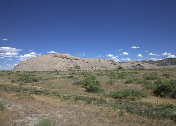
Independence Rock, a long grey granite dome rising out of sagebrush flats, seen from the west under a deep blue sky

Independence Rock State Historic Site

Alcova

A granite whaleback named before the wagons came, by trappers in 1824 or Sublette in 1830, and polished by wind until it took names easily.

View details →
A wagon track worn deep into pale sandstone climbing a grassy ridge near Guernsey, pines on the crest

Oregon Trail Ruts State Historic Site

Guernsey

The clearest wagon ruts on the trail, worn by iron tires and cut deeper by travelers who hacked at the ledge to get their wagons over.

View details →
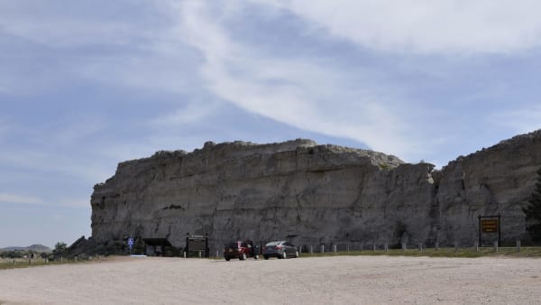
Register Cliff, a long pale sandstone bluff above a gravel parking area near Guernsey, a few cars at its foot

Register Cliff State Historic Site

Guernsey

The first camp out of Fort Laramie, where the oldest date on the rock reads 1829 and three emigrants never left.

View details →
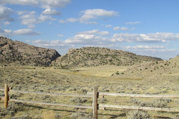
The notch of Devil's Gate cut through a granite ridge, seen across sagebrush range behind a rail fence

Sun Ranch and Devil's Gate

Alcova

Tom Sun's 1872 cattle ranch at Devil's Gate, sold in 1996 to the church for whom the cove nearby is sacred, and the fight over who should hold that cove.

View details →

Scenic Drives through Casper & the Oregon Trail

Scenic Byway

The Emigrant Road: Fort Laramie to South Pass

About three hundred miles of the Oregon, California and Mormon trails across Wyoming, from the fort on the North Platte up the Sweetwater to the crest of the continent.

305 mi · 6.5 hrs

Stories from Casper & the Oregon Trail

History

The Rock That Named a Scandal

A sandstone knob north of Casper gave its name to an oil reserve set aside for the Navy, and the reserve gave its name to the worst federal scandal of the 1920s.

4 min read

Casper & the Oregon Trail rewards the unhurried. Pick a base, fan out, and let the country between the headline stops surprise you.

← Explore more of Open Road Guide