Home / Oregon / The South Oregon Coast / Shore Acres State Park
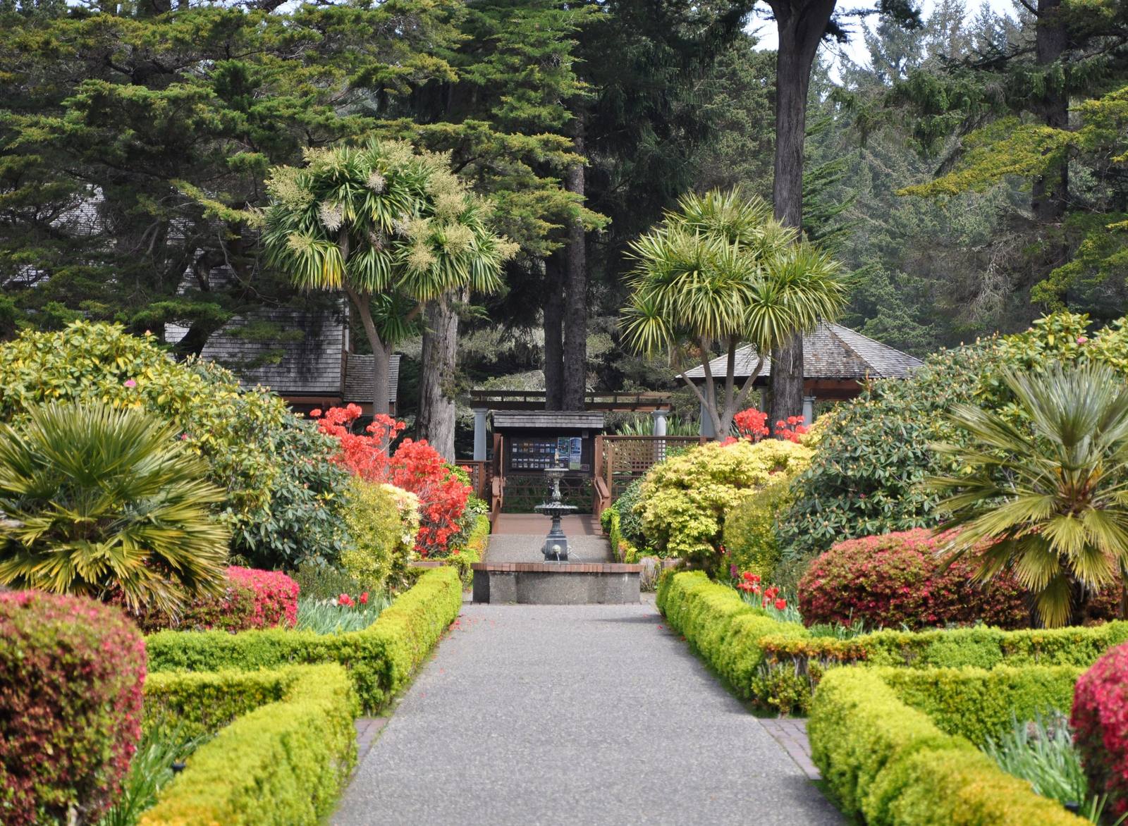
Clipped hedges and spring flowerbeds lining a path through the formal garden at Shore AcresFinetooth / CC BY-SA 3.0 via Wikimedia Commons
🏗️Architectural

Shore Acres State Park

Part ofThe South Oregon Coast

A timber family's clifftop estate whose mansion burned three months after its mistress died, whose larger replacement the state could not keep, and whose gardens it did.

WinterPhotography
⏱
Duration
An hour for the garden and the observation building.
📅
Best Season
Winter for storm waves; spring and summer for the garden; Thanksgiving to New Year's for the lights.

The Story

Louis Simpson was the son of Asa Simpson, the shipping and timber magnate who founded North Bend on Coos Bay, and around 1906 he bought the sandstone cliffs south of Cape Arago for a country estate. He built a three-story mansion with an indoor swimming pool facing the sea and five acres of formal gardens behind it, planted with things brought from around the world on the family's ships, including a Japanese garden around a lily pond a hundred feet long. His wife Cassie fell ill in 1920 and died in April 1921. That July the mansion burned.

Simpson started over, building a second house, two stories and 224 feet long, just as his fortune began to fail. Financial losses and the Depression ruined him, and in 1942 he sold Shore Acres to the State of Oregon for a park. The second mansion deteriorated and was torn down in 1948; the gardens, and the gardener's cottage, survived. In 1970 the state began restoring the garden, and today it is planted to bloom in every season, with a rose-testing plot and the Japanese lily pond. Since 1987 volunteers have hung holiday lights through it from Thanksgiving to New Year's.

Where the houses stood, an enclosed observation building looks over the cliffs. In winter, storm swells break against the tilted sandstone below and throw spray high up the cliffs, and from December into June gray whales pass offshore. A trail drops to Simpson Beach, a small cove below the gardens; Sunset Bay is a mile north, and Cape Arago, with sea lions and seals on Simpson Reef, a mile south.

Visitor Info

⏱
Time Needed
An hour for the garden and the observation building.
📅
Best Season
Winter for storm waves; spring and summer for the garden; Thanksgiving to New Year's for the lights.
🛣️
Highway
Cape Arago Highway

On the Map

Nearby

The closest stops worth working into your route

historical14 mi away
Bandon
A town at the mouth of the Coquille built near the site of an 1854 massacre, named for a town in Ireland, and burned in 1936 by the Irish gorse its founder planted.
historical34 mi away
Cape Blanco Lighthouse
The westernmost light in Oregon, kept for decades by two men who spent their whole careers on the cape and, from 1903, by the state's first woman keeper.
natural37 mi away
Oregon Dunes
Forty miles of moving sand that Frank Herbert came to write about in 1957, and a government project to stop them that gave him Dune and is now being undone.
historical40 mi away
Battle Rock
Port Orford's founding legend, named for a battle by the man who fired the cannon and remembered by another witness, and by the people it happened to, as something else.
historical66 mi away
Wolf Creek Inn
A stage-road hotel built in 1883 for the overnight stop on the sixteen-day run between San Francisco and Portland, still taking guests under state ownership.
geological94 mi away
The Table Rocks
Two horseshoe mesas the Takelma called Ti'tanak, where the 1853 treaty was signed at the foot of one, with a wildflower on top that grows nowhere else.

Historical markers nearby

Roadside plaques and monuments within a short detour

Marker7.4 mi away
Shifting Sands - Sand Dunes
Marker7.4 mi away
The Coos People
Marker7.4 mi away
Coos Bay - Explore More
Marker7.4 mi away
The Hollering Place
Marker9.3 mi away
Southern Oregon Coast Region
Marker9.5 mi away
Beaver Hill Mine