Home / Oregon / The South Oregon Coast / Bandon
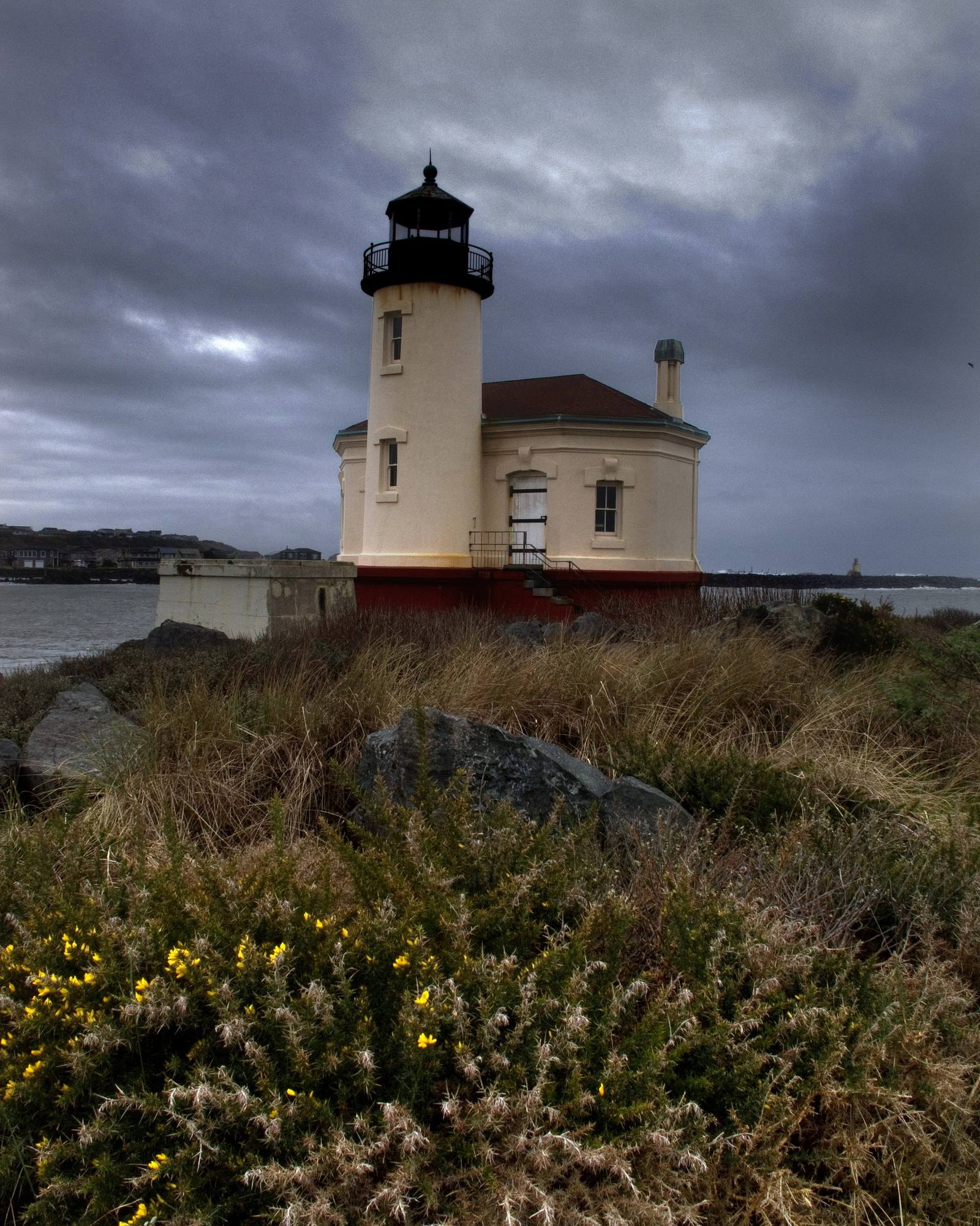
The Coquille River lighthouse at the river's mouth in Bandon, flowering scrub in the foreground under a storm skysmyr1 / CC BY 3.0 via Wikimedia Commons
🏛️Historical

Bandon

Part ofThe South Oregon Coast
On this driveU.S. 101: The Wild Rivers Crossing

A town at the mouth of the Coquille built near the site of an 1854 massacre, named for a town in Ireland, and burned in 1936 by the Irish gorse its founder planted.

Year-RoundPhotographyNative American Heritage
⏱
Duration
An hour in Old Town; half a day with the beach loop and the lighthouse.
📅
Best Season
Year-round; summer is foggy, and fall is often the clearest season on this coast.

The Story

The mouth of the Coquille River was the home of the Nasomah band of the Coquille, whose plank-house village stood on both banks a short way upstream. Gold in the beach sands brought miners in 1853, and on January 28, 1854, about forty of them, organized two days earlier as volunteers over a list of minor complaints, attacked the village as its people slept, killing about sixteen and burning their houses. The Indian agent who arrived afterward called it a massacre too inhuman to be readily believed. The Coquille were later moved north to the Coast Reservation; a sacred rock at the river mouth, Tupper Rock, was later blasted for the jetty. The federal government restored the Coquille Indian Tribe in 1989, and the tribe celebrated it here, near the Nasomah village site, which a small park in town now memorializes.

In 1873 George Bennett arrived from Bandon in County Cork, talked his neighbors into taking his hometown's name, and planted gorse, the yellow-flowering, oily shrub of Irish hedges. It spread over the hills and into the vacant lots. On September 26, 1936, a forest fire east of town reached it, and the gorse went up as if it had been doused with gasoline; water only scattered the burning branches. Ten or eleven people died, by different counts, and most of the town burned, the whole business district with it.

Bandon rebuilt, and gorse still covers thousands of acres of southwest Oregon. Old Town lines the harbor; south of it, Beach Loop Drive runs above Coquille Point, Face Rock and a beach full of sea stacks. Across the river the Coquille River Lighthouse, lit in 1896, stands in Bullards Beach State Park, and cranberry bogs surround the town.

Visitor Info

⏱
Time Needed
An hour in Old Town; half a day with the beach loop and the lighthouse.
📅
Best Season
Year-round; summer is foggy, and fall is often the clearest season on this coast.
🛣️
Highway
US-101

On the Map

Nearby

The closest stops worth working into your route

architectural14 mi away
Shore Acres State Park
A timber family's clifftop estate whose mansion burned three months after its mistress died, whose larger replacement the state could not keep, and whose gardens it did.
historical21 mi away
Cape Blanco Lighthouse
The westernmost light in Oregon, kept for decades by two men who spent their whole careers on the cape and, from 1903, by the state's first woman keeper.
historical26 mi away
Battle Rock
Port Orford's founding legend, named for a battle by the man who fired the cannon and remembered by another witness, and by the people it happened to, as something else.
natural51 mi away
Oregon Dunes
Forty miles of moving sand that Frank Herbert came to write about in 1957, and a government project to stop them that gave him Dune and is now being undone.
historical59 mi away
Wolf Creek Inn
A stage-road hotel built in 1883 for the overnight stop on the sixteen-day run between San Francisco and Portland, still taking guests under state ownership.
geological87 mi away
The Table Rocks
Two horseshoe mesas the Takelma called Ti'tanak, where the 1853 treaty was signed at the foot of one, with a wildflower on top that grows nowhere else.

Historical markers nearby

Roadside plaques and monuments within a short detour

Marker10 mi away
Beaver Hill Mine
Marker12 mi away
Spruce Soldiers
Marker20 mi away
Southern Oregon Coast Region
Marker20 mi away
Coos Bay - Explore More
Marker20 mi away
Shifting Sands - Sand Dunes
Marker20 mi away
The Coos People