Home / Oregon / Southern Oregon / The Table Rocks
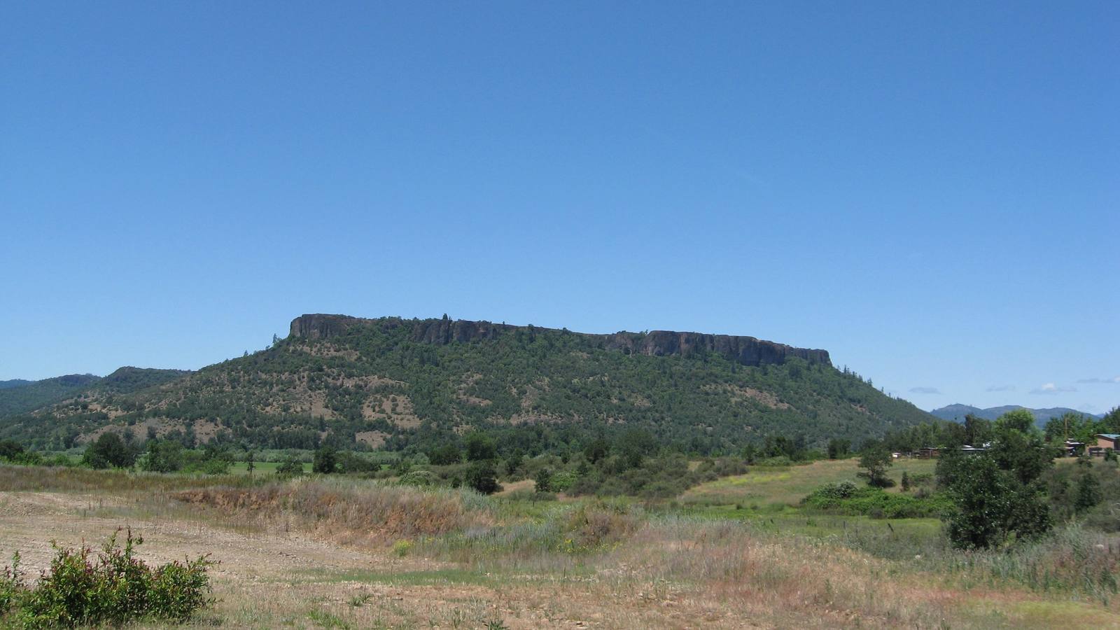
Lower Table Rock seen from the south, its flat andesite cap rimmed by cliffs above wooded slopes and dry grassZabMilenko / CC BY 3.0 via Wikimedia Commons
🏜️Geological

The Table Rocks

Part ofSouthern Oregon

Two horseshoe mesas the Takelma called Ti'tanak, where the 1853 treaty was signed at the foot of one, with a wildflower on top that grows nowhere else.

Native American HeritageSpringHiking
⏱
Duration
Two to three hours for either rock.
📅
Best Season
March through May for the wildflowers and full vernal pools; summer afternoons are hot and shadeless.

The Story

The Table Rocks rise nearly 800 feet out of the Rogue Valley north of Medford, two horseshoe-shaped mesas capped with andesite lava about seven million years old. The lava once covered far more ground; the Rogue River has carried more than ninety percent of it away, and the Table Rocks stand because their hard caps kept the softer sediments beneath them from wearing down. The Takelma called them Ti'tanak, a name whose meaning has been lost, and dug camas along the creeks below.

The valley's treaty history is pinned to this ground. On September 10, 1853, after a summer of fighting between miners and the Takelma, a council at the east base of Lower Table Rock produced a treaty that gave up most of the valley and set aside a small reservation around the rocks, with Fort Lane built nearby. It lasted barely three years, ending in the war of 1855 and 1856 and the removal of the survivors north to the Coast Reservation.

On top, the andesite does not let water through, and in winter and spring rain collects in shallow vernal pools. Fairy shrimp hatch in them, and around their edges blooms the dwarf woolly meadowfoam, a tiny white wildflower found only on these two mesas. The Bureau of Land Management and The Nature Conservancy have owned nearly all of both rocks since the 1980s. A trail climbs each, roughly three miles round trip and 750 feet of gain, open year-round; on top, stay on the path, because the pools are easy to trample. Lower Table Rock's summit still carries the outline of an old airstrip, and concrete pillboxes from army live-fire training stand near the base of Upper Table Rock.

Visitor Info

⏱
Time Needed
Two to three hours for either rock.
📅
Best Season
March through May for the wildflowers and full vernal pools; summer afternoons are hot and shadeless.
🛣️
Highway
I-5

On the Map

Nearby

The closest stops worth working into your route

historical11 mi away
Jacksonville and the Britt Gardens
The gold camp a Swiss photographer walked into in 1852 pulling his camera on a cart, and the hillside where his 1862 sequoia now shades a summer music festival.
cultural22 mi away
Oregon Shakespeare Festival
A summer Shakespeare season that grew from one roofless 1935 performance into one of the country's largest repertory theaters, then had to ask for an emergency rescue in 2023.
historical28 mi away
Wolf Creek Inn
A stage-road hotel built in 1883 for the overnight stop on the sixteen-day run between San Francisco and Portland, still taking guests under state ownership.
geological35 mi away
Oregon Caves
A cave of marble rather than limestone, found in 1874 by a hunter who followed his dog in by matchlight and found his way out by the sound of a stream.
architectural51 mi away
Crater Lake Lodge
A hotel on the caldera rim that opened in 1915 with tar paper on its walls, was never quite finished, came close to demolition, and is now mostly new behind its old face.
historical51 mi away
Watchman Lookout
A 1932 fire lookout on an 8,013-foot rim peak, built to watch for smoke and to teach hikers at the same time, straight above Wizard Island.