Home / Oregon / The Columbia River Gorge & Mount Hood / Rowena Crest and the Tom McCall Preserve
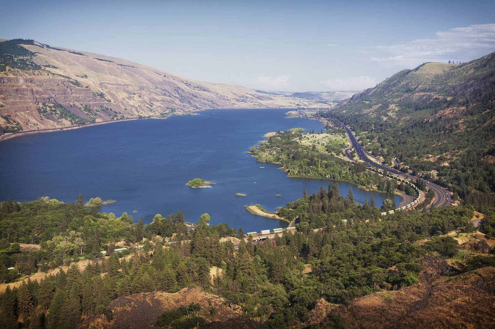
The Columbia River east from Rowena Crest, the gorge opening into dry hills and the old highway belowSteven Pavlov / CC BY-SA 4.0 via Wikimedia Commons
🏜️Geological

Rowena Crest and the Tom McCall Preserve

Part ofThe Columbia River Gorge & Mount Hood
On this driveThe Historic Columbia River Highway: Troutdale to The Dalles

A crest where the Ice Age floods jammed against a basalt promontory, above a plateau of mounds no one has fully explained, and a few in the parking loop that the highway department built.

Scenic DrivingPhotographySpringHiking
⏱
Duration
Fifteen minutes at the viewpoint; an hour on the plateau trail; two to three hours to Tom McCall Point and back.
📅
Best Season
Mid-March through May for wildflowers; the Tom McCall Point trail is closed November through February.

The Story

At Rowena the old highway climbs out of the forest onto open grassland, then drops off the edge of the Rowena Plateau in a stack of hairpin loops. The crest stands nearly 700 feet over the river at the upstream end of the plateau, a promontory of Columbia River basalt that pushes into the channel and pinches the Gorge into the Rowena Gap. Toward the end of the last ice age the Missoula floods came down the Columbia again and again as a glacial dam in Montana failed and re-formed. Here the water jammed against the promontory, backed up into a temporary lake over The Dalles basin, and poured across the plateau, scouring it to bedrock and leaving ponds where whirlpools bored into the rock.

What the floods left is strange. The plateau is covered in low, evenly spaced humps of fine soil, called mima or biscuit mounds, and geologists still disagree about how they formed. The mounds in the middle of the viewpoint's roundabout are the one known exception: the Oregon Department of Transportation built them to match the rest.

The Nature Conservancy and Oregon State Parks look after the land as the Tom McCall Preserve, named for the governor whose conservation work helped protect the Gorge. A short, nearly level trail crosses the plateau past the flood ponds to the cliff edge; a steeper one climbs about a thousand feet in a mile and a half to Tom McCall Point and a view of Mount Hood. From March into May the grassland turns yellow with balsamroot and blue with lupine. The trail to Tom McCall Point closes from November through February; dogs are not allowed on either trail, and rattlesnakes are.

Visitor Info

⏱
Time Needed
Fifteen minutes at the viewpoint; an hour on the plateau trail; two to three hours to Tom McCall Point and back.
📅
Best Season
Mid-March through May for wildflowers; the Tom McCall Point trail is closed November through February.
🛣️
Highway
Historic Columbia River Highway

On the Map

Nearby

The closest stops worth working into your route

cultural16 mi away
Celilo Village
The village that stayed on the bluff above the drowned falls, rebuilt half a century late by the government that flooded them, where the salmon season still opens each April.
industrial31 mi away
Bonneville Dam
The first federal dam on the Columbia, where someone has counted the fish climbing its ladders every year since 1938, beside an island the Corps used as a dump for forty years.
architectural31 mi away
Timberline Lodge
A lodge raised by hand by relief workers in 1936-38, from boulders off the mountain and iron forged from old railroad rails, and dark for an unpaid power bill less than twenty years later.
natural40 mi away
Multnomah Falls
A 620-foot double waterfall whose 1925 stone lodge survived because firefighters kept it soaked while the forest burned around it in September 2017.
architectural47 mi away
Vista House at Crown Point
A rest stop on a basalt point 733 feet above the Columbia, budgeted at $12,000, finished for about $100,000, and mocked for years as Oregon's most expensive outhouse.
cultural64 mi away
The Museum at Warm Springs
Oregon's first tribal museum, built because the three tribes of Warm Springs watched their families' heirlooms leaving the reservation and decided to buy them back.

Historical markers nearby

Roadside plaques and monuments within a short detour

Marker10 mi away
Oregon Nisei Veterans WWII Memorial Highway
Marker17 mi away
Ancient Indian Fishing Grounds
Marker19 mi away
Deschutes River Crossing