Home / Oregon / The Columbia River Gorge & Mount Hood / Multnomah Falls
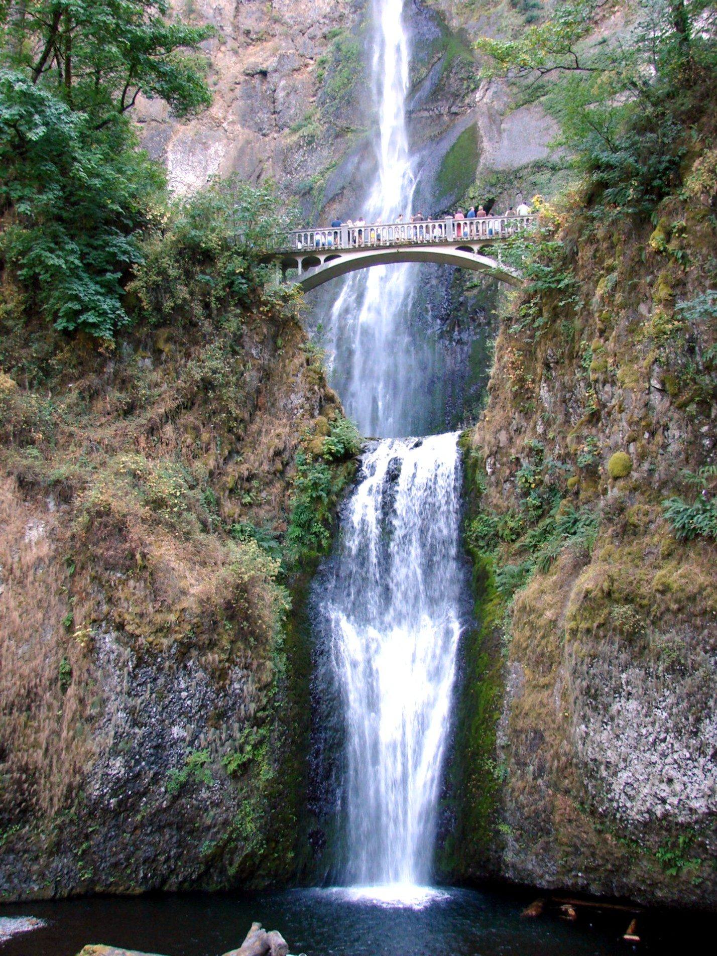
Multnomah Falls dropping in two tiers, the 1914 Benson footbridge spanning the gap between theminkknife_2000 / CC BY-SA 2.0 via Wikimedia Commons
🌲Natural

Multnomah Falls

Part ofThe Columbia River Gorge & Mount Hood
On this driveThe Historic Columbia River Highway: Troutdale to The Dalles

A 620-foot double waterfall whose 1925 stone lodge survived because firefighters kept it soaked while the forest burned around it in September 2017.

IconicPhotographyHiking
⏱
Duration
Half an hour to the bridge and back; two hours to the top.
📅
Best Season
Winter and spring for the fullest flow; a weekday morning any time to avoid the crowd.

The Story

Multnomah Creek drops off the basalt rim of the Gorge in two falls, 620 feet in all, the tallest waterfall in Oregon, and a million or more people a year walk up to look at it. Simon Benson, the timber man who also paid for much of the old highway's scenery, gave the land, and his name is on the concrete footbridge built across the gap between the upper and lower falls in 1914. The stone lodge at the foot dates from 1925; it passed to the Forest Service in 1939 and still houses a restaurant and visitor center.

On the afternoon of September 2, 2017, a fifteen-year-old hiking the Eagle Creek Trail, about a dozen miles east, threw fireworks into the canyon during a burn ban. Two nights later the wind drove the fire west to the falls. Structural crews from the Oregon State Fire Marshal's office, with engines, a ladder truck and water tenders, kept the lodge wet through a storm of embers while the big trees around it torched; by the evening of September 5 the worst had passed. The fire burned some 48,000 acres, shut Interstate 84 for days and much of the Gorge's trail network for years. In 2018 a judge ordered the boy to pay $36.6 million in restitution, acknowledging in the same ruling that he could never pay it in full.

The burned slopes above the falls are greening again, and the Forest Service has strung rockfall fencing on the cliff behind the lodge. A short paved walk climbs to the Benson Bridge; the trail beyond switchbacks to the top. From late spring into early fall a timed-entry permit is often required to park at the falls, so check before you go.

Visitor Info

⏱
Time Needed
Half an hour to the bridge and back; two hours to the top.
📅
Best Season
Winter and spring for the fullest flow; a weekday morning any time to avoid the crowd.
📍
Location
53000 E Historic Columbia River Hwy, Corbett, OR 97019
🛣️
Highway
I-84

On the Map

Nearby

The closest stops worth working into your route

architectural6.7 mi away
Vista House at Crown Point
A rest stop on a basalt point 733 feet above the Columbia, budgeted at $12,000, finished for about $100,000, and mocked for years as Oregon's most expensive outhouse.
industrial9.5 mi away
Bonneville Dam
The first federal dam on the Columbia, where someone has counted the fish climbing its ladders every year since 1938, beside an island the Corps used as a dump for forty years.
architectural26 mi away
Timberline Lodge
A lodge raised by hand by relief workers in 1936-38, from boulders off the mountain and iron forged from old railroad rails, and dark for an unpaid power bill less than twenty years later.
historical28 mi away
Vanport
Briefly Oregon's second-largest city, built in about 110 days for Kaiser's shipyard workers, washed away in an afternoon in 1948, and later renamed out of existence.
historical28 mi away
McLoughlin House
The retirement house of the Hudson's Bay man who supplied the Oregon Trail's starving arrivals, saved from a paper mill's lot in 1909 and hauled up the bluff to a park he had given the town.
natural29 mi away
Willamette Falls
A horseshoe of basalt across the Willamette, ringed by a century of mills, that is still one of the last places in the Columbia basin where tribes gather lamprey by hand.

Historical markers nearby

Roadside plaques and monuments within a short detour

Marker8 mi away
River Highway
Marker8.6 mi away
Beacon Rock
Marker13 mi away
Sandy River Bridge
Marker13 mi away
Troutdale
Marker24 mi away
Laurel Hill
Marker28 mi away
Vanport