Home / Oregon / The Columbia River Gorge & Mount Hood / Bonneville Dam
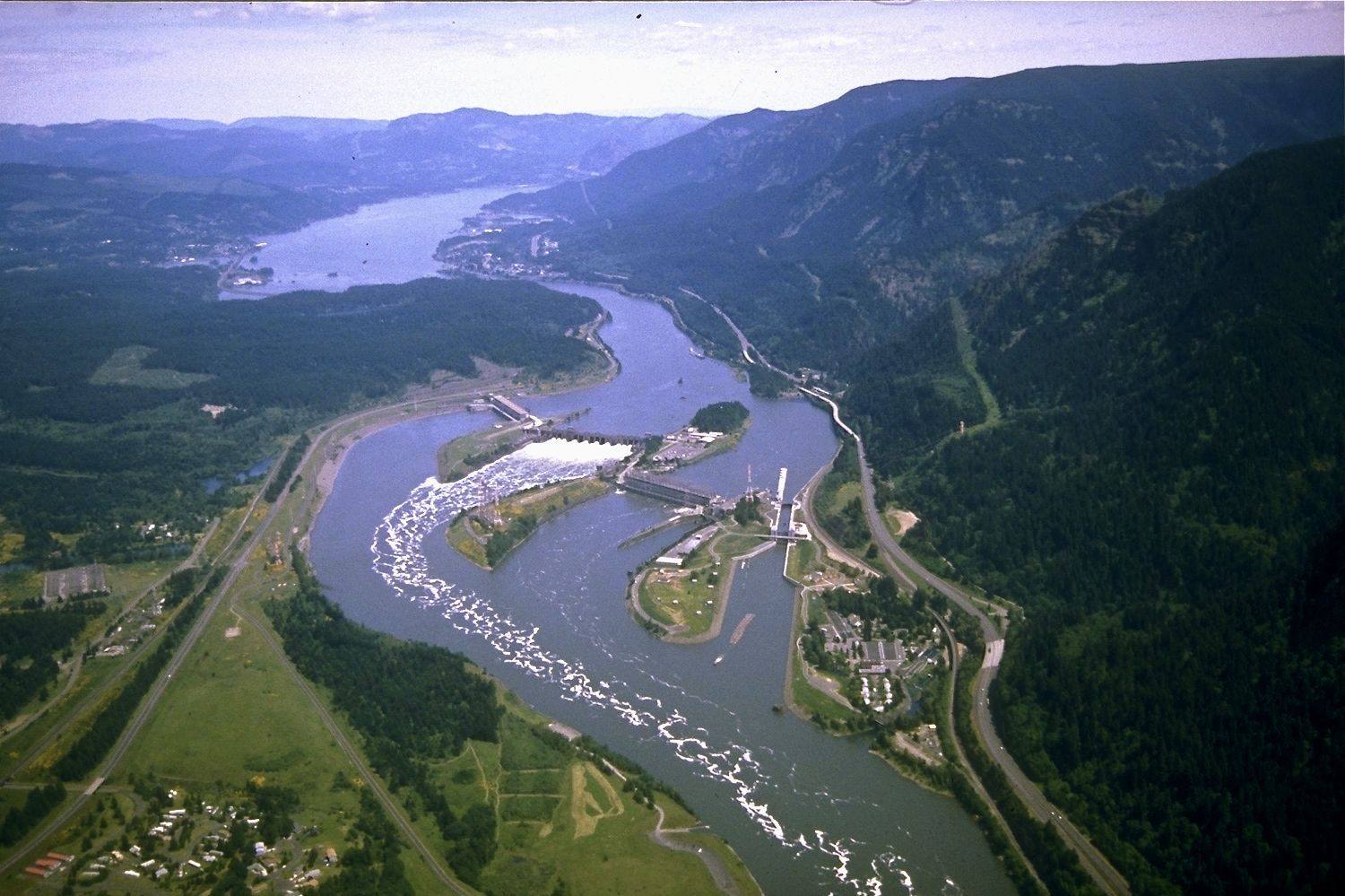
Aerial view east up the Columbia over Bonneville Lock and Dam, the spillway and powerhouses spanning the river between forested wallsU.S. Army Corps of Engineers / public domain via Wikimedia Commons
🏭Industrial

Bonneville Dam

Part ofThe Columbia River Gorge & Mount Hood
On this driveThe Historic Columbia River Highway: Troutdale to The Dalles

The first federal dam on the Columbia, where someone has counted the fish climbing its ladders every year since 1938, beside an island the Corps used as a dump for forty years.

Native American Heritage
⏱
Duration
An hour for the visitor center and windows; another half hour at the hatchery.
📅
Best Season
April through September for the most fish at the windows; spring chinook and summer sockeye runs are the peaks.

The Story

Before 1938 the Columbia ran through the Cascade Rapids a few miles above here, the white water that stopped canoes and steamboats, forced Oregon Trail emigrants into a portage, and had been fished and traded around by Chinookan villages for a very long time. Bonneville Dam, built by the Army Corps of Engineers in the 1930s, the first federal lock and dam on the river, put the rapids under its reservoir, and with them some thirty-seven tribal fishing sites by the government's own later count.

The dam was built with fish ladders, long staircases of pools that let salmon and steelhead climb past it, and the Bradford Island visitor center on the Oregon side puts you below the waterline beside one. Through the windows chinook, sockeye, coho, steelhead, shad and lamprey work upstream, and nearby a counter logs every fish by species, as someone has each year since the ladders opened. Those counts are much of how the Northwest knows what has become of its salmon. Downstream, the Bonneville Fish Hatchery keeps white sturgeon in a viewing pond, the largest of them, Herman, more than ten feet long.

The island has another history. From 1942 to 1982 the Corps used its east end as a landfill and dumped electrical equipment into the river off its northeast corner, some of it loaded with PCBs, which build up in fish. Fish caught near the island have carried some of the highest PCB levels measured in the country, and health authorities warn against eating resident fish from this stretch. After petitions from the Yakama Nation and the Oregon and Washington environmental agencies, the EPA listed Bradford Island as a Superfund site on March 17, 2022.

Visitor Info

⏱
Time Needed
An hour for the visitor center and windows; another half hour at the hatchery.
📅
Best Season
April through September for the most fish at the windows; spring chinook and summer sockeye runs are the peaks.
🛣️
Highway
I-84

On the Map

Nearby

The closest stops worth working into your route

natural9.5 mi away
Multnomah Falls
A 620-foot double waterfall whose 1925 stone lodge survived because firefighters kept it soaked while the forest burned around it in September 2017.
architectural16 mi away
Vista House at Crown Point
A rest stop on a basalt point 733 feet above the Columbia, budgeted at $12,000, finished for about $100,000, and mocked for years as Oregon's most expensive outhouse.
architectural24 mi away
Timberline Lodge
A lodge raised by hand by relief workers in 1936-38, from boulders off the mountain and iron forged from old railroad rails, and dark for an unpaid power bill less than twenty years later.
geological31 mi away
Rowena Crest and the Tom McCall Preserve
A crest where the Ice Age floods jammed against a basalt promontory, above a plateau of mounds no one has fully explained, and a few in the parking loop that the highway department built.
historical37 mi away
Vanport
Briefly Oregon's second-largest city, built in about 110 days for Kaiser's shipyard workers, washed away in an afternoon in 1948, and later renamed out of existence.
historical38 mi away
McLoughlin House
The retirement house of the Hudson's Bay man who supplied the Oregon Trail's starving arrivals, saved from a paper mill's lot in 1909 and hauled up the bluff to a park he had given the town.

Historical markers nearby

Roadside plaques and monuments within a short detour

Marker0.9 mi away
Beacon Rock
Marker17 mi away
River Highway
Marker21 mi away
Oregon Nisei Veterans WWII Memorial Highway
Marker22 mi away
Sandy River Bridge
Marker22 mi away
Troutdale
Marker24 mi away
Laurel Hill