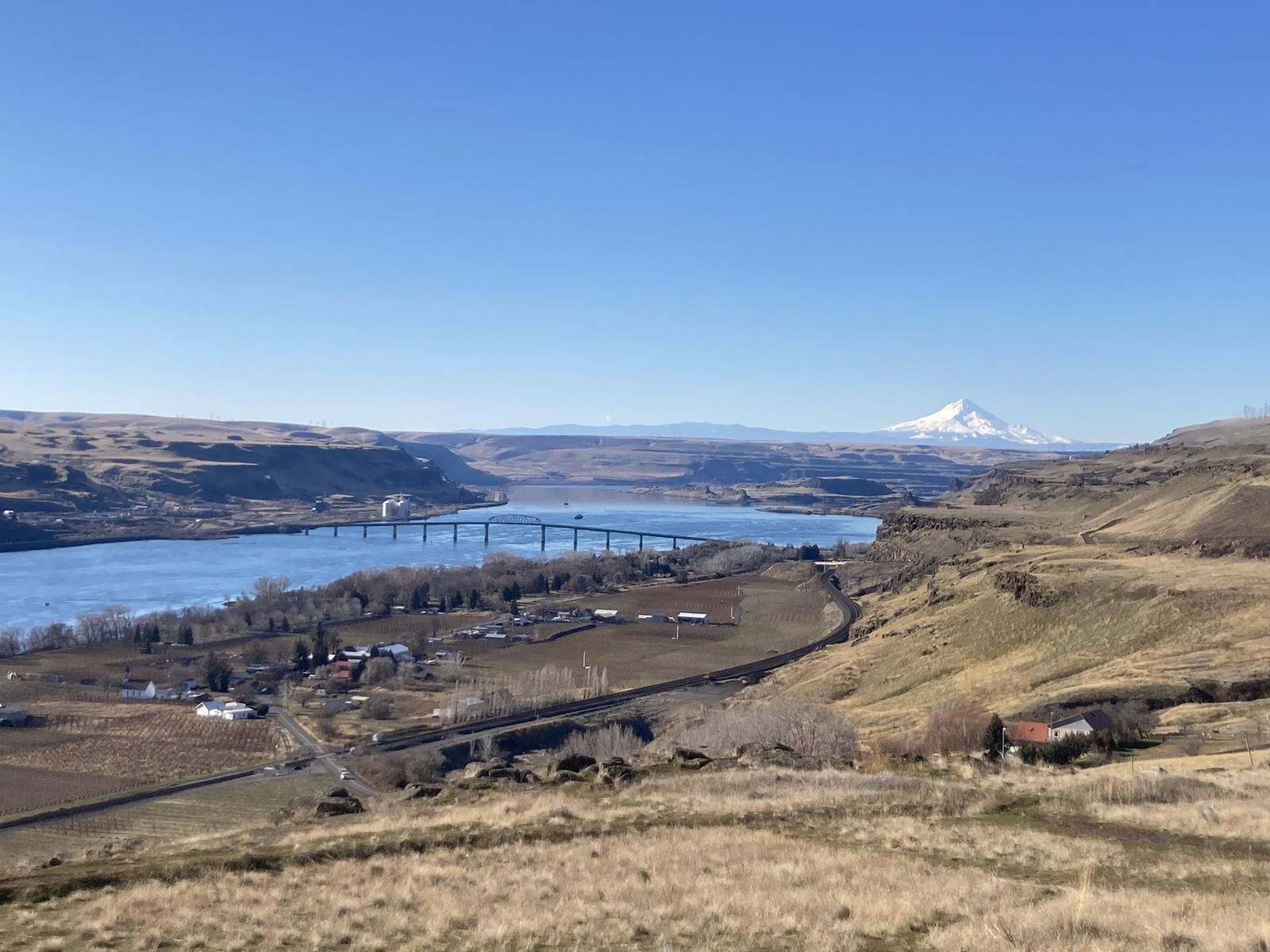
Mount Hood white on the horizon above the Columbia River east of The Dalles, dry grassland and a highway bridge in the foreground
Mattsjc / CC BY 4.0 via Wikimedia Commons
Oregon · Region

The Columbia River Gorge & Mount Hood

Wasco and Wishram country on the Columbia — Celilo Falls, drowned in 1957, the first scenic highway in America past Multnomah Falls, Sam Barlow's toll road around Mount Hood, and Timberline Lodge.

6 places to explore

For eleven thousand years and more, the river was the economy here. The Columbia forced its way through the Cascades over a run of rapids and falls, and at Celilo, a dozen miles above The Dalles, Wasco, Wishram and Sahaptin-speaking fishermen dipnetted salmon from wooden scaffolds over the falls, at a trading place people reached from across the West. The treaties of 1855 guaranteed the tribes their usual and accustomed fishing places. On March 10, 1957, the gates of The Dalles Dam closed, and within hours Celilo Falls was underwater, with part of the village; some ten thousand people came to watch it go. Celilo Village still stands on the bluff above the reservoir.

Emigrants who reached The Dalles had a choice: raft the river through the Cascades rapids, or, from 1846, pay Sam Barlow's toll and take his wagon road around the south shoulder of Mount Hood, Oregon's highest peak — the last overland leg of the Oregon Trail. Timberline Lodge stands high on that shoulder, built by hand by Works Progress Administration crews and dedicated by Franklin Roosevelt in September 1937.

The Historic Columbia River Highway, built between 1913 and 1922 as the first planned scenic road in the country, climbs to Crown Point and drops past Multnomah Falls on the stone bridges and masonry walls Samuel Lancaster laid out for the views. Interstate 84 replaced it at river level; long stretches of the old road survive for driving and the rest for walking and cycling. East of Hood River the rain shadow takes hold, the fir forest gives way to bare basalt and wheat, and the wind funnels up the canyon against the current, steadily enough that Hood River rebuilt itself around windsurfing.

What to See in The Columbia River Gorge & Mount Hood

6 places across the region, grouped by what they are.

Geology & Rock Formations
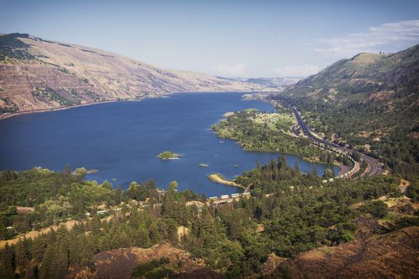
The Columbia River east from Rowena Crest, the gorge opening into dry hills and the old highway below

Rowena Crest and the Tom McCall Preserve

Mosier

A crest where the Ice Age floods jammed against a basalt promontory, above a plateau of mounds no one has fully explained, and a few in the parking loop that the highway department built.

View details →

Natural Areas

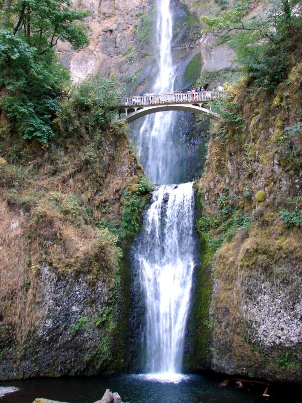
Multnomah Falls dropping in two tiers, the 1914 Benson footbridge spanning the gap between them

Multnomah Falls

Corbett

A 620-foot double waterfall whose 1925 stone lodge survived because firefighters kept it soaked while the forest burned around it in September 2017.

View details →

Towns & Gateways

Celilo Village

The Dalles

The village that stayed on the bluff above the drowned falls, rebuilt half a century late by the government that flooded them, where the salmon season still opens each April.

View details →

Architecture

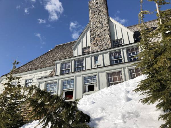
The west wing of Timberline Lodge in March snow, its stone chimney rising over shingled gables

Timberline Lodge

Government Camp

A lodge raised by hand by relief workers in 1936-38, from boulders off the mountain and iron forged from old railroad rails, and dark for an unpaid power bill less than twenty years later.

View details →
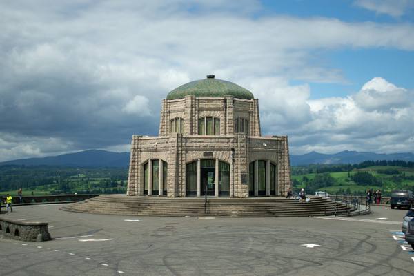
Vista House, the domed stone octagon on Crown Point, under a broken sky

Vista House at Crown Point

Corbett

A rest stop on a basalt point 733 feet above the Columbia, budgeted at $12,000, finished for about $100,000, and mocked for years as Oregon's most expensive outhouse.

View details →

Industry & Mining

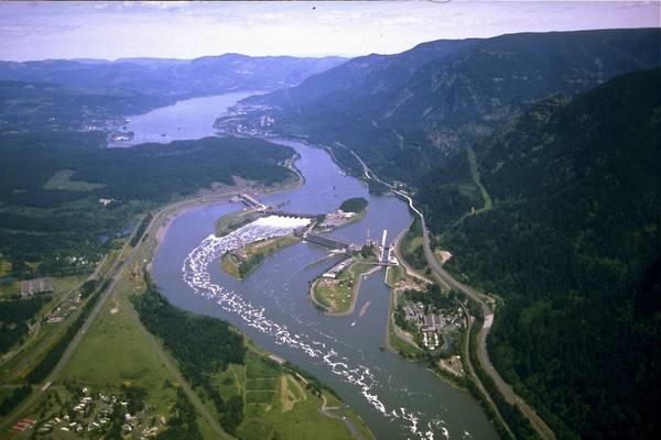
Aerial view east up the Columbia over Bonneville Lock and Dam, the spillway and powerhouses spanning the river between forested walls

Bonneville Dam

Cascade Locks

The first federal dam on the Columbia, where someone has counted the fish climbing its ladders every year since 1938, beside an island the Corps used as a dump for forty years.

View details →

Scenic Drives through The Columbia River Gorge & Mount Hood

Scenic Byway

The Historic Columbia River Highway: Troutdale to The Dalles

Samuel Lancaster's 1913–1922 road through the Gorge: Vista House at Crown Point, the waterfall corridor and Multnomah Falls, then the Rowena Loops down into The Dalles.

75 mi · 2 hrs

Stories from The Columbia River Gorge & Mount Hood

Geology

The Bridge of the Gods

In the mid-1400s the side of Table Mountain fell into the Columbia and dammed it. The people of the river remembered. It took science six centuries and several wrong dates to catch up.

5 min read

The Columbia River Gorge & Mount Hood rewards the unhurried. Pick a base, fan out, and let the country between the headline stops surprise you.

← Explore more of Open Road Guide