Home / Idaho / The Portneuf & Bear River Country / Preston and Napoleon Dynamite
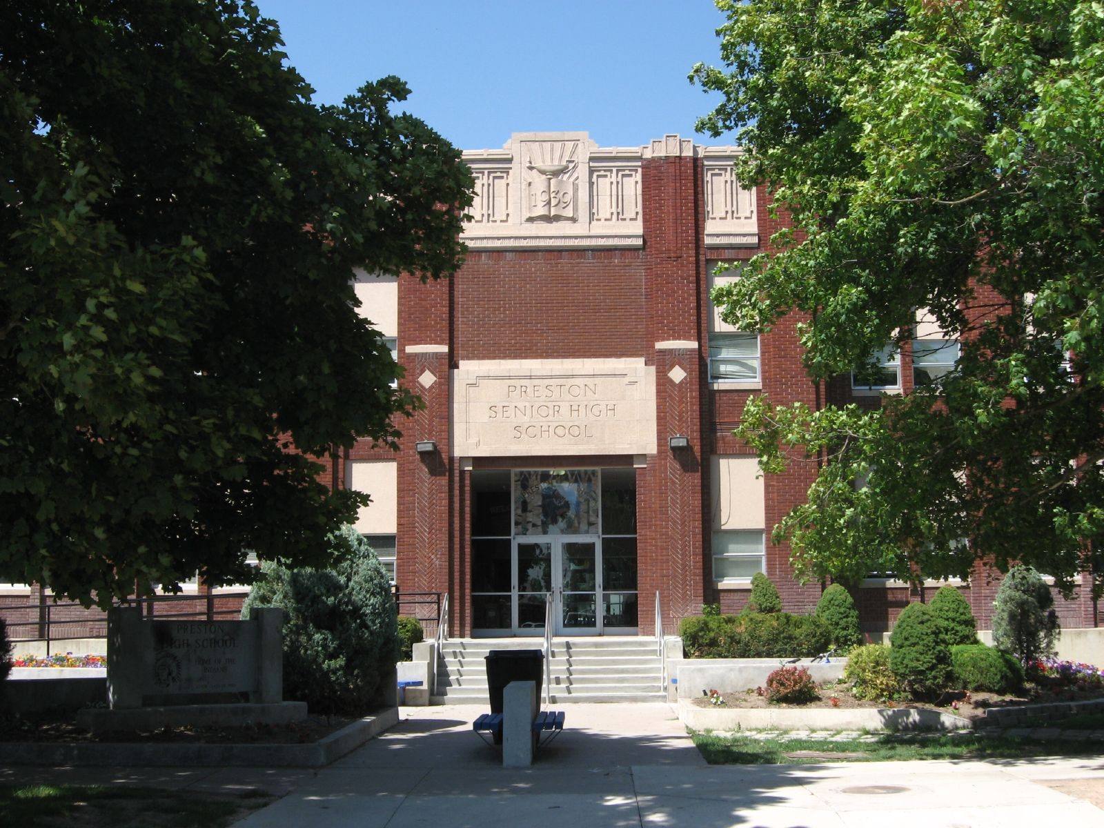
The brick front of Preston Senior High School behind shade treesKen Lund / CC BY-SA 2.0 via Flickr
🎭Cultural

Preston and Napoleon Dynamite

Part ofThe Portneuf & Bear River Country
On this driveU.S. 91 and Idaho 34: The Cache Valley Crossing

A farm town in the north end of Cache Valley that a former student turned into a set in the summer of 2003, without changing much of anything.

Year-RoundFilm LocationsWeird & WonderfulFree
⏱
Duration
Half an hour for the high school and downtown; longer with a list of locations.
📅
Best Season
Any season; the town is a working farm town year-round.

The Story

Preston is a farm town at the north end of Cache Valley, the Franklin County seat, with a wide main street, a high school and a thrift store. In July 2003 Jared Hess, who had graduated from Preston High School in 1997, came back with his wife and co-writer Jerusha, a cast led by Jon Heder and a budget of about $400,000, and shot Napoleon Dynamite around town in just over twenty days. Most of the film's situations are loosely drawn from his own years there.

What makes the film's Preston recognizable is how little was dressed. The school scenes, tetherball included, were shot at the real high school. The orange suit came off a mannequin at the Deseret Industries thrift store. Napoleon's house stands on a country road outside town; the egg farm, the convenience store in Franklin and the fields along the section roads are what they look like in the film, because that is what they were. The movie opened at Sundance in January 2004 and took in more than $40 million, and the Idaho Legislature passed a resolution commending the Hesses for it.

For several summers afterward Preston ran a Napoleon Dynamite festival, with tater-tot eating, tetherball tournaments and look-alike contests, and fans still come with a list of locations. The town's other history sits close by: about four miles north on US-91 is Boa Ogoi, the site of the Bear River Massacre, which the Northwestern Band of the Shoshone Nation is restoring as its own ground.

The high school is on South 2nd East and the thrift store is downtown. Napoleon's house and the farms are private property; look from the road.

Visitor Info

⏱
Time Needed
Half an hour for the high school and downtown; longer with a list of locations.
📅
Best Season
Any season; the town is a working farm town year-round.
🛣️
Highway
US-91

On the Map

Nearby

The closest stops worth working into your route

historical3.9 mi away
Boa Ogoi (Bear River Massacre Site)
The Northwestern Band bought back the ground where its people were killed in 1863, and is turning farm fields back into the river bottom they knew.
geological18 mi away
Minnetonka Cave
Found by a grouse hunter, named first for a porcupine and then in a language from the far side of the Rockies. Five kinds of bats winter inside.
natural18 mi away
Tony Grove Lake
A glacial alpine lake at 8,100 feet surrounded by wildflower meadows
recreational19 mi away
Beaver Mountain Ski Area
A family-owned ski hill that has been run by the same family since 1939
historical21 mi away
American West Heritage Center
A living history farm spanning 160 acres of Cache Valley
natural23 mi away
Jardine Juniper
One of the oldest living trees in the world at over 1,500 years old

Historical markers nearby

Roadside plaques and monuments within a short detour

Marker3.9 mi away
Bear River Massacre
Marker3.9 mi away
Utah & Northern Railway
Marker5.3 mi away
Old Delta Sediments
Marker6.4 mi away
Hatch House
Marker6.5 mi away
Idaho's Oldest Town
Marker11 mi away
Pioneer Home and Granary
Lewiston, Utah