Home / California / Joshua Tree & the Southern Deserts / Palm Springs
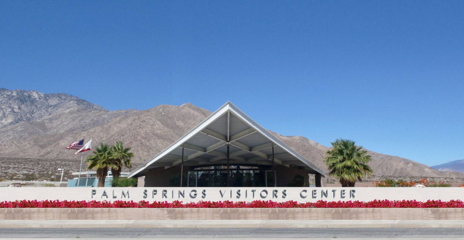
The Palm Springs Visitors Center โ€” the 1965 Tramway Gas Station by Albert Frey and Robson Chambers โ€” its cantilevered wedge roof against the bare slopes of Mount San Jacinto.Bryanb7 / CC BY-SA 3.0 via Wikimedia Commons
๐ŸŽญCultural

Palm Springs

Part ofJoshua Tree & the Southern Deserts

Cahuilla homeland, checkerboard reservation, mid-century playground, and the square mile the city burned.

Year-RoundPhotographyNative American HeritageFree
โฑ
Duration
A day or more; a base for the whole Coachella Valley.
๐ŸŽŸ
Admission
Free to visit; the tramway, canyons, and museums charge separately.
๐Ÿ“…
Best Season
October through May. Summer highs routinely exceed 110 degrees.
๐Ÿ’ก
Fun Fact
The Agua Caliente reservation is not one block of land but fifty-one alternating square miles, a checkerboard created when the railroad received every other section as a subsidy.

The Story

Start with the water. Sรฉc-he, the hot mineral spring in what is now downtown, is where the Agua Caliente Band of Cahuilla Indians place their beginnings, and it is still theirs. In 1876 President Grant set aside that square mile, Section 14, as reservation land; the following year President Hayes extended the reservation across the even-numbered sections of three townships. The odd-numbered sections had already gone to the Southern Pacific Railroad as a construction subsidy. The result is a checkerboard: fifty-one alternating square miles of tribal and non-tribal land, laid over a city that grew up on top of it.

Section 14 sits in the middle of downtown. Because Palm Springs excluded non-white residents nearly everywhere else, Black and Mexican American families leased there and built homes. Through the 1950s and 1960s the city cleared them out, bulldozing and burning houses; a California attorney general's report later called it a city-engineered holocaust. The city apologized in 2021, and in November 2024 approved a settlement with the survivors and their descendants, paying 5.9 million dollars in direct compensation in October 2025 alongside 20 million in housing programs.

The rest of what draws people here is real too: the largest concentration of mid-century modern architecture in the country, a February festival built around it, the Indian Canyons and Tahquitz Canyon on tribal land, and a tramway that lifts you from the desert floor to eight thousand feet of pine forest in about ten minutes.

Visitor Info

โฑ
Time Needed
A day or more; a base for the whole Coachella Valley.
๐ŸŽŸ
Admission
Free to visit; the tramway, canyons, and museums charge separately.
๐Ÿ“…
Best Season
October through May. Summer highs routinely exceed 110 degrees.
๐Ÿ›ฃ๏ธ
Highway
CA-111 / I-10

On the Map

Stories

A story featuring this place

Go deeper into the history and character of this stop

Culture
The Word They Used Was Abatement
JoAnn ยท 7 min read

Nearby

The closest stops worth working into your route

natural25 mi away
San Gorgonio Mountain
The highest ground in Southern California, and the only summit down here that stands clear above the trees.
roadside25 mi away
Pioneertown
A Western movie set built in 1946 that people moved into and never left.
geological27 mi away
Onyx Summit
The highest pass any state highway crosses in Southern California, at the top of the long way into Big Bear.
natural34 mi away
Joshua Tree National Park
Where the high Mojave meets the low Colorado, among monzogranite piles and a yucca that is not a tree.
natural36 mi away
Baldwin Lake Ecological Reserve
Pebble plains occur in this valley and nowhere else on earth, and the flowers on them are small enough that you have to lie down.
natural36 mi away
Cholla Cactus Garden
Ten acres of teddybear cholla that look soft and are anything but, at the seam between two deserts.

Historical markers nearby

Roadside plaques and monuments within a short detour

Marker23 mi away
Site of De Anza Camp, March 1774
Anza
Marker24 mi away
Soviet Transpolar Landing Site
San Jacinto
Marker25 mi away
Site of Indian Village of Pochea
Hemet
Marker25 mi away
Ramona Bowl, Site of the Ramona Pageant
Hemet
Marker29 mi away
Saahatpa
Beaumont
Marker30 mi away
Hemet Maze Stone
Hemet