Home / California / Joshua Tree & the Southern Deserts / Pioneertown
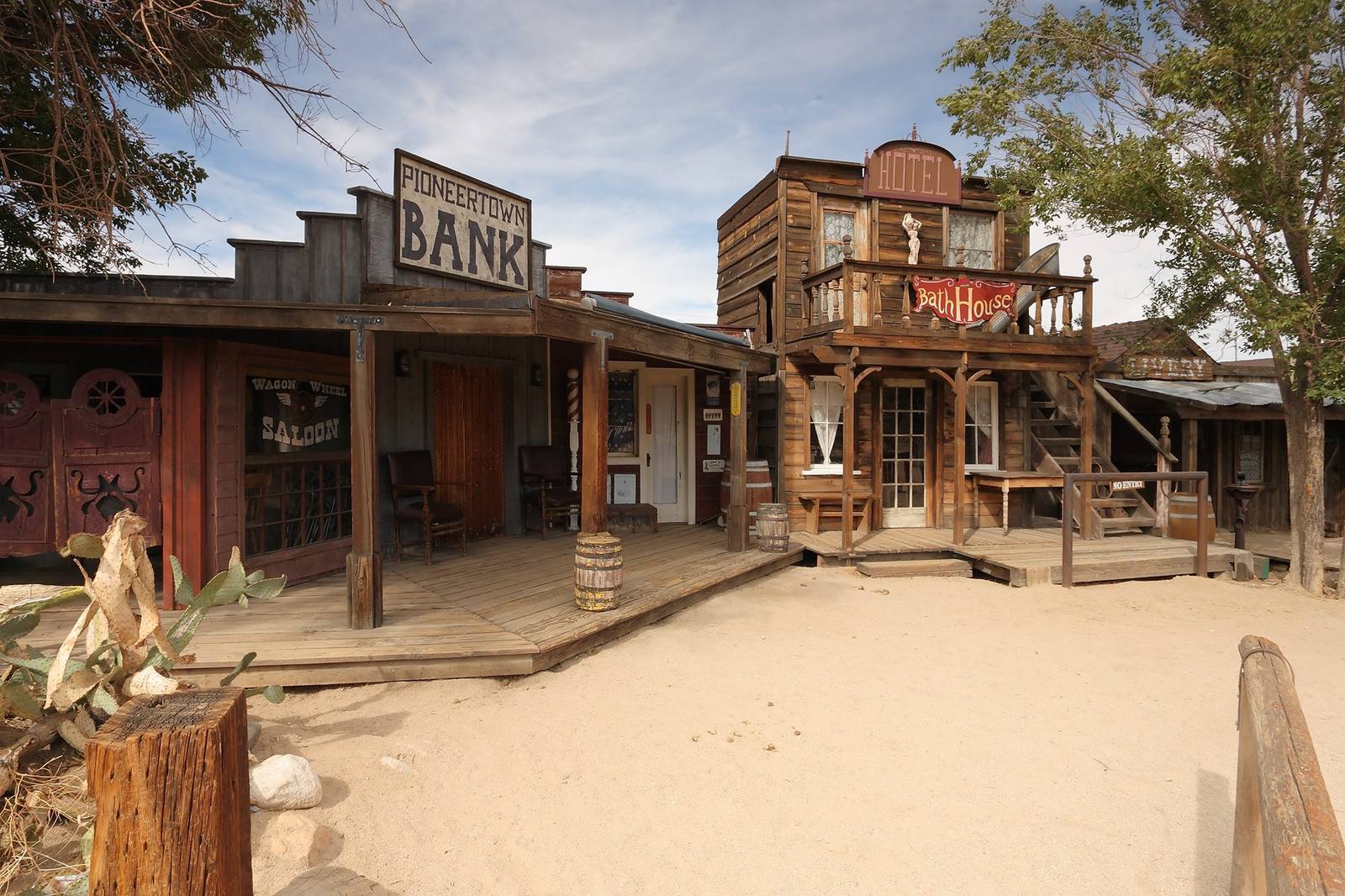
Mane Street at Pioneertown — a timber false front lettered PIONEERTOWN BANK at the left above a plank boardwalk, with a WAGON WHEEL SALOON window, a barber pole and two empty chairs under its porch roof. A two-storey building at the centre carries a HOTEL sign on its parapet and a painted Bath House sign on its balcony rail, a livery stands further along the row, and the street itself is bare graded sand. A prickly pear grows at the lower left and there is nobody in the frame.Matthew Field / CC BY-SA 3.0 via Wikimedia Commons
🛣️Roadside

Pioneertown

Part ofJoshua Tree & the Southern Deserts

A Western movie set built in 1946 that people moved into and never left.

WinterFamily-FriendlyPhotographyFilm LocationsWeird & WonderfulFree
Duration
An hour or two for the street; an evening if there is music.
🎟
Admission
Free to walk Mane Street; food and shows are separately priced.
📅
Best Season
October through May; book Pappy and Harriets well ahead on show nights.
💡
Fun Fact
The buildings were built as functioning businesses behind film facades, so the saloon front on Mane Street originally hid a working bowling alley.

The Story

Most film sets get struck when the picture wraps. Pioneertown was built to keep. In 1946 a group of Hollywood investors, among them Roy Rogers, Gene Autry, Russell Hayden, and the Sons of the Pioneers who gave the place its name, put up an 1880s frontier street in the high desert above Yucca Valley. The trick was that the facades were real buildings. Behind the saloon front was a working bowling alley; behind others, an ice cream parlor and a motel. Cast and crew could film on Mane Street in the morning and live there the rest of the day.

More than fifty films and television shows shot here in the 1940s and 1950s, including The Cisco Kid, Annie Oakley, and The Gene Autry Show. When the Western died, the town did not. People stayed. Mane Street is a historic district now, and a few hundred residents live in and around it.

The old cantina set had a second life as a burrito joint popular with biker clubs, and in 1982 Harriet and Claude Allen turned it into Pappy and Harriet's Pioneertown Palace. It should be a roadhouse serving barbecue to a hundred people. Instead it books touring acts far too large for the room, and has for decades.

It sits four miles up the hill from Yucca Valley, twenty minutes from the west entrance of Joshua Tree National Park.

Visitor Info

Time Needed
An hour or two for the street; an evening if there is music.
🎟
Admission
Free to walk Mane Street; food and shows are separately priced.
📅
Best Season
October through May; book Pappy and Harriets well ahead on show nights.
🛣️
Highway
Pioneertown Road (off CA-62)

On the Map

Nearby

The closest stops worth working into your route

geological12 mi away
Onyx Summit
The highest pass any state highway crosses in Southern California, at the top of the long way into Big Bear.
natural19 mi away
San Gorgonio Mountain
The highest ground in Southern California, and the only summit down here that stands clear above the trees.
natural20 mi away
Baldwin Lake Ecological Reserve
Pebble plains occur in this valley and nowhere else on earth, and the flowers on them are small enough that you have to lie down.
historical20 mi away
Doble
Three men with money reopened this mine and all three failed. The town is named after the second one.
cultural24 mi away
Big Bear Solar Observatory
A reservoir dug for orange groves turned out to be one of the steadiest places on the continent to look at the sun.
cultural25 mi away
Palm Springs
Cahuilla homeland, checkerboard reservation, mid-century playground, and the square mile the city burned.

Historical markers nearby

Roadside plaques and monuments within a short detour

Marker20 mi away
Holcomb Valley
Big Bear City
Marker27 mi away
Old Bear Valley Dam
Big Bear Lake