The Story
There are two roads between Boulder and Escalante. One is paved, signed, named on every map, and takes about forty minutes. The other is Hells Backbone Road, and the people who built it called it The Poison Road.
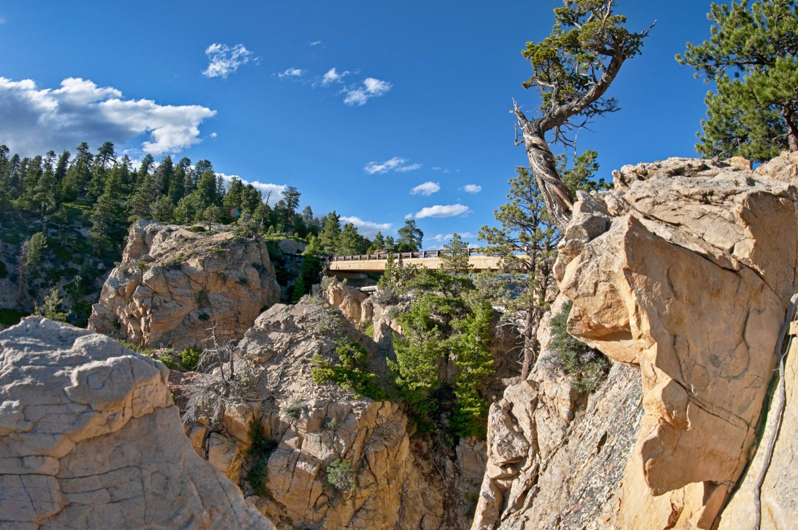
It is thirty-eight miles of gravel that climbs to over nine thousand feet on the southern shoulder of Boulder Mountain, threads the upper canyons of Pine Creek and Death Hollow and Sand Creek, and crosses a chasm between the two on a concrete bridge a hundred and nine feet long and fourteen feet wide. There is a fifteen-hundred-foot drop on either side of that bridge.
The bridge you cross today was rebuilt in 2005. The original was wooden. To start construction in 1933, a CCC worker named Lorrel "Sixty" McInnely put a bulldozer in gear and towed a compressor across two lodgepole pines that had been felled to span the gap. Crewmen braced themselves on the cliff face holding a rope tied around his waist, in case the logs gave. The logs held. The rest of the bridge was built from there.
The road is part of Forest Road 153, in Dixie National Forest. It was carved out of the rim country in a single summer in 1933, as the first automobile route between Boulder and Escalante. It was also a road that closed for five months a year, every year, because the snow at nine thousand feet does not care about commerce. That is why Boulder kept getting its mail by mule for seven more winters, until the lower road that became Highway 12 opened in 1940.
From late spring to autumn, when the road is graded and dry, a regular passenger car can manage the whole length in about two hours, plus however long you spend at the bridge, which will be longer than you planned. The drive runs from juniper desert through ponderosa pine and aspen and back down again. There are vistas of the Box-Death Hollow Wilderness that do not show up from Highway 12. There are campgrounds at Posey Lake and Blue Spruce. There is a trailhead for Death Hollow itself if you have the experience and the dry bags.
The two ends are easy enough to find. From Escalante, head north out of town on 300 East, which becomes the Posey Lake Road, and watch for the signed Hells Backbone turnoff a few miles up. From the Boulder side, it leaves Highway 12 about five miles south of town. Either way the surface is graded gravel that an ordinary car handles in dry weather — but there are no services, no fuel, and little to no cell signal for the length of it, and at nine thousand feet an afternoon thunderhead can turn the road greasy in minutes. Go with a full tank, more water than you think you need, and the willingness to turn back if the sky darkens. The payoff for the trouble runs past sundown: this is some of the darkest sky in southern Utah, and the Milky Way over the bridge is a thing people climb up here on purpose to see.
What you will not find is signage explaining what this road is, or what it cost to build, or why the men who built it gave it the name they did. The road does not advertise itself. It just sits up there above the paved one, eleven miles longer and ninety years older, waiting for the kind of traveler who would rather take the long way.
Visitor Info
On the Map
Nearby
The closest stops worth working into your route
Historical markers nearby
Roadside plaques and monuments within a short detour