Home / Oregon / Portland & the Willamette Valley / Willamette Falls
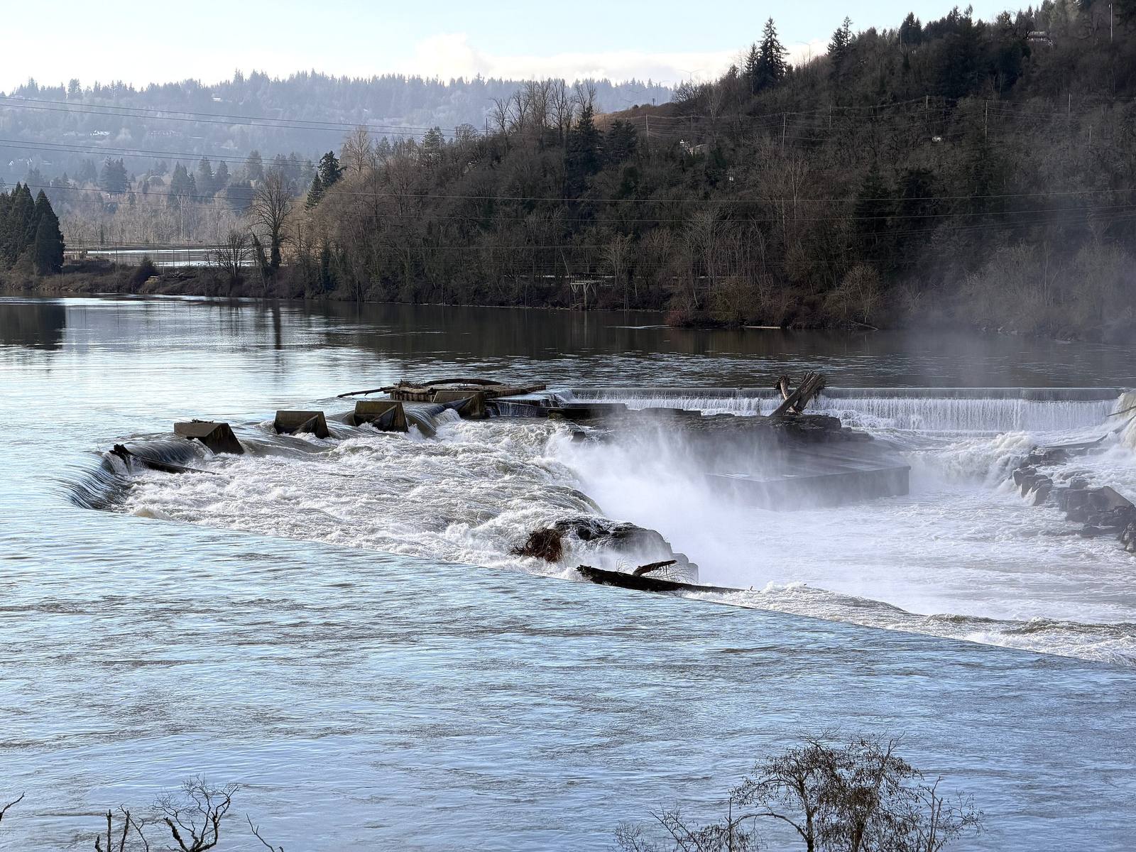
The Willamette River pouring over the horseshoe basalt ledge of Willamette Falls in high winter flowPortlandAppraisalBlog / CC BY-SA 4.0 via Wikimedia Commons
🌲Natural

Willamette Falls

Part ofPortland & the Willamette Valley

A horseshoe of basalt across the Willamette, ringed by a century of mills, that is still one of the last places in the Columbia basin where tribes gather lamprey by hand.

Native American Heritage
⏱
Duration
Fifteen minutes at the viewpoint.
📅
Best Season
Winter and spring for the fullest flow; summer for the lamprey season, watched only from a distance.

The Story

The Willamette pours over a horseshoe-shaped basalt ledge some fifteen hundred feet across here, a drop of about thirty-five feet, and for thousands of years the falls were a fishery and a meeting place. The Clackamas and the Clowewalla lived at them, and Wasco, Multnomah, Yakama, Tualatin and Molala people came to trade for dried salmon and to ask for fishing rights. The last Clackamas at the falls were removed to the Grand Ronde reservation in 1856.

Every summer Pacific lamprey, the eel-like fish that are a first food for the river's tribes, gather at the base of the falls on their way upstream; settlers in the late 1800s described the rock as carpeted with them, in places three deep. Their numbers have collapsed across the Columbia basin, and this is one of the last places where tribal members still gather them by hand from the wet rocks. The Yakama, Umatilla, Warm Springs and Nez Perce hold treaty rights to fish here, and the Confederated Tribes of Grand Ronde harvest under an agreement with the state. Commercial lamprey harvest at the falls ended in 2002, and the tribes lead the work to bring the runs back.

The industrial century sits beside them. Locks opened on the west side in 1873 to lift steamboats past the falls and closed for lack of repair money in 2011; woolen and paper mills lined both banks, and an electric plant began generating here in 1888. The falls themselves are closed to the public. The best view is from the viewpoint above the river on the West Linn side, off I-205; the Grand Ronde tribe, which now owns the old mill site on the Oregon City bank, calls the falls by their own name, tumwata.

Visitor Info

⏱
Time Needed
Fifteen minutes at the viewpoint.
📅
Best Season
Winter and spring for the fullest flow; summer for the lamprey season, watched only from a distance.
🛣️
Highway
I-205

On the Map

Nearby

The closest stops worth working into your route

historical1.1 mi away
McLoughlin House
The retirement house of the Hudson's Bay man who supplied the Oregon Trail's starving arrivals, saved from a paper mill's lot in 1909 and hauled up the bluff to a park he had given the town.
historical14 mi away
Champoeg
The river-bend meadow where settlers voted for a government in 1843, and where the Willamette took the entire town but one warehouse eighteen years later.
historical17 mi away
Vanport
Briefly Oregon's second-largest city, built in about 110 days for Kaiser's shipyard workers, washed away in an afternoon in 1948, and later renamed out of existence.
architectural23 mi away
Vista House at Crown Point
A rest stop on a basalt point 733 feet above the Columbia, budgeted at $12,000, finished for about $100,000, and mocked for years as Oregon's most expensive outhouse.
natural29 mi away
Multnomah Falls
A 620-foot double waterfall whose 1925 stone lodge survived because firefighters kept it soaked while the forest burned around it in September 2017.
natural33 mi away
Silver Falls State Park
Ten waterfalls in a logged-over canyon whose owner once charged a dime admission and pushed junk cars off the edge for the crowd, until a photographer got it made a park.

Historical markers nearby

Roadside plaques and monuments within a short detour

Marker0 mi away
Willamette Falls Locks
Marker0 mi away
Willamette Falls
Marker0 mi away
Dr. John McLoughlin
Marker0 mi away
George Abernethy
Marker0.6 mi away
Oregon City Falls
Marker0.6 mi away
Oregon City