Home / Wyoming / Devils Tower & the Black Hills / Vore Buffalo Jump
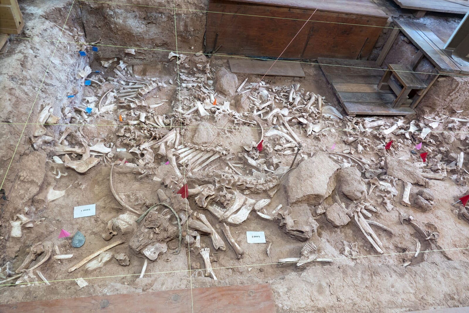
Bison bones packed in a layer of the excavation at the Vore Buffalo Jump, marked with tags and string lines under the shelterStrange Biology / CC BY 2.0 via Wikimedia Commons
🎭Cultural

Vore Buffalo Jump

Part ofDevils Tower & the Black Hills
On this driveDeadwood to Devils Tower and down the Belle Fourche

A gypsum sinkhole where hunters trapped bison for 250 years, each hunt sealed in its own layer, and the reason Interstate 90 bends south here.

Native American HeritageSummer
⏱
Duration
One hour.
📅
Best Season
Summer, when tours run.

The Story

The Vore site is not a cliff but a sinkhole, a pit some sixty feet deep that opened where water dissolved the gypsum under the prairie at the western edge of the Black Hills. For roughly 250 years, from the 1500s to around 1800, hunters drove bison over its rim, butchered them in the hole and hauled the meat and hides up and out to carry their people through the winter. Sediment washing in buried the bones and tools quickly and kept the layers apart: about twenty layers of bone, each the remains of one hunt, separated by thin yearly bands of silt that can be counted like tree rings. Archaeologists estimate that at least four thousand bison died here. The site lies between the open plains and the shelter of the Hills, country many nations contested, and the foundation that keeps it counts the Shoshone, Crow, Cheyenne, Arapaho and Kiowa-Apache among its likely users.

Highway surveyors found it in the path of Interstate 90 around 1970. Drilling brought up bison bone, University of Wyoming archaeologists were called, and the interstate was moved south. Only a small part of the site has been dug. The Vore family gave the land first to the university and then to the Vore Buffalo Jump Foundation, which keeps a building over the excavation and gives tours in summer. It sits between I-90 and old US-14 near Beulah.

Visitor Info

⏱
Time Needed
One hour.
📅
Best Season
Summer, when tours run.
🛣️
Highway
I-90

On the Map

Nearby

The closest stops worth working into your route

industrial7.1 mi away
Aladdin Coal Tipple
The last nineteenth-century wooden coal tipple believed to stand in the country, which fed Black Hills gold smelters and is now close to falling.
natural17 mi away
Spearfish Canyon
A limestone canyon nineteen miles long whose waterfalls ran dry for most of a century while the Homestake piped their water to its power plants.
industrial23 mi away
Homestake Open Cut & Sanford Lab Visitor Center
A 1,250-foot pit on Lead's Main Street, the visible top of a gold mine that went down 8,000 feet in 125 years and is a physics laboratory now.
historical24 mi away
Deadwood Historic District
A gold-rush town on treaty land, rebuilt in brick after the 1879 fire and rescued a century later by a vote to let casinos pay for its preservation.
historical24 mi away
Mount Moriah Cemetery
The hillside where Deadwood moved its dead: Wild Bill and Calamity Jane side by side, Seth Bullock looking at his friend's tower, and the Chinese burner of 1908.
geological28 mi away
Devils Tower National Monument
A plug of gray-green igneous rock cooled into columns 40 million years ago, first climbed on a stake ladder in 1893, where a parachutist was stranded for six days in 1941.

Historical markers nearby

Roadside plaques and monuments within a short detour

Marker6.1 mi away
Northern Hills Rest Area
South Dakota
Marker12 mi away
Custer Expedition
Sundance
Marker12 mi away
Crook County
Sundance
Marker15 mi away
Thoen Stone
South Dakota
Marker20 mi away
Inyan Kara Methodist Episcopal Church
Sundance
Marker23 mi away
Second Deadwood Gold Discovery
South Dakota