Home / New Mexico / Santa Fe & the Jemez / Valles Caldera National Preserve
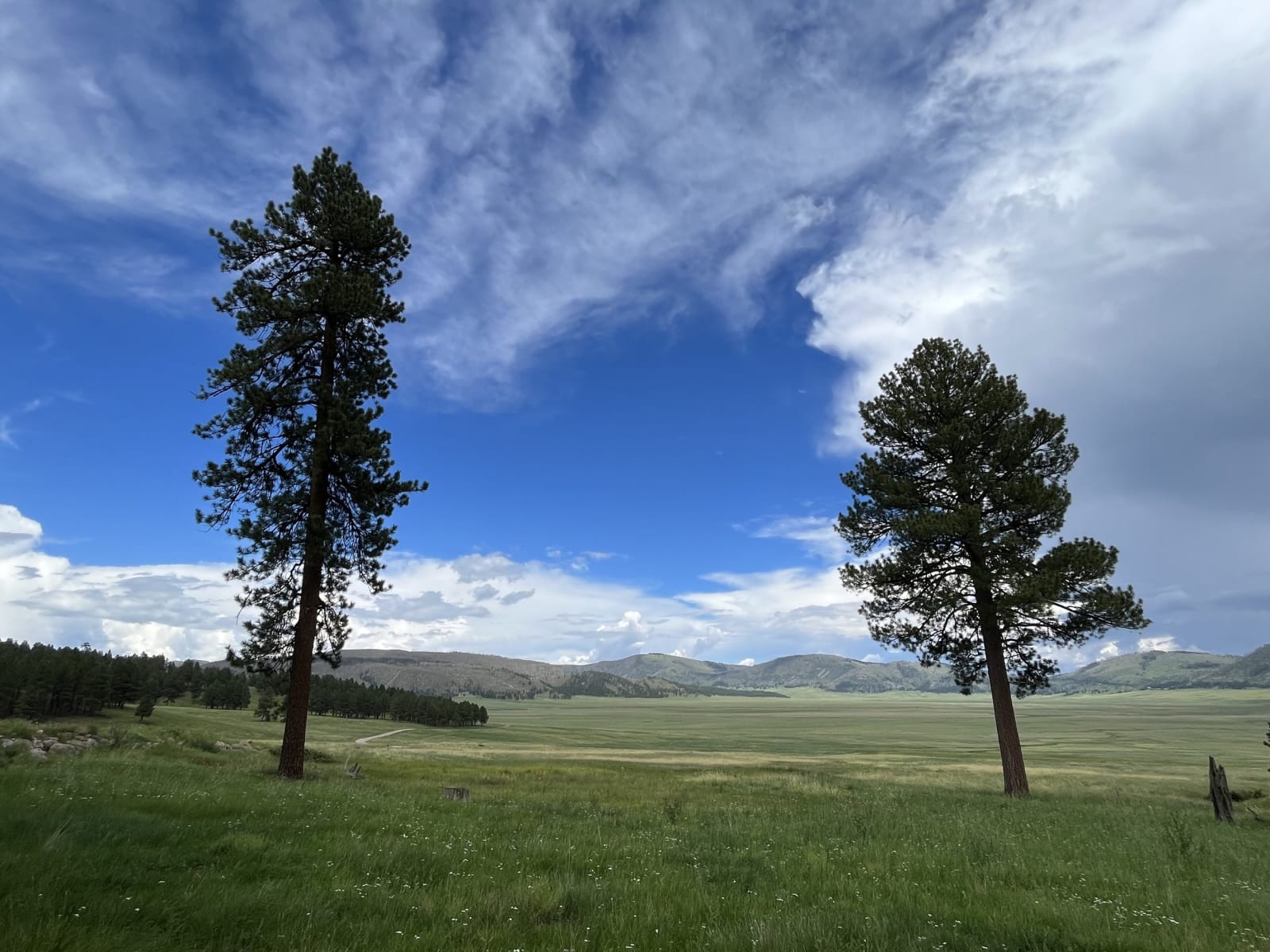
Two ponderosa pines at the northern edge of the Valle Grande meadow in Valles Caldera, forested hills beyondImp336 / CC BY-SA 4.0 via Wikimedia Commons
๐Ÿœ๏ธGeological

Valles Caldera National Preserve

Part ofSanta Fe & the Jemez

A crater thirteen miles across, floored with grass, left by an eruption 1.25 million years ago and owned privately for 140 years under a law that called it vacant land.

Scenic DrivingPhotographySummerVolcanicFallFreeHiking
โฑ
Duration
An hour at the overlook; a day to hike.
๐ŸŽŸ
Admission
Free entry; some backcountry access by permit.
๐Ÿ“…
Best Season
Summer and fall; elk are easiest to see at dawn and dusk.
๐Ÿ’ก
Fun Fact
The 1860 law that gave the caldera away let the Baca heirs choose only vacant land. People had been coming to it for obsidian for some eleven thousand years.

The Story

Highway 4 climbs west out of the ponderosa forest beyond Los Alamos and comes out suddenly on the rim of the Valle Grande, a sweep of grass running miles to the north with Redondo Peak rising beyond it. This is the floor of the Valles Caldera, about thirteen miles wide, the hollow left when the Jemez volcano erupted and collapsed in on itself about 1.25 million years ago. Redondo, about 11,250 feet, is a resurgent dome, ground pushed back up from below after the collapse.

People came here for at least eleven thousand years to hunt and to gather obsidian, and points of Jemez obsidian have turned up from the northern plains to Mexico. Redondo Peak is sacred to Jemez and other pueblos, and its summit is closed to hikers.

The caldera's private century began with a quarrel over Las Vegas, a hundred miles east. Luis Marรญa Cabeza de Baca's heirs and the town of Las Vegas claimed the same grant, and in 1860 Congress settled it by letting the heirs choose an equal acreage of vacant land elsewhere, in up to five squares. Their first choice, Baca Location No. 1, took in the Valle Grande. For 140 years it was sheep range, cattle ranch and logging country. In 2000 the government bought the ranch, about 89,000 acres, for $101 million and handed it to a trust expected to pay its own way by 2015; the same law transferred some 5,000 acres to Santa Clara Pueblo. The trust never paid its way, and in 2015 the National Park Service took the preserve over.

The entrance road leaves Highway 4 for the Valle Grande staging area and the old ranch buildings. Elk graze the valleys at dawn and dusk. Much of the backcountry is open only by permit or on set days.

Visitor Info

โฑ
Time Needed
An hour at the overlook; a day to hike.
๐ŸŽŸ
Admission
Free entry; some backcountry access by permit.
๐Ÿ“…
Best Season
Summer and fall; elk are easiest to see at dawn and dusk.
๐Ÿ›ฃ๏ธ
Highway
NM-4

On the Map

Nearby

The closest stops worth working into your route

architectural11 mi away
Fuller Lodge
The upright-log dining hall of a boys' ranch school, which fed and housed the Manhattan Project after the Army bought the school in 1942.
historical13 mi away
Jemez Historic Site
The stone walls of a 1620s mission church standing among the ruins of Gisewa, a Jemez village named for the hot springs beside it.
historical13 mi away
Bandelier National Monument
Rooms carved into soft volcanic tuff in Frijoles Canyon, named for a Swiss scholar who was led there in 1880 by a man from Cochiti Pueblo.
cultural33 mi away
El Santuario de Chimayรณ
A small adobe shrine on the High Road to Taos, built around 1816 over earth that pilgrims still carry away in hope of healing.
geological33 mi away
Ghost Ranch
Red, yellow and white cliffs above the Piedra Lumbre basin, where Georgia O'Keeffe bought seven acres in 1940 and paleontologists found a hillside full of dinosaurs in 1947.
historical33 mi away
Palace of the Governors
The long adobe on the north side of the Santa Fe plaza, called the oldest public building in continuous use in the country, though its own founding date is in dispute.