Home / Idaho / The Magic Valley / Shoshone Falls
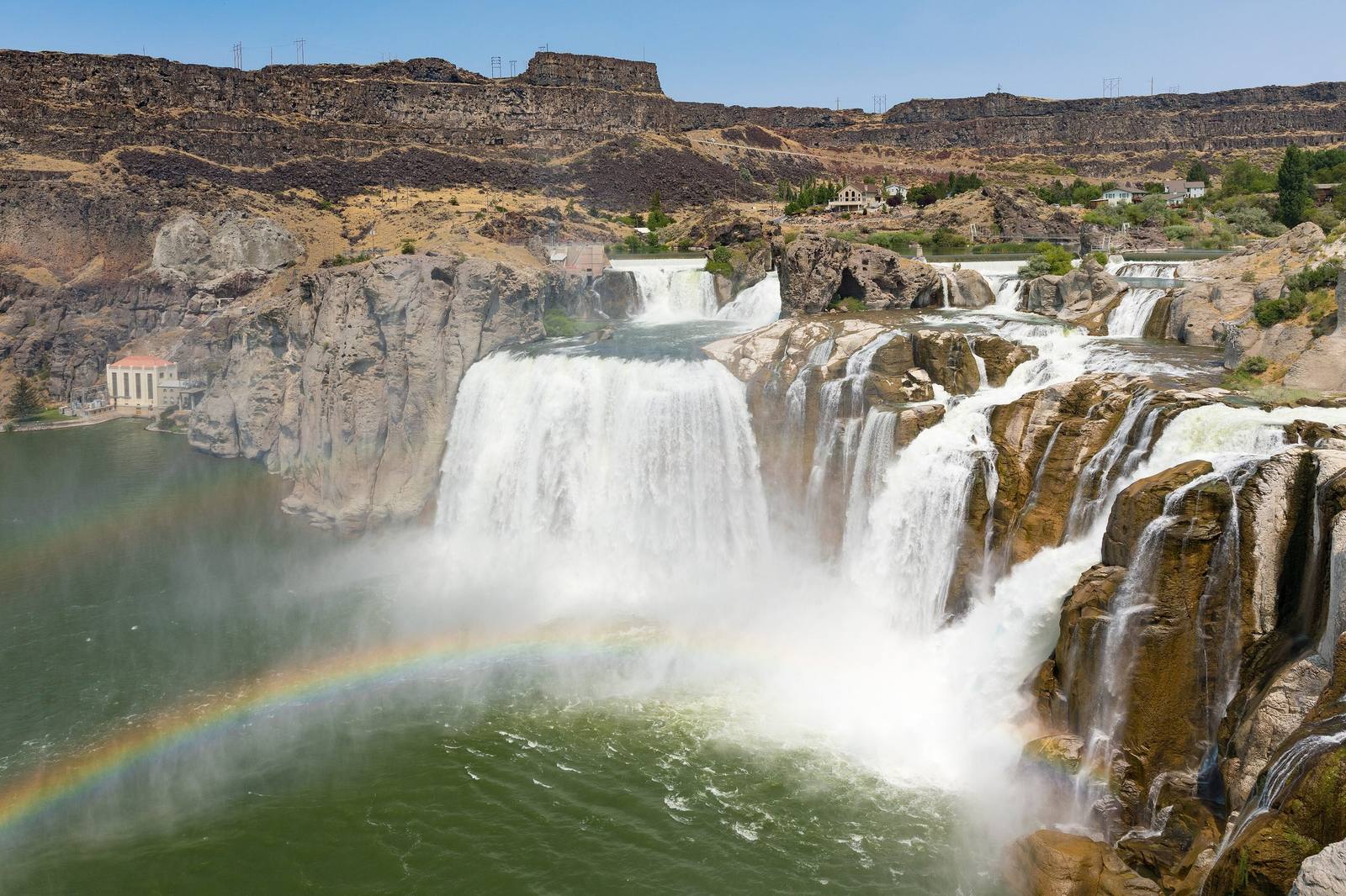
Shoshone Falls pouring over its basalt rim in several channels, a rainbow in the spray and the power plant at leftFrank Schulenburg / CC BY-SA 4.0 via Wikimedia Commons
🌲Natural

Shoshone Falls

Part ofThe Magic Valley
On these drivesThousand Springs: Shoshone Falls to HagermanU.S. 93: The Jackpot Crossing

Higher than Niagara, and turned up and down on a schedule. What reaches the rim is whatever the canals leave.

IconicPhotography
⏱
Duration
Thirty minutes at the overlook; an hour or two with the rim trail.
📅
Best Season
April to mid-May for the full spring flow, and during the salmon releases; late summer can be a trickle.

The Story

Shoshone Falls runs on a timetable. Twenty-four miles upstream, Milner Dam sends most of the Snake into the canals that made the Magic Valley, and in late summer the riverbed below it can run dry. Directly above the falls, Idaho Power's plant has taken its share since 1907. What spills over the 212-foot rim is whatever is left.

In a big snow year that can be more than 20,000 cubic feet a second, a wall of water across the whole canyon; a typical spring peaks around 10,000 to 12,000. After that the utility is bound only to a daytime "scenic flow" of 300 cubic feet a second from April through Labor Day, and in dry years even that is hard to find. The falls you see depend less on this week's weather than on water rights filed a century ago.

The best shows now come from an odd source. Each spring, and often again in early summer, the Bureau of Reclamation releases stored water from the upper Snake to help young salmon and steelhead down the lower Snake and Columbia to the sea. For a few weeks that water pours over the one barrier no salmon ever climbed, the falls that marked the upper end of the runs for the Newe who fished below them.

The City of Twin Falls runs the park on the south rim east of town, with an overlook platform, a rim trail and a day-use fee per vehicle. Check the posted flow before driving out. Late September sometimes brings a second rise, when the irrigation season ends and the canals stop drawing.

Visitor Info

⏱
Time Needed
Thirty minutes at the overlook; an hour or two with the rim trail.
📅
Best Season
April to mid-May for the full spring flow, and during the salmon releases; late summer can be a trickle.
🛣️
Highway
Falls Avenue east of Twin Falls; Shoshone Falls Grade Road

On the Map

Nearby

The closest stops worth working into your route

architectural2.7 mi away
Perrine Bridge
Four hundred and eighty-six feet of air between deck and river, and the one span in the country you may jump from without asking.
historical10 mi away
Minidoka National Historic Site
The prisoners built a board for the names of their sons in the Army. When the camp was given away as farms, the board was lost.
natural23 mi away
Box Canyon Springs
The eleventh-largest spring in the United States, pouring from the head of a dead-end canyon with water that sank into the lava far to the northeast.
geological31 mi away
Hagerman Fossil Beds National Monument
Idaho's state fossil is closer to a zebra than a horse, and nearly the whole herd is in a museum in Washington.
cultural44 mi away
Jackpot
A casino town made by an Idaho law, a mile inside the Nevada line, that still keeps Idaho's clock.
geological51 mi away
City of Rocks National Reserve
Two granite spires the emigrants steered by. They look like twins and formed about 2.5 billion years apart.

Historical markers nearby

Roadside plaques and monuments within a short detour

Marker2.7 mi away
Shoshone Falls
Marker2.7 mi away
College of Southern Idaho
Marker3 mi away
Emigrant Road
Marker5.5 mi away
Hansen Bridge
Marker7.6 mi away
Prehistoric Hunters
Marker7.6 mi away
Hunt