Home / Idaho / The Magic Valley / Hagerman Fossil Beds National Monument
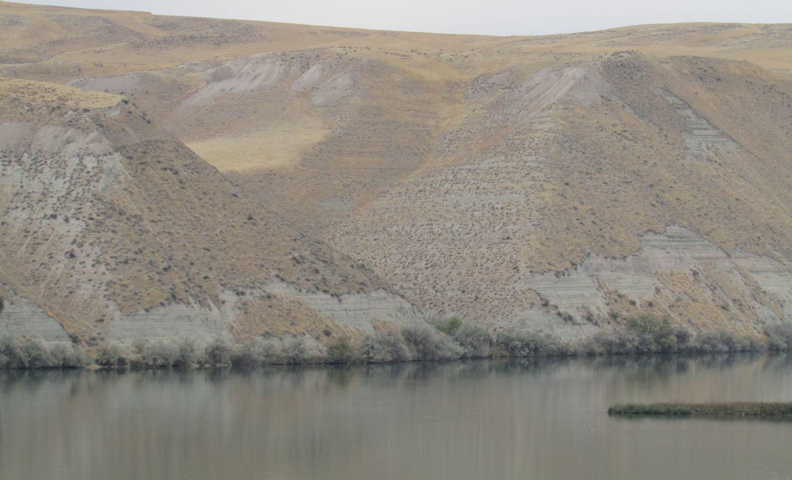
Layered pale sediment bluffs of the Hagerman fossil beds rising above the still Snake RiverChris Light / CC BY-SA 4.0 via Wikimedia Commons
🏜️Geological

Hagerman Fossil Beds National Monument

Part ofThe Magic Valley
On this driveThousand Springs: Shoshone Falls to Hagerman

Idaho's state fossil is closer to a zebra than a horse, and nearly the whole herd is in a museum in Washington.

Fossils
⏱
Duration
Forty-five minutes at the visitor center; an hour at the overlooks, more on the Emigrant Trail.
📅
Best Season
Spring and autumn; overlooks and trails are not maintained in winter, and summer is hot.

The Story

Idaho's state fossil is not quite a horse. Equus simplicidens, the Hagerman horse, stood about the size of a zebra, and comparing its bones with living species, scientists place it closer to zebras than to modern horses. It is also among the oldest widely accepted members of the genus Equus, grazing a Pliocene country of lakes and marsh here roughly three to four million years ago.

A cattle rancher, Elmer Cook, found the bones eroding from these bluffs and in 1928 showed them to H. T. Stearns of the U.S. Geological Survey, who passed them to James Gidley at the Smithsonian. Gidley's crews dug from 1929 through 1931 and again in 1934, working a quarry that grew to a 45-foot back wall, and shipped three tons of specimens east. The quarry held more than two hundred horses of both sexes and every age, a herd, and the largest single find of the species. Those remains are still in the Smithsonian's collection.

The fossil beds themselves are closed. The monument, created in 1988, protects 4,351 acres of the bluffs, and the only fossils on show are in the Thousand Springs Visitor Center, which the Park Service shares with the state on US-30 a mile north of downtown Hagerman. The overlooks are about nine miles away on Bell Rapids Road: one above the Snake and the pale bluffs, the other looking across the Hagerman Valley at the route of the Oregon Trail, whose ruts still cross the monument's southern end. The three-mile Emigrant Trail links them. Carry water; there is no shade.

Visitor Info

⏱
Time Needed
Forty-five minutes at the visitor center; an hour at the overlooks, more on the Emigrant Trail.
📅
Best Season
Spring and autumn; overlooks and trails are not maintained in winter, and summer is hot.
🛣️
Highway
US-30; Bell Rapids Road

On the Map

Nearby

The closest stops worth working into your route

natural8.6 mi away
Box Canyon Springs
The eleventh-largest spring in the United States, pouring from the head of a dead-end canyon with water that sank into the lava far to the northeast.
architectural28 mi away
Perrine Bridge
Four hundred and eighty-six feet of air between deck and river, and the one span in the country you may jump from without asking.
natural31 mi away
Shoshone Falls
Higher than Niagara, and turned up and down on a schedule. What reaches the rim is whatever the canals leave.
historical37 mi away
Minidoka National Historic Site
The prisoners built a board for the names of their sons in the Army. When the camp was given away as farms, the board was lost.
geological38 mi away
Bruneau Dunes State Park
Sand dunes that stay where they are, in a bend the Snake River abandoned, under dark skies an hour from Boise.
cultural56 mi away
Jackpot
A casino town made by an Idaho law, a mile inside the Nevada line, that still keeps Idaho's clock.

Historical markers nearby

Roadside plaques and monuments within a short detour

Marker6 mi away
Salmon Falls
Marker6 mi away
Thousand Springs
Marker7.3 mi away
Fishing Falls
Marker7.3 mi away
Payne's Ferry
Marker8.4 mi away
Fossil Beds
Marker21 mi away
Glenn's Ferry