Home / Idaho / The Magic Valley / Box Canyon Springs
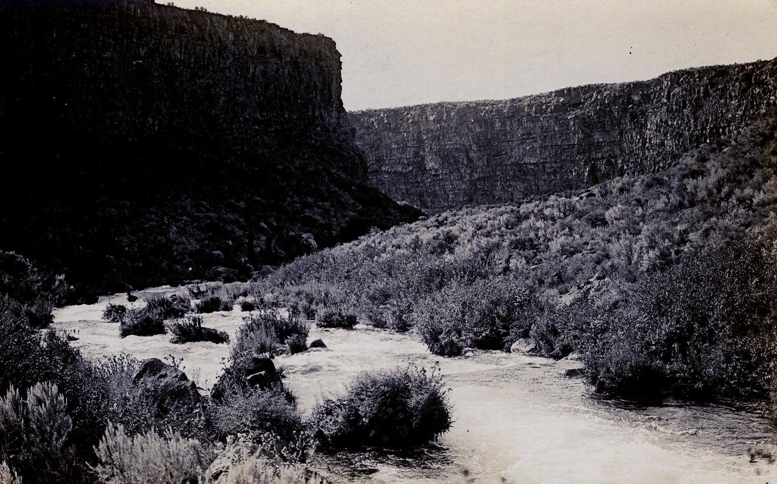
Box Canyon near Wendell in a real-photo postcard of about 1915, its spring creek running between sheer basalt wallsWaterArchives.org / CC BY-SA 2.0 via Wikimedia Commons
🌲Natural

Box Canyon Springs

Part ofThe Magic Valley
On this driveThousand Springs: Shoshone Falls to Hagerman

The eleventh-largest spring in the United States, pouring from the head of a dead-end canyon with water that sank into the lava far to the northeast.

Off the Beaten PathPhotography
⏱
Duration
An hour on the rim; two to walk down to the spring and back.
📅
Best Season
Year-round; the water holds the same cold temperature in every season.

The Story

Box Canyon ends in a wall. No river comes in above it: the water that fills the canyon pours out of the rock at its head, about 180,000 gallons a minute, the eleventh-largest spring in the United States. It runs cold and so clear that the pool at the head shows blue, then drops over a twenty-foot fall and down a mile of canyon to the Snake.

Its source is far to the north and east, where the Big Lost and Little Lost rivers and a handful of creeks run out of the mountains and vanish into the lava fields around Craters of the Moon. The water moves southwest through fractured basalt in the Snake River Plain aquifer, which holds roughly as much as Lake Erie, and comes out along the north wall of the Snake's canyon here. The Nature Conservancy reckons the trip takes close to two centuries. How the canyon itself was cut is argued: a 2008 study concluded that a sudden flood carved it, not the slow undermining of the spring.

Cold, clean water in a desert does not go unclaimed. The valley's first commercial trout farm opened in 1909 outside Twin Falls, and the Magic Valley became the largest center of trout farming in the country. Box Canyon's owner held a right to divert much of the spring to a fish farm when The Nature Conservancy bought the land and water in 1999, with the state's help. It is now the Earl M. Hardy Box Canyon Springs Nature Preserve, a unit of Thousand Springs State Park, though some of the flow still goes to a hatchery. A trail runs along the rim and drops about 300 feet to the water.

Visitor Info

⏱
Time Needed
An hour on the rim; two to walk down to the spring and back.
📅
Best Season
Year-round; the water holds the same cold temperature in every season.
🛣️
Highway
US-30 between Hagerman and Buhl

On the Map

Nearby

The closest stops worth working into your route

geological8.6 mi away
Hagerman Fossil Beds National Monument
Idaho's state fossil is closer to a zebra than a horse, and nearly the whole herd is in a museum in Washington.
architectural20 mi away
Perrine Bridge
Four hundred and eighty-six feet of air between deck and river, and the one span in the country you may jump from without asking.
natural23 mi away
Shoshone Falls
Higher than Niagara, and turned up and down on a schedule. What reaches the rim is whatever the canals leave.
historical29 mi away
Minidoka National Historic Site
The prisoners built a board for the names of their sons in the Army. When the camp was given away as farms, the board was lost.
geological46 mi away
Bruneau Dunes State Park
Sand dunes that stay where they are, in a bend the Snake River abandoned, under dark skies an hour from Boise.
cultural51 mi away
Jackpot
A casino town made by an Idaho law, a mile inside the Nevada line, that still keeps Idaho's clock.

Historical markers nearby

Roadside plaques and monuments within a short detour

Marker2 mi away
Payne's Ferry
Marker2 mi away
Fishing Falls
Marker3.1 mi away
Thousand Springs
Marker3.1 mi away
Salmon Falls
Marker13 mi away
Fossil Beds
Marker20 mi away
Emigrant Road