Home / Idaho / The Magic Valley / Perrine Bridge
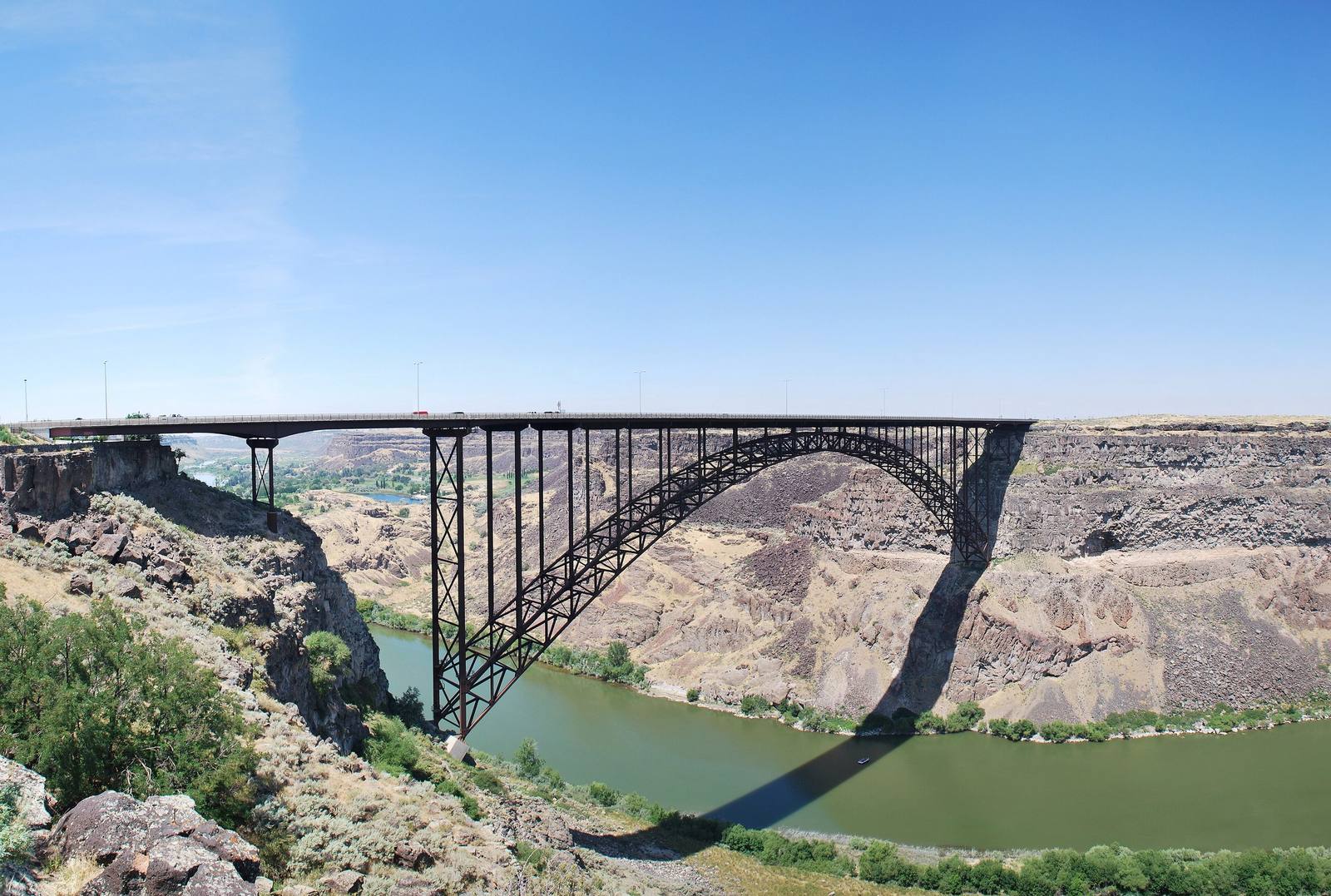
The steel arch of the Perrine Bridge spanning the Snake River Canyon, the river far belowJbindy2 / CC BY 3.0 via Wikimedia Commons
🏗️Architectural

Perrine Bridge

Part ofThe Magic Valley
On these drivesThousand Springs: Shoshone Falls to HagermanU.S. 93: The Jackpot Crossing

Four hundred and eighty-six feet of air between deck and river, and the one span in the country you may jump from without asking.

IconicPhotographyWeird & Wonderful
⏱
Duration
Thirty minutes on the walkway; an hour or more on the rim trail.
🎟
Admission
Free
📅
Best Season
Year-round.

The Story

The first bridge here charged a toll. A private company opened a steel cantilever across the Snake River Canyon in September 1927 and collected a fare until the state bought it in 1940 and let traffic cross free. By the 1970s it could not carry modern loads, and in May 1973 work began on a replacement just to the east. The new truss arch opened in July 1976, 1,500 feet long with a main span of 993 feet, and the old cantilever was taken down.

The deck of the Perrine Bridge stands 486 feet above the river, and that height draws people from other continents. It is about the only man-made structure in the United States where BASE jumping is allowed year-round without a permit. Three Twin Falls men, former Army paratroopers, made the first recorded jumps in 1987 on surplus military parachutes, after trying the drop first with a 55-gallon drum. Parachuting and bungee jumping from the bridge were still illegal in the early 1990s, and a bungee jumper went to jail for it in 1991; by the end of that decade the law had given way. Eleven jumpers had died here by early 2025.

On a calm morning jumpers step off the rail, open their canopies below the deck and drift down to the river, then climb back out of the canyon to go again. The bridge carries pedestrian walkways, so everyone else can look down the same drop.

The Twin Falls Visitor Center at the south end serves both crowds, with parking, a statue of I. B. Perrine and the Canyon Rim Trail, which passes under the bridge. Walk it east and the dirt ramp of 1974 comes into view on the same south rim, about a mile and a half away.

Visitor Info

⏱
Time Needed
Thirty minutes on the walkway; an hour or more on the rim trail.
🎟
Admission
Free
📅
Best Season
Year-round.
🛣️
Highway
US-93

On the Map

Nearby

The closest stops worth working into your route

natural2.7 mi away
Shoshone Falls
Higher than Niagara, and turned up and down on a schedule. What reaches the rim is whatever the canals leave.
historical12 mi away
Minidoka National Historic Site
The prisoners built a board for the names of their sons in the Army. When the camp was given away as farms, the board was lost.
natural20 mi away
Box Canyon Springs
The eleventh-largest spring in the United States, pouring from the head of a dead-end canyon with water that sank into the lava far to the northeast.
geological28 mi away
Hagerman Fossil Beds National Monument
Idaho's state fossil is closer to a zebra than a horse, and nearly the whole herd is in a museum in Washington.
cultural44 mi away
Jackpot
A casino town made by an Idaho law, a mile inside the Nevada line, that still keeps Idaho's clock.
geological53 mi away
City of Rocks National Reserve
Two granite spires the emigrants steered by. They look like twins and formed about 2.5 billion years apart.

Historical markers nearby

Roadside plaques and monuments within a short detour

Marker0.2 mi away
Shoshone Falls
Marker0.2 mi away
College of Southern Idaho
Marker1.4 mi away
Emigrant Road
Marker8.1 mi away
Hansen Bridge
Marker9.6 mi away
Prehistoric Hunters
Marker9.6 mi away
Hunt