Home / Idaho / The Magic Valley / Minidoka National Historic Site
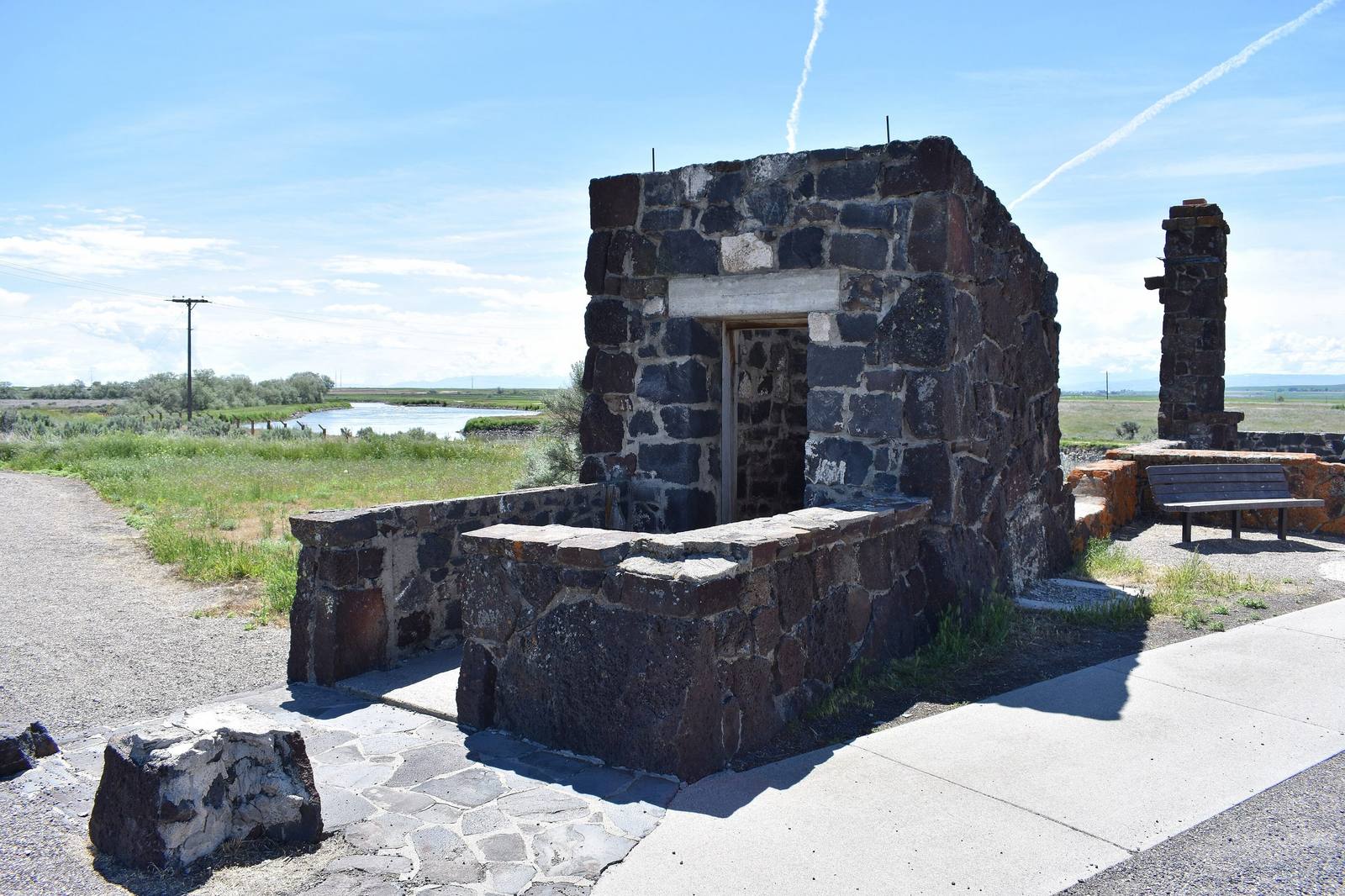
The ruined basalt walls of the guard station and waiting room at the entrance to the Minidoka campTamanoeconomico / CC BY-SA 4.0 via Wikimedia Commons
🏛️Historical

Minidoka National Historic Site

Part ofThe Magic Valley

The prisoners built a board for the names of their sons in the Army. When the camp was given away as farms, the board was lost.

⏱
Duration
An hour for the Honor Roll and the trail; longer with the visitor center.
📅
Best Season
Year-round; the visitor center keeps seasonal hours, and summers are hot and shadeless.

The Story

Near the entrance stands a board with an eagle on top and columns of names. The people held at Minidoka built the first one in 1943, after the government opened military service to the Japanese Americans it had imprisoned, and they added names as sons and brothers left the camp for the war. Nearly a thousand served from here. By the end of the war Minidoka had the longest casualty list of any of the ten camps.

The board did not survive the peace. After the camp closed in October 1945 its irrigated ground was cut into farms of about ninety acres and given to returning veterans by lottery, 43 in 1947 and 46 more in 1949. Each winner took two barracks with the land. The rest of the buildings were sold, given away or torn down for lumber, and somewhere in that dispersal the original Honor Roll was lost.

The Friends of Minidoka rebuilt it on its original site in 2011 with a National Park Service grant, and it is not finished. Families keep sending the names the 1943 board missed; an update in 2023 added about 140, bringing it to 845. It is one of the few things here that is still growing.

The rest of the site is mostly ground: a reconstructed guard tower, part of the rock garden prisoners built, restored near the entrance, an original barrack returned to the site, and a 1.6-mile trail through the old blocks. More than thirteen thousand people, most of them from Seattle, Portland and the rest of the Northwest, lived behind this wire between 1942 and 1945.

Visitor Info

⏱
Time Needed
An hour for the Honor Roll and the trail; longer with the visitor center.
📅
Best Season
Year-round; the visitor center keeps seasonal hours, and summers are hot and shadeless.
🛣️
Highway
Hunt Road, off SR-25 near Eden

On the Map

Nearby

The closest stops worth working into your route

natural10 mi away
Shoshone Falls
Higher than Niagara, and turned up and down on a schedule. What reaches the rim is whatever the canals leave.
architectural12 mi away
Perrine Bridge
Four hundred and eighty-six feet of air between deck and river, and the one span in the country you may jump from without asking.
natural29 mi away
Box Canyon Springs
The eleventh-largest spring in the United States, pouring from the head of a dead-end canyon with water that sank into the lava far to the northeast.
geological37 mi away
Hagerman Fossil Beds National Monument
Idaho's state fossil is closer to a zebra than a horse, and nearly the whole herd is in a museum in Washington.
geological50 mi away
City of Rocks National Reserve
Two granite spires the emigrants steered by. They look like twins and formed about 2.5 billion years apart.
cultural53 mi away
Jackpot
A casino town made by an Idaho law, a mile inside the Nevada line, that still keeps Idaho's clock.

Historical markers nearby

Roadside plaques and monuments within a short detour

Marker2.4 mi away
Hunt
Marker2.4 mi away
Prehistoric Hunters
Marker8.4 mi away
Hansen Bridge
Marker11 mi away
Emigrant Road
Marker12 mi away
Shoshone Falls
Marker12 mi away
College of Southern Idaho