Home / Idaho / The Magic Valley / City of Rocks National Reserve
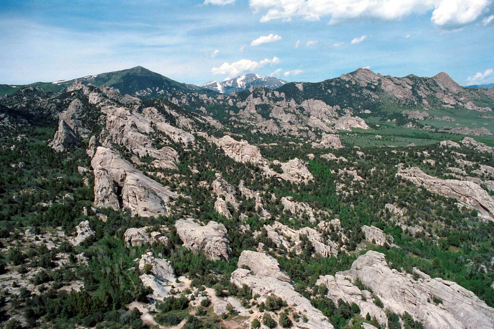
Granite spires and domes scattered through pine and juniper at City of Rocks, with Graham Peak and Cache Peak behindNational Park Service / public domain via Wikimedia Commons
🏜️Geological

City of Rocks National Reserve

Part ofThe Magic Valley

Two granite spires the emigrants steered by. They look like twins and formed about 2.5 billion years apart.

Pioneer HistoryPhotography
⏱
Duration
Half a day for the loop roads and a short walk; climbers stay for days.
📅
Best Season
May through October; some gravel roads close with snow from November to April.

The Story

The Twin Sisters are not twins. The two granite spires rise about 750 feet above the basin floor at the south end of the reserve, matched in size and shape, but the darker one is roughly 2.5 billion years old, some of the oldest rock exposed in the western United States. The paler one belongs to the Almo pluton, which cooled underground about 28 million years ago. Most of the fins and domes around you are the younger rock, eroded out once a cap of harder quartzite above it wore away.

The emigrants steered by them. Close to a quarter of a million people came through this basin between 1843 and 1882, on the California Trail and later on the freight and stage road from Kelton, Utah, to Boise. Addison Pratt, a Mormon Battalion officer on his way home from California, named the Sisters on September 15, 1848, and the Battalion men opened a road that year from Granite Pass to Salt Lake. It met the California Trail about a mile and a half south of the spires, and from the junction one road went on over the pass. When the trails opened, Granite Pass lay in Mexico, less than a mile from Oregon Territory. The springs and grass along Circle Creek, where many of them camped, were Newe country long before the wagons.

Today more than half of the reserve's hundred thousand yearly visitors come to climb, on granite that draws people from around the world. Castle Rocks State Park next door shares a visitor center in Almo. Gravel roads loop through the spires, and some close in winter.

Visitor Info

⏱
Time Needed
Half a day for the loop roads and a short walk; climbers stay for days.
📅
Best Season
May through October; some gravel roads close with snow from November to April.
🛣️
Highway
Elba-Almo Road, west of Almo

On the Map

Nearby

The closest stops worth working into your route

cultural50 mi away
Jackpot
A casino town made by an Idaho law, a mile inside the Nevada line, that still keeps Idaho's clock.
historical50 mi away
Minidoka National Historic Site
The prisoners built a board for the names of their sons in the Army. When the camp was given away as farms, the board was lost.
natural51 mi away
Shoshone Falls
Higher than Niagara, and turned up and down on a schedule. What reaches the rim is whatever the canals leave.
architectural53 mi away
Perrine Bridge
Four hundred and eighty-six feet of air between deck and river, and the one span in the country you may jump from without asking.
historical56 mi away
Massacre Rocks State Park
Named for emigrant deaths that happened somewhere else, five months before a massacre that was called a battle.
historical67 mi away
Golden Spike National Historical Park
Where East met West — the spot that connected America by rail

Historical markers nearby

Roadside plaques and monuments within a short detour

Marker15 mi away
City of Rocks
Marker21 mi away
Hudspeth's Cutoff
Marker24 mi away
Albion State Normal School
Marker24 mi away
Diamondfield Jack
Marker28 mi away
Idahome