Home / New Mexico / Las Cruces, the Gila & the Southwest / Santa Rita Copper Mine
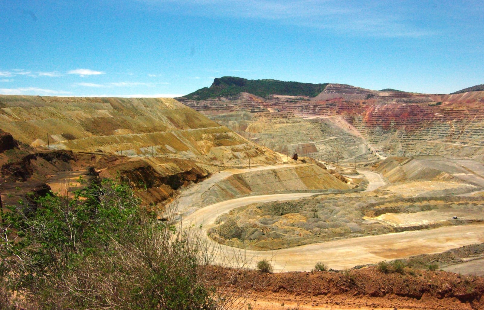
The terraced walls and haul roads of the open-pit copper mine at Santa Rita, banded in yellow and redRaymond M. Coveney / CC BY-SA 3.0 via Wikimedia Commons
🏭Industrial

Santa Rita Copper Mine

Part ofLas Cruces, the Gila & the Southwest
On this driveNM-152 and NM-15: City of Rocks to the Gila Cliff Dwellings

The copper pit east of Silver City that swallowed the town it was named for, beneath a spire of volcanic rock long said to look like a nun at prayer.

Year-RoundMining BoomFree
⏱
Duration
Half an hour.
🎟
Admission
Free overlook.
📅
Best Season
Year-round.

The Story

Around 1800 an Apache man showed the copper here to José Manuel Carrasco, a retired Spanish officer, and Carrasco staked a claim and began mining it. He sold out to Francisco Manuel de Elguea, who brought in convict labor, built an adobe fort to hold the workers and guard them, and sent the copper south to Mexico by mule train. They called the place Santa Rita del Cobre.

In 1910 the Chino Copper Company began working it as an open pit, with steam shovels and rail cars, and the pit kept spreading. The company town of Santa Rita stood on its edge. In the 1950s ore was found under the town itself, the townsite was abandoned and its people moved away, and by 1970 Santa Rita was gone. Its former residents keep its memory at the Santa Rita Shrine, a lone structure at the junction of NM-152 and NM-356.

The pit is now about 1,500 feet deep and a mile and a half across, owned by Freeport-McMoRan, which paused mining in 2008 and resumed in 2011. An overlook on the south side of NM-152 east of Hanover has displays on the mine's history and works. On the skyline beyond the pit stands the Kneeling Nun, a block of the same volcanic tuff as City of Rocks that slid from the cliffs above it and has long been said to resemble a nun kneeling in prayer. As the mine has moved toward it, people have raised concerns about how stable it is.

Visitor Info

⏱
Time Needed
Half an hour.
🎟
Admission
Free overlook.
📅
Best Season
Year-round.
🛣️
Highway
NM-152

On the Map

Nearby

The closest stops worth working into your route

geological15 mi away
City of Rocks State Park
Pinnacles of volcanic tuff up to forty feet high standing in the grassland between Deming and Silver City, worn out of an eruption 34.9 million years ago.
historical32 mi away
Gila Cliff Dwellings National Monument
Rooms built into five caves above a Gila side canyon in the late 1270s and lived in for about a generation, at the end of forty-four winding miles of mountain road from Silver City.
historical71 mi away
Pancho Villa State Park
The site of Camp Furlong at Columbus, named for the revolutionary whose raiders attacked the town in 1916, as a gesture of friendship toward Mexico.
historical82 mi away
Mesilla Plaza
A plaza laid out in 1848 by people who meant to stay in Mexico, American six years later, a stage stop and Civil War headquarters, and scene of a deadly political riot in 1871.
attraction92 mi away
Very Large Array
Twenty-seven radio dishes, each 82 feet across and 230 tons, spread in a Y across an Ice Age lakebed on the Plains of San Agustin and moved on rails to change how sharply they see.
natural93 mi away
Chiricahua National Monument
The Land of Standing-Up Rocks — Cochise and Geronimo's stronghold