Home / New Mexico / Las Cruces, the Gila & the Southwest / City of Rocks State Park
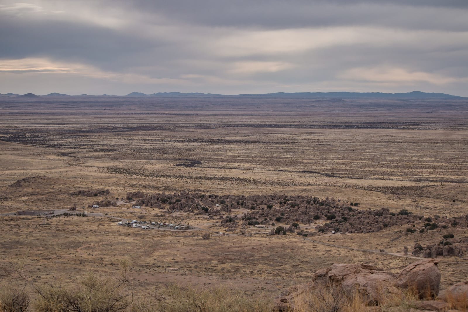
The rock formations of City of Rocks State Park seen from Table Mountain as a dark band across the wide grassland, mountains on the horizonJ7uy5 / CC BY-SA 3.0 via Wikimedia Commons
🏜️Geological

City of Rocks State Park

Part ofLas Cruces, the Gila & the Southwest
On this driveNM-152 and NM-15: City of Rocks to the Gila Cliff Dwellings

Pinnacles of volcanic tuff up to forty feet high standing in the grassland between Deming and Silver City, worn out of an eruption 34.9 million years ago.

Off the Beaten PathWinterStargazingPhotographyDark SkyPaid EntryVolcanicWeird & Wonderful
⏱
Duration
Two hours, or overnight for the stars.
🎟
Admission
State park day-use fee.
📅
Best Season
Fall through spring.
💡
Fun Fact
The eruption that made these rocks was more than a thousand times larger than Mount St. Helens in 1980.

The Story

Out on the grassland between Deming and Silver City, a cluster of gray and pinkish pillars and boulders rises like a town seen from far off, some of them forty feet tall, with sandy lanes running between them. The rock is tuff. Some 34.9 million years ago an eruption at the Emory caldera, in the southern Black Range to the east, sent ash, pumice and hot gas across this country as a racing cloud that settled so hot it welded into solid stone. That eruption was more than a thousand times larger than Mount St. Helens in 1980. As the rock cooled it cracked along joints, and freeze and thaw, wind and the roots of plants have been widening the cracks ever since.

The layer is called the Kneeling Nun Tuff, after a spire of the same rock that stands above the copper pit at Santa Rita, a short drive to the north.

The park was set aside in 1952. Campsites are tucked in among the rocks, and a desert botanical garden sits by the visitor center. It is an International Dark Sky Park, and the Gene and Elisabeth Simon Observatory, the first built in a New Mexico state park, holds a 14-inch telescope used for public star programs. Mimbres people lived along the nearby valleys, and Faywood Hot Springs is a couple of miles away.

Visitor Info

⏱
Time Needed
Two hours, or overnight for the stars.
🎟
Admission
State park day-use fee.
📅
Best Season
Fall through spring.
🛣️
Highway
US-180

On the Map

Nearby

The closest stops worth working into your route

industrial15 mi away
Santa Rita Copper Mine
The copper pit east of Silver City that swallowed the town it was named for, beneath a spire of volcanic rock long said to look like a nun at prayer.
historical47 mi away
Gila Cliff Dwellings National Monument
Rooms built into five caves above a Gila side canyon in the late 1270s and lived in for about a generation, at the end of forty-four winding miles of mountain road from Silver City.
historical56 mi away
Pancho Villa State Park
The site of Camp Furlong at Columbus, named for the revolutionary whose raiders attacked the town in 1916, as a gesture of friendship toward Mexico.
historical72 mi away
Mesilla Plaza
A plaza laid out in 1848 by people who meant to stay in Mexico, American six years later, a stage stop and Civil War headquarters, and scene of a deadly political riot in 1871.
natural90 mi away
Chiricahua National Monument
The Land of Standing-Up Rocks — Cochise and Geronimo's stronghold
natural105 mi away
Bosque del Apache National Wildlife Refuge
A Rio Grande refuge south of Socorro where cranes and geese winter by the tens of thousands on wetlands and fields kept by people, because the river no longer floods to make them.