Home / New Mexico / Las Cruces, the Gila & the Southwest / Mesilla Plaza
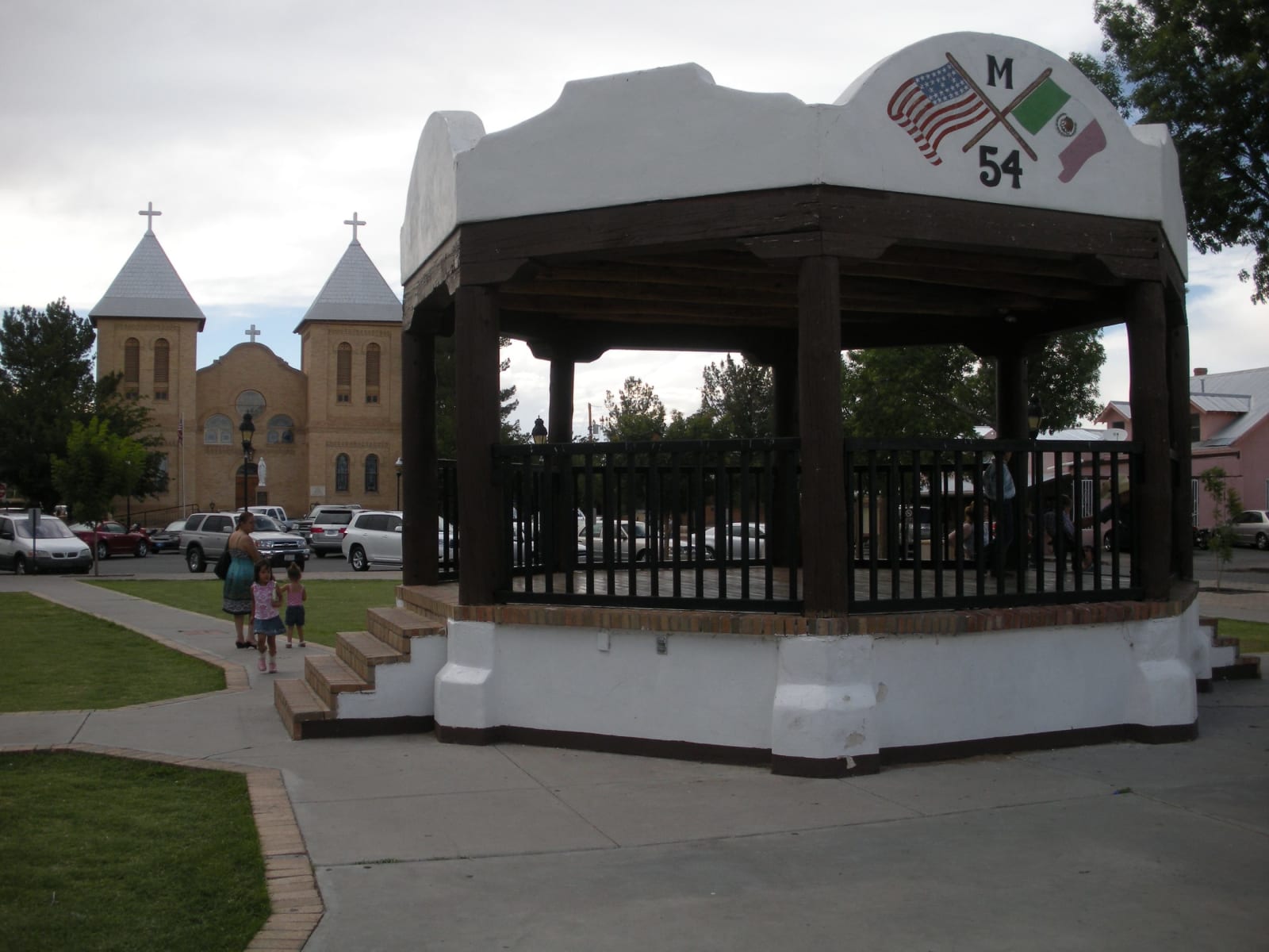
The white bandstand on Mesilla Plaza with the twin towers of the Basilica of San Albino behind itRoger Pierson / CC BY-SA 3.0 via Wikimedia Commons
🏛️Historical

Mesilla Plaza

Part ofLas Cruces, the Gila & the Southwest

A plaza laid out in 1848 by people who meant to stay in Mexico, American six years later, a stage stop and Civil War headquarters, and scene of a deadly political riot in 1871.

WinterFree
⏱
Duration
One to two hours.
🎟
Admission
Free.
📅
Best Season
Fall through spring.

The Story

After the war of 1846 to 1848 put the Rio Grande valley north of El Paso in American hands, families who wanted to remain in Mexico moved to the west bank of the river and founded La Mesilla in 1848 on what they took to be Mexican ground, clustering their houses around a plaza. The Gadsden Purchase moved the border south, and in November 1854 the American flag went up over that plaza.

For the next decades the plaza was a crossroads. The Butterfield Overland Mail ran through it from 1857 to 1861 on the way from San Antonio to San Diego, and by the late 1860s Mesilla, with more than 2,500 people, was the largest town between those two cities. The adobe that served the stages later became the Corn Exchange Hotel, and since 1939 it has been La Posta, a restaurant still run by its founder's family. During the Civil War the plaza served first as Confederate and then as Union headquarters for the military district of Arizona.

In August 1871 rival political rallies met on the plaza, and the shooting that followed was one of the bloodiest political riots in New Mexico's territorial history. When the railroad came through the valley a decade later, it went to Las Cruces, and Mesilla stopped growing, which is much of why its plaza survives.

The Basilica of San Albino, yellow brick with square belfries, closes the north end of the plaza; it was built from 1906 to 1908 on the site of an earlier adobe church, in a parish founded around 1852. A bandstand from the 1930s stands in the middle, and the plaza and its buildings have been a National Historic Landmark since 1961.

Visitor Info

⏱
Time Needed
One to two hours.
🎟
Admission
Free.
📅
Best Season
Fall through spring.
🛣️
Highway
I-10

On the Map

Nearby

The closest stops worth working into your route

natural50 mi away
White Sands National Park
The largest gypsum dunefield on Earth, a national park since 2019, surrounded on all sides by military ground whose missile tests close its only road for hours at a time.
historical58 mi away
Pancho Villa State Park
The site of Camp Furlong at Columbus, named for the revolutionary whose raiders attacked the town in 1916, as a gesture of friendship toward Mexico.
geological72 mi away
City of Rocks State Park
Pinnacles of volcanic tuff up to forty feet high standing in the grassland between Deming and Silver City, worn out of an eruption 34.9 million years ago.
industrial82 mi away
Santa Rita Copper Mine
The copper pit east of Silver City that swallowed the town it was named for, beneath a spire of volcanic rock long said to look like a nun at prayer.
cultural87 mi away
Three Rivers Petroglyph Site
More than 21,000 petroglyphs on a basalt ridge above the Tularosa Basin, one of the few places in the Southwest set aside for its rock art alone, walked on a rough half-mile trail.
historical99 mi away
Trinity Site
Where the first atomic bomb was exploded on July 16, 1945, open one day a year, and remembered by its neighbors as the start of decades of illness the government took eighty years to acknowledge.