Home / Alabama / Montgomery, Selma & the Black Belt / Old Cahawba Archaeological Park
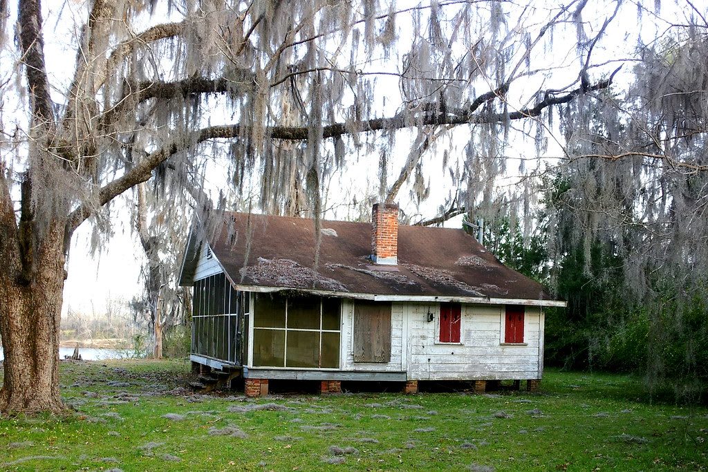
A weathered wooden cottage with a screened porch under a live oak hung with Spanish moss.scott weingart / CC BY 2.0 via Flickr
🏛️Historical

Old Cahawba Archaeological Park

Part ofMontgomery, Selma & the Black Belt

Alabama's first state capital, at the mouth of the Cahaba River: a cotton town that faded into ruin and, for a few years after the Civil War, a center of Black political life.

⏱
Duration
Two to three hours.
🎟
Admission
Small admission fee charged by the Alabama Historical Commission at the welcome center.
📅
Best Season
Fall through spring; summer is hot and the low ground floods after heavy rain.

The Story

Under the ruins of Alabama's first capital lie the remains of a large Mississippian village, and the name itself is Native: from two Choctaw words meaning "water above," or from a Creek word for the cane that once covered these river valleys. A sizable Choctaw town stood here in the early 1700s and was gone well before Alabama became a territory. The land came open to white settlement after the Creek defeat at Horseshoe Bend in 1814 and the cession that followed.

Cahawba was laid out in 1819 on a Philadelphia-style grid where the Cahaba River meets the Alabama, and it served as the state capital from 1820 until 1825. Floods and politics moved the government to Tuscaloosa in 1826, but the town came back in the 1840s and 1850s as a river port for the Black Belt, when Dallas County was the wealthiest county in the state on cotton raised by enslaved people. During the Civil War the Confederacy held more than 3,000 Union soldiers in a prison here.

After the war Cahawba lost its railroad and, in 1866, the county seat to Selma. By 1870 about 300 people remained, most of them freedpeople, who held political meetings in the old courthouse and earned the town the name "Mecca of the Radical Republican Party." Many became landowners, and some won office. By 1900 the buildings were nearly all gone, many of their bricks carted off to Selma. Today the Alabama Historical Commission keeps the dirt streets, the Crocheron columns, the Perine artesian well, chimney ruins, slave-quarter remnants, old town cemeteries and nature trails.

Visitor Info

⏱
Time Needed
Two to three hours.
🎟
Admission
Small admission fee charged by the Alabama Historical Commission at the welcome center.
📅
Best Season
Fall through spring; summer is hot and the low ground floods after heavy rain.
🛣️
Highway
Cahaba Road, off AL 22

On the Map

Nearby

The closest stops worth working into your route

historical7.8 mi away
Edmund Pettus Bridge
The 1940 steel arch over the Alabama River where state troopers and a mounted posse beat voting-rights marchers on Bloody Sunday, March 7, 1965.
historical8.3 mi away
Brown Chapel AME Church
The 1908 church a freed congregation built in Selma, headquarters of the 1965 voting-rights campaign and the starting point of all three marches toward Montgomery.
cultural20 mi away
Gee's Bend
A Black farming community in a deep bend of the Alabama River, cut off from its county seat for 44 years after residents tried to vote, whose quilts are now shown in major museums.
historical22 mi away
Lowndes Interpretive Center
The National Park Service center on US 80 built where Tent City sheltered sharecroppers evicted for registering to vote, midway along the Selma to Montgomery route through "Bloody Lowndes."
historical39 mi away
Safe House Black History Museum
Two shotgun houses in Greensboro's Depot neighborhood, one of them where neighbors hid Martin Luther King Jr. from the Klan on March 21, 1968.
historical40 mi away
Magnolia Grove
An 1840 temple-form Greek Revival townhouse in Greensboro, built for a cotton planter, with its original kitchen and a one-room slave house still standing behind it.

Historical markers nearby

Roadside plaques and monuments within a short detour

Marker7.9 mi away
Sturdivant Hall
Selma
Marker8.3 mi away
First Baptist Church (Selma)
Selma
Marker8.4 mi away
Tabernacle Baptist Church
Selma
Marker21 mi away
Snow Hill Normal and Industrial Institute
Snow Hill
Marker22 mi away
Holy Ground Battlefield
White Hall
Marker23 mi away
Prairie Mission
Catherine