Home / Texas / Austin, San Marcos & the Lost Pines / Mount Bonnell
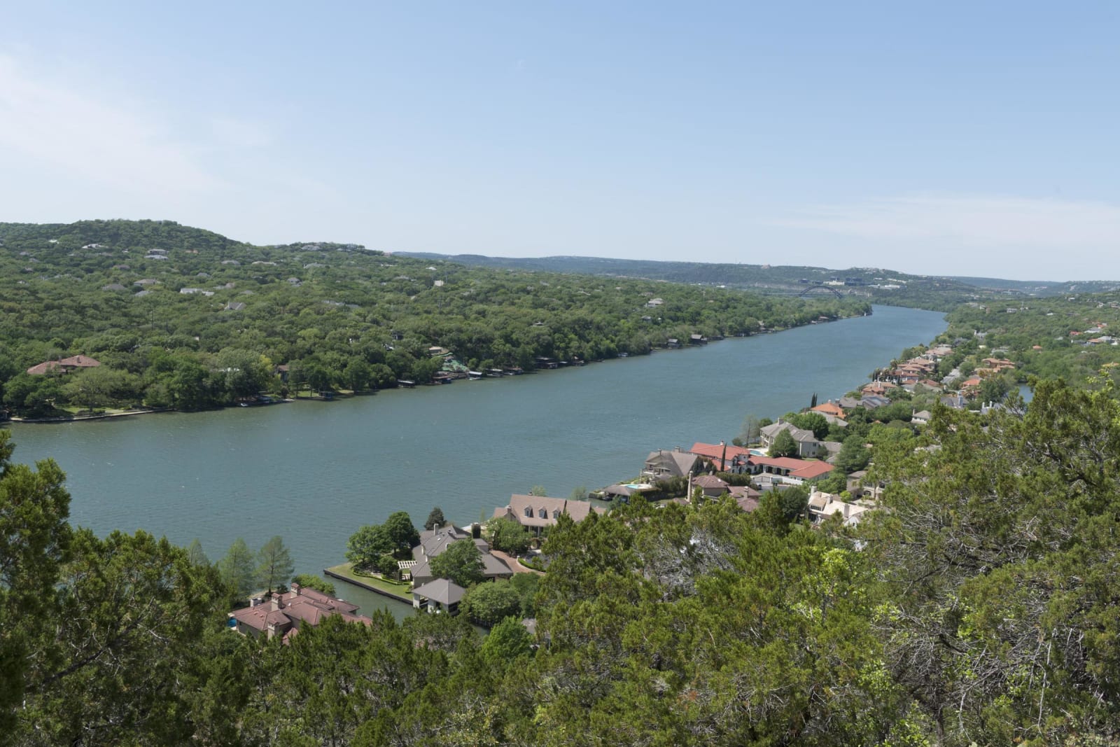
Lake Austin winding between wooded hills and waterfront houses, seen from the top of Mount Bonnell.Carol M. Highsmith / public domain via the Library of Congress
🌲Natural

Mount Bonnell

Part ofAustin, San Marcos & the Lost Pines

Austin's old lookout over the Colorado, named by an 1838 traveler, picnicked on by George and Libbie Custer, and reached by a 1939 flight of about 100 limestone steps.

⏱
Duration
30 minutes to an hour.
🎟
Admission
Free.
📅
Best Season
Year round; the overlook faces west over Lake Austin for sunsets.

The Story

Mount Bonnell rises about 775 feet above sea level on the east bank of the Colorado River, now Lake Austin, in western Austin. Native peoples used the height long before any written record. The first known written mention comes from George W. Bonnell, a journalist who rode out in 1838 with Edward Burleson and the editor Simon Mussina. His Topographical Description of Texas, published in April 1840, gave the peak its name, claimed a precipice of seven hundred feet down to the water and called the view one of the grandest and loveliest in nature.

It has been a place for outings ever since. After the Civil War, George Armstrong Custer, posted in Austin, picnicked on the summit with his wife Libbie. They found it too steep for a cavalry horse and climbed on foot, while the regimental band played below. Local lore said a couple who came once would fall in love, came twice would be engaged and came three times would marry; Lieutenant Thomas Tolman and Corinne Barret became engaged here on Christmas Eve 1866, as their son told it in 1924. James Michener later lived on the mountain while writing Texas.

In 1939 the sons of Frank M. Covert Sr. deeded the top to Travis County as Covert Park, and about 100 limestone steps were laid to the crest, with stone tables and pylons along the overlook. The city took the five-acre park in 1972, and in 2006 it became part of the Balcones Canyonlands Preserve. Houses cover the slopes below, so stay on the park paths.

Visitor Info

⏱
Time Needed
30 minutes to an hour.
🎟
Admission
Free.
📅
Best Season
Year round; the overlook faces west over Lake Austin for sunsets.
🛣️
Highway
Loop 1 (MoPac) / 35th Street

On the Map

Nearby

The closest stops worth working into your route

cultural3.2 mi away
Harry Ransom Center
The University of Texas archive where a Gutenberg Bible and the earliest surviving camera photograph are always on view, free, beside the papers of Watergate and the movies.
historical3.5 mi away
Bullock Texas State History Museum
The state's history museum at the head of Congress Avenue, built around the hull of La Salle's ship La Belle, raised from Matagorda Bay with 1.8 million artifacts.
historical3.6 mi away
LBJ Presidential Library
A ten-story travertine archive on the University of Texas campus holding 45 million pages from a presidency of civil rights laws, the War on Poverty and Vietnam.
architectural3.7 mi away
Texas State Capitol
Austin's fourth statehouse, a Renaissance Revival capitol of 1888 that stands 311 feet to its Goddess of Liberty and was restored after the 1983 fire.
natural3.9 mi away
Barton Springs Pool
A three-acre pool in the bed of Barton Creek, fed by the fourth-largest spring in Texas at 68 to 70 degrees, and shared with an endangered salamander found almost nowhere else.
historical4.5 mi away
French Legation State Historic Site
A raised pine house built in 1840 and 1841 for France's envoy to the Republic of Texas, who left Austin in a rage over a neighbor's pigs before it was finished.

Historical markers nearby

Roadside plaques and monuments within a short detour

Marker0 mi away
Mount Bonnell
Austin
Marker1.1 mi away
Major John B. Jones
Austin
Marker1.1 mi away
William Steele
Austin
Marker1.1 mi away
Texas in the Civil War - Federal Forces
Austin
Marker1.1 mi away
Texas in the Civil War - Adjutants General
Austin
Marker1.1 mi away
Camp Mabry
Austin