Home / Kentucky / Louisville & the Ohio River / Louisville Waterfront Park
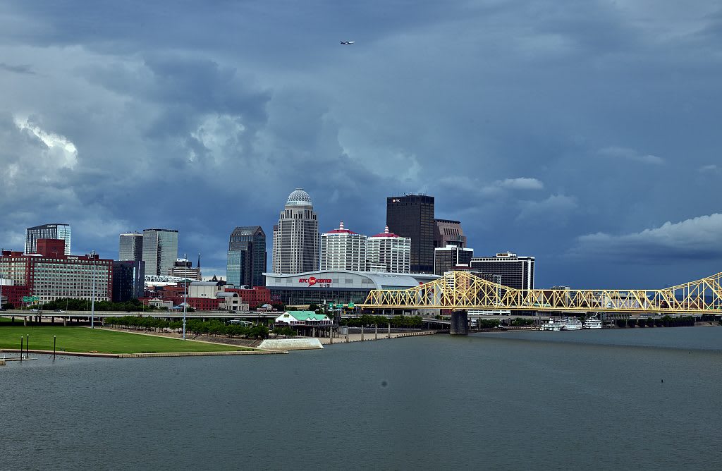
The Waterfront Park lawn and downtown Louisville seen across the Ohio River under storm clouds, with a yellow truss bridge at right.Carol M. Highsmith / public domain via Library of Congress
🏛️Historical

Louisville Waterfront Park

Part ofLouisville & the Ohio River

Eighty-five acres of lawn on the Ohio below downtown, where the Falls made a city, the river trade carried people south, and an old railroad bridge now walks you to Indiana.

⏱
Duration
One to two hours, longer to walk the bridge to Jeffersonville and back.
🎟
Admission
Free.
📅
Best Season
Year round; spring and fall are best for the walk across the Big Four Bridge.

The Story

People lived along this stretch of the Ohio from at least 1000 BCE until about 1650, from Archaic hunters to the Adena and Hopewell and then Fort Ancient and Mississippian communities. The Falls of the Ohio, the only break in the river between Pittsburgh and the Mississippi, made this a crossing and a portage. After the Beaver Wars of the 1600s emptied the valley, the Shawnee from the north and the Cherokee from the south hunted this ground but built no towns on it. George Rogers Clark's regiment landed on Corn Island at the falls on May 27, 1778, with about 80 civilians, who crossed to the mainland the next spring.

After the Louisville and Portland Canal opened around the falls in 1830, boats ran through from Pittsburgh to New Orleans, and the river carried people as cargo. Louisville held one of the largest slave trades in the country; traders gathered enslaved Kentuckians here to ship south to New Orleans, and in the 1850s between 2,500 and 4,000 people a year were sold out of the state that way. "Sold down the river" comes from that traffic. People escaping slavery called the same water the River Jordan.

Hargreaves Associates laid out the park's 85 acres between 1994 and 2012 over scrap yards and sandpits. The Big Four Bridge, an 1895 railroad bridge closed in 1969, reopened to walkers and cyclists in 2013 and reached Jeffersonville in 2014. From midspan, look downriver toward the falls. The flood walls went up after January 1937, when the river covered about 70 percent of the city.

Visitor Info

⏱
Time Needed
One to two hours, longer to walk the bridge to Jeffersonville and back.
🎟
Admission
Free.
📅
Best Season
Year round; spring and fall are best for the walk across the Big Four Bridge.
🛣️
Highway
I-64 / River Road

On the Map

Nearby

The closest stops worth working into your route

cultural1.1 mi away
Muhammad Ali Center
Six stories on the riverfront that Muhammad Ali and Lonnie Ali founded to tell how a West End boy became the man who would not go to Vietnam.
historical1.6 mi away
Cave Hill Cemetery
A garden cemetery of 1848 on 296 rolling acres and 500 kinds of trees, where George Rogers Clark lies and Muhammad Ali was buried in 2016.
historical1.8 mi away
Western Branch Library
The 1908 Carnegie library at Tenth and Chestnut, opened in 1905 as the first public library in the nation run by and for Black residents, still lending books.
natural2.9 mi away
Cherokee Park
Frederick Law Olmsted's 409-acre park along Beargrass Creek, laid out in 1891, flattened by a tornado in 1974 and replanted to his plan.
cultural4.3 mi away
Churchill Downs and the Kentucky Derby Museum
The 1875 track under the twin spires, where 13 of the 15 riders in the first Kentucky Derby were Black and Isaac Murphy won it three times.
historical4.5 mi away
Historic Locust Grove
A Georgian farmhouse of about 1790 built by enslaved craftsmen, where George Rogers Clark spent his last years and Lewis and Clark stopped on the way home from the Pacific.

Historical markers nearby

Roadside plaques and monuments within a short detour

Marker0.4 mi away
Jug Band Pioneer
Louisville
Marker0.7 mi away
St. John's Evangelical Church
Louisville
Marker0.8 mi away
St. Joseph Catholic Church
Louisville
Marker0.9 mi away
Galt House
Louisville
Marker0.9 mi away
Louisville's Steamboat Era
Louisville
Marker0.9 mi away
St. Boniface Parish
Louisville