Home / Kentucky / Louisville & the Ohio River / Cherokee Park
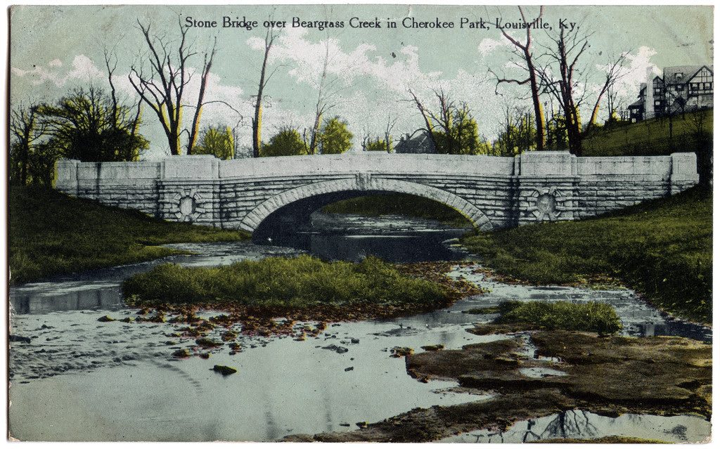
An early 1900s postcard of a stone arch bridge over Beargrass Creek in Cherokee Park.Diane Deaton Street / CC BY 2.0 via Flickr
🌲Natural

Cherokee Park

Part ofLouisville & the Ohio River

Frederick Law Olmsted's 409-acre park along Beargrass Creek, laid out in 1891, flattened by a tornado in 1974 and replanted to his plan.

⏱
Duration
One hour for the drive, half a day to walk it.
🎟
Admission
Free.
📅
Best Season
Year round; April for dogwoods, October for color.

The Story

The Cherokee hunted this ground from the south and the Shawnee from the north in the 1700s, though neither nation had towns here. In 1891 Louisville gave the names of Native nations to the great parks it commissioned from Frederick Law Olmsted's firm, a fashion of the day more than a tribute, and Cherokee Park opened that year. Olmsted's idea was to keep the rolling land along Beargrass Creek much as it was, with meadows opening between woods and the roads following the hollows.

The park covers 409 acres in the city's East End. Beargrass Creek winds through much of it under a long run of bridges, and the 2.4-mile Scenic Loop circles the park with a one-way lane for cars and a separate lane for walkers, runners and cyclists. Hogan's Fountain, on a hilltop along the loop, was paid for by the Hogan family in 1905 and sculpted by Enid Yandell, and the lawn around it is the park's favorite picnic ground.

On April 3, 1974, an F4 tornado tore through the park and brought down thousands of mature trees. The city replanted from Olmsted's original plans, setting out some 2,500 trees and 4,600 shrubs, so the park you see is both his and half a century old. Entrances come in from the Cherokee Triangle, Bonnycastle, Highlands-Douglass, Crescent Hill and Seneca Gardens, and the winding roads inside are easy to get turned around on.

Visitor Info

⏱
Time Needed
One hour for the drive, half a day to walk it.
🎟
Admission
Free.
📅
Best Season
Year round; April for dogwoods, October for color.
🛣️
Highway
I-64 (Grinstead Drive)

On the Map

Nearby

The closest stops worth working into your route

historical1.6 mi away
Cave Hill Cemetery
A garden cemetery of 1848 on 296 rolling acres and 500 kinds of trees, where George Rogers Clark lies and Muhammad Ali was buried in 2016.
historical2.2 mi away
Farmington Historic Plantation
The Speed family's 1816 hemp plantation house, told through the 20 to 70 people they enslaved here, and the place Lincoln stayed in 1841.
historical2.9 mi away
Louisville Waterfront Park
Eighty-five acres of lawn on the Ohio below downtown, where the Falls made a city, the river trade carried people south, and an old railroad bridge now walks you to Indiana.
cultural3.7 mi away
Muhammad Ali Center
Six stories on the riverfront that Muhammad Ali and Lonnie Ali founded to tell how a West End boy became the man who would not go to Vietnam.
historical3.8 mi away
Historic Locust Grove
A Georgian farmhouse of about 1790 built by enslaved craftsmen, where George Rogers Clark spent his last years and Lewis and Clark stopped on the way home from the Pacific.
historical3.9 mi away
Western Branch Library
The 1908 Carnegie library at Tenth and Chestnut, opened in 1905 as the first public library in the nation run by and for Black residents, still lending books.

Historical markers nearby

Roadside plaques and monuments within a short detour

Marker0.5 mi away
Enid Yandell (1869-1934)
Louisville
Marker0.9 mi away
Murray Atkins Walls - Civil Rights Pioneer
Louisville
Marker0.9 mi away
Louisville Legion
Louisville
Marker1.1 mi away
St. Frances of Rome School/Sisters of Charity of Nazareth
Louisville
Marker1.1 mi away
Artist of Confederacy
Louisville
Marker1.2 mi away
George Rogers Clark
Louisville