Home / Wyoming / Casper & the Oregon Trail / Independence Rock State Historic Site
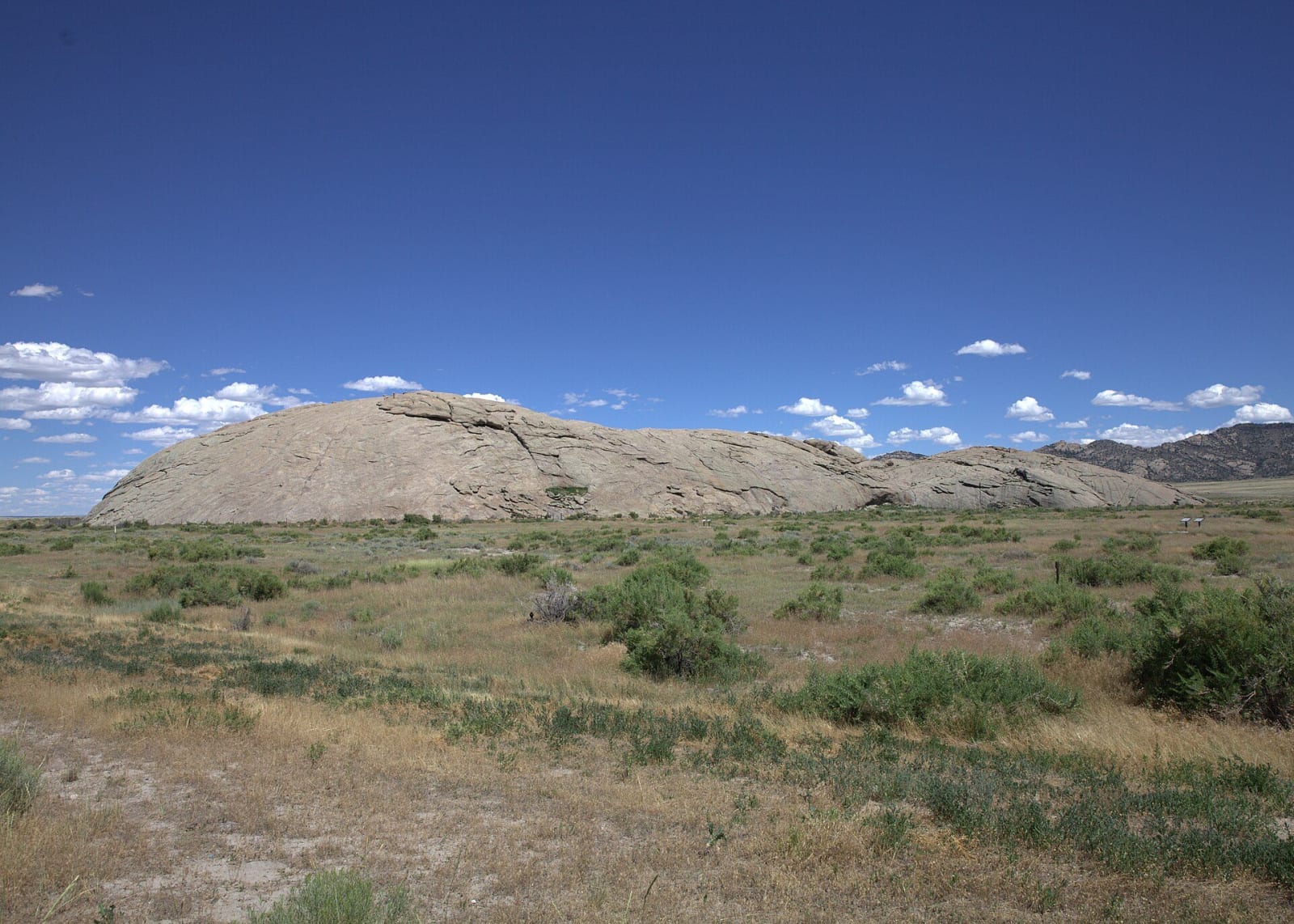
Independence Rock, a long grey granite dome rising out of sagebrush flats, seen from the west under a deep blue skyGoretexguy / CC BY-SA 3.0 via Wikimedia Commons
🏛️Historical

Independence Rock State Historic Site

Part ofCasper & the Oregon Trail
On this driveThe Emigrant Road: Fort Laramie to South Pass

A granite whaleback named before the wagons came, by trappers in 1824 or Sublette in 1830, and polished by wind until it took names easily.

Year-RoundPioneer HistoryFreeHiking
⏱
Duration
One hour, more to climb it.
📅
Best Season
Year-round; summer for the climb.

The Story

No one is sure who named it. One account gives the honor to fur trappers who camped at the rock on the Fourth of July in 1824, Thomas Fitzpatrick among them by some tellings. Another gives it to William Sublette, who came by with eighty-one men and ten wagons on July 4, 1830, and kept the holiday there. Either way the name was on the rock before the emigrant trains arrived.

It is a single whaleback of granite about 1,900 feet long and some 130 feet high, standing alone in the Sweetwater valley at the southeastern end of the Granite Mountains. Windblown sand has grooved and polished its surface, which is part of why it took names so readily; thousands were cut or painted on it, and lichen and flaking have since taken many. Emigrants reached for comparisons. John Ball, passing in 1832, thought it looked like a great bowl turned upside down.

On July 4, 1862, the first Masonic lodge meeting in what became Wyoming was held on its summit, and in 1930 Boy Scouts came on pilgrimage to mark a century since Sublette's wagons. The rock was made a National Historic Landmark in 1961. It stands beside a rest area on WY-220, about fifty-five miles southwest of Casper, and a trail of about a mile circles its base.

Visitor Info

⏱
Time Needed
One hour, more to climb it.
📅
Best Season
Year-round; summer for the climb.
🛣️
Highway
WY-220

On the Map

Nearby

The closest stops worth working into your route

historical5.6 mi away
Sun Ranch and Devil's Gate
Tom Sun's 1872 cattle ranch at Devil's Gate, sold in 1996 to the church for whom the cove nearby is sacred, and the fight over who should hold that cove.
historical45 mi away
Fort Caspar Museum
The crossing before the fort: the Mormon ferry of 1847 and Guinard's toll bridge of 1859, rebuilt beside the 1936 log station.
historical50 mi away
Fort Fred Steele State Historic Site
A fort built in 1868 to guard the Union Pacific's North Platte crossing, which became the collecting yard for railroad ties floated down the river.
cultural74 mi away
St. Stephen's Mission
A Jesuit mission on land the Arapaho leader Black Coal chose, its church painted with Arapaho designs, its boarding school named for what it was.
historical85 mi away
South Pass City State Historic Site
The Carissa lode built the town in a year; the mine outlived the boom by eight decades, and its mill runs again for visitors.
natural89 mi away
Medicine Bow Peak
The Snowy Range's quartzite high point, where United Air Lines Flight 409 struck the east face in 1955 and killed all sixty-six aboard.

Historical markers nearby

Roadside plaques and monuments within a short detour

Marker5.7 mi away
Tom Sun Ranch
Marker5.7 mi away
The Oregon Trail
Marker5.7 mi away
The Pioneer Women