Home / Wyoming / Cheyenne, Laramie & the Snowy Range / Medicine Bow Peak
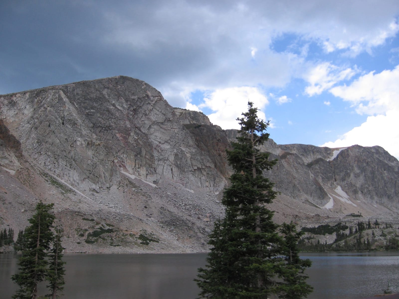
The pale quartzite face of Medicine Bow Peak rising above Lake Marie, spruce trees on the shorePhotomnt / public domain via Wikimedia Commons
🌲Natural

Medicine Bow Peak

Part ofCheyenne, Laramie & the Snowy Range

The Snowy Range's quartzite high point, where United Air Lines Flight 409 struck the east face in 1955 and killed all sixty-six aboard.

SummerHiking
⏱
Duration
Thirty minutes at the pass; a full day to climb.
📅
Best Season
Late June through September, when the pass is open and the trail clear.

The Story

Medicine Bow Peak, a little over 12,000 feet, is the high point of the Snowy Range, and its pale cliffs are quartzite, part of an ancient ridge far older than the mountains around it. From Snowy Range Pass on WY-130, at 10,847 feet, the east face rises above Lake Marie and Mirror Lake, and it usually holds snow from October into late June. A trail climbs to the summit from the lakes.

At 7:26 on the morning of October 6, 1955, United Air Lines Flight 409, a four-engine DC-4 bound from New York to San Francisco by way of Denver and Salt Lake City, flew into that east face at about 11,570 feet. It had left Denver late and had flown some twenty miles west of its prescribed course, in and out of cloud; investigators named cloud hiding the mountain and downdrafts around the peak among the causes, and United later found that pilots sometimes cut over the peak to save time. All sixty-six people aboard were killed, among them servicemen, infants and members of the Mormon Tabernacle Choir. Recovering them from the cliffs and the boulder field below took five days.

Pieces of the wreckage are still on the mountain, and a small plaque on a hill facing the peak marks the crash. The highway over the pass closes in winter.

Visitor Info

⏱
Time Needed
Thirty minutes at the pass; a full day to climb.
📅
Best Season
Late June through September, when the pass is open and the trail clear.
🛣️
Highway
WY-130

On the Map

Nearby

The closest stops worth working into your route

historical44 mi away
Fort Fred Steele State Historic Site
A fort built in 1868 to guard the Union Pacific's North Platte crossing, which became the collecting yard for railroad ties floated down the river.
geological51 mi away
Vedauwoo
Knobs of 1.4-billion-year-old granite between Laramie and Cheyenne, rough as sandpaper and famous among climbers for its wide cracks.
cultural78 mi away
Cheyenne Frontier Days
A railroad agent's excursion scheme for a town with no crop to celebrate, which became a six-hour show in 1897 and the Daddy of 'em All.
architectural79 mi away
Wyoming State Capitol
A sandstone capitol set to face the Union Pacific depot down one long street, its copper dome gilded in 1900 when the copper tarnished.
historical88 mi away
Sun Ranch and Devil's Gate
Tom Sun's 1872 cattle ranch at Devil's Gate, sold in 1996 to the church for whom the cove nearby is sacred, and the fight over who should hold that cove.
historical89 mi away
Independence Rock State Historic Site
A granite whaleback named before the wagons came, by trappers in 1824 or Sublette in 1830, and polished by wind until it took names easily.