Home / Wyoming / Casper & the Oregon Trail / Fort Caspar Museum
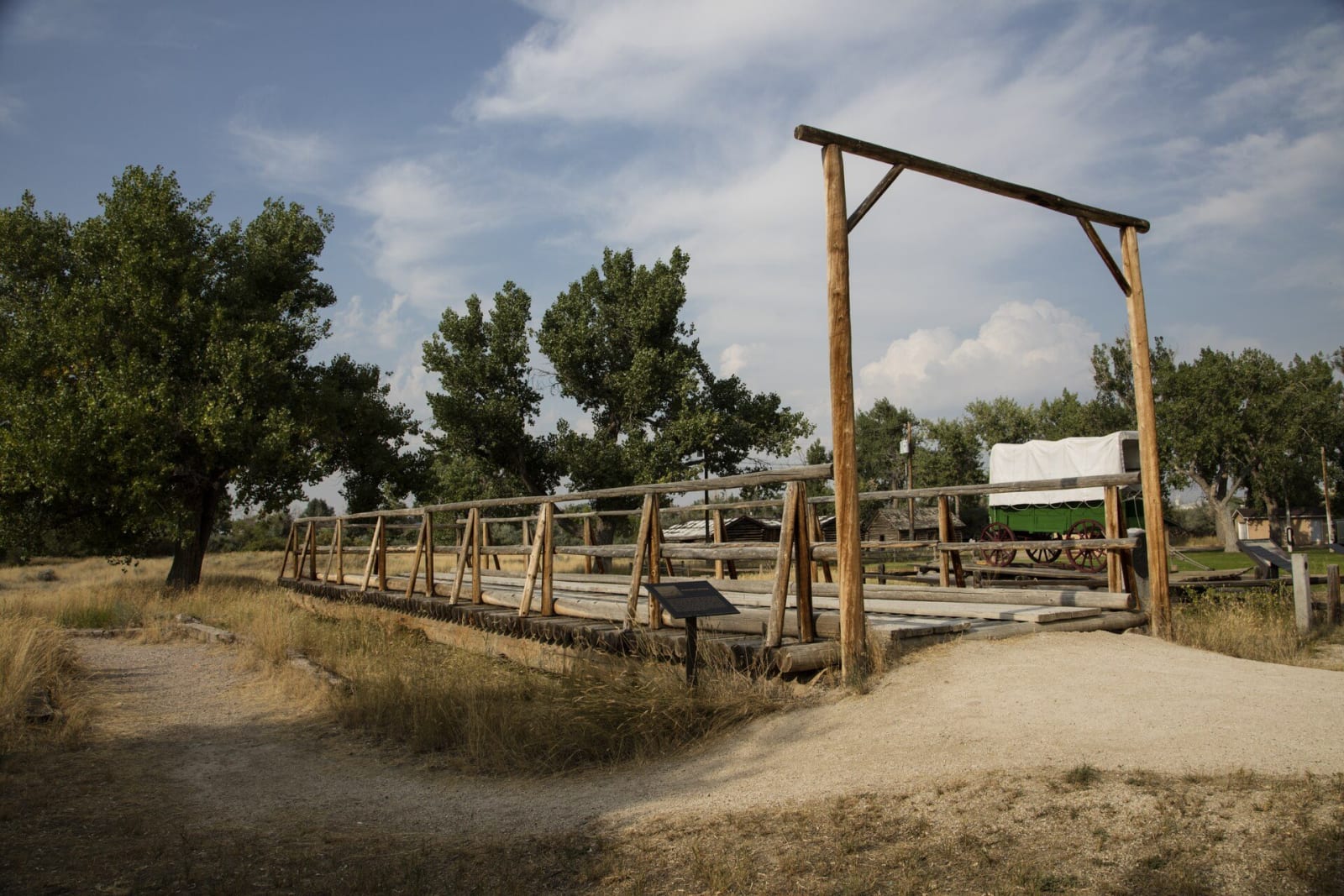
The reconstructed Guinard toll bridge at Fort Caspar, a timber deck on log cribs crossing a dry channel toward a covered wagon, cottonwoods behindCarol M. Highsmith / public domain via Wikimedia Commons
🏛️Historical

Fort Caspar Museum

Part ofCasper & the Oregon Trail
On this driveThe Emigrant Road: Fort Laramie to South Pass

The crossing before the fort: the Mormon ferry of 1847 and Guinard's toll bridge of 1859, rebuilt beside the 1936 log station.

Year-RoundPioneer HistoryFamily-Friendly
⏱
Duration
One to two hours.
📅
Best Season
Year-round; the fort buildings open in summer.

The Story

Before there was a fort here, there was a crossing. In June 1847 Brigham Young's pioneer company, held up by a flooding North Platte at the place trappers called the Upper Crossing, built a ferry, carried other emigrants over for pay and left men behind to keep running it; Mormon crews came back to work it through the 1852 season. In 1859 the trader Louis Guinard built a timber toll bridge about a thousand feet long, with a trading post at its south end, and the bridge put the ferries out of business. Richard Burton spent a night at the station in August 1860, the Pony Express changed horses there in 1860 and 1861, and the telegraph opened an office in 1861.

Soldiers moved into Guinard's buildings in 1862 to guard the line, and the garrison became Platte Bridge Station. The post was ordered closed in October 1867, and the bridge and buildings were burned soon after the Army left.

The log fort on the site is a 1936 reconstruction by Casper citizens and the Works Progress Administration, built close to the original footprint from a plan drawn by Caspar Collins himself, so what stands is the station he knew rather than the larger fort later named for him. A replica of the Mormon ferry and a rebuilt span of Guinard's bridge were added in the 1980s, and the city runs a museum beside them.

Visitor Info

⏱
Time Needed
One to two hours.
📅
Best Season
Year-round; the fort buildings open in summer.
🛣️
Highway
WY-258

On the Map

Nearby

The closest stops worth working into your route

historical45 mi away
Independence Rock State Historic Site
A granite whaleback named before the wagons came, by trappers in 1824 or Sublette in 1830, and polished by wind until it took names easily.
historical51 mi away
Sun Ranch and Devil's Gate
Tom Sun's 1872 cattle ranch at Devil's Gate, sold in 1996 to the church for whom the cove nearby is sacred, and the fight over who should hold that cove.
historical79 mi away
Fort Fred Steele State Historic Site
A fort built in 1868 to guard the Union Pacific's North Platte crossing, which became the collecting yard for railroad ties floated down the river.
historical92 mi away
Oregon Trail Ruts State Historic Site
The clearest wagon ruts on the trail, worn by iron tires and cut deeper by travelers who hacked at the ledge to get their wagons over.
historical94 mi away
Register Cliff State Historic Site
The first camp out of Fort Laramie, where the oldest date on the rock reads 1829 and three emigrants never left.
natural102 mi away
Medicine Bow Peak
The Snowy Range's quartzite high point, where United Air Lines Flight 409 struck the east face in 1955 and killed all sixty-six aboard.

Historical markers nearby

Roadside plaques and monuments within a short detour

Marker0 mi away
Oregon Trail Memorial
Marker0 mi away
The Pony Express
Marker0 mi away
Oregon Trail