 Rick Willoughby / CC BY 2.0
The Story
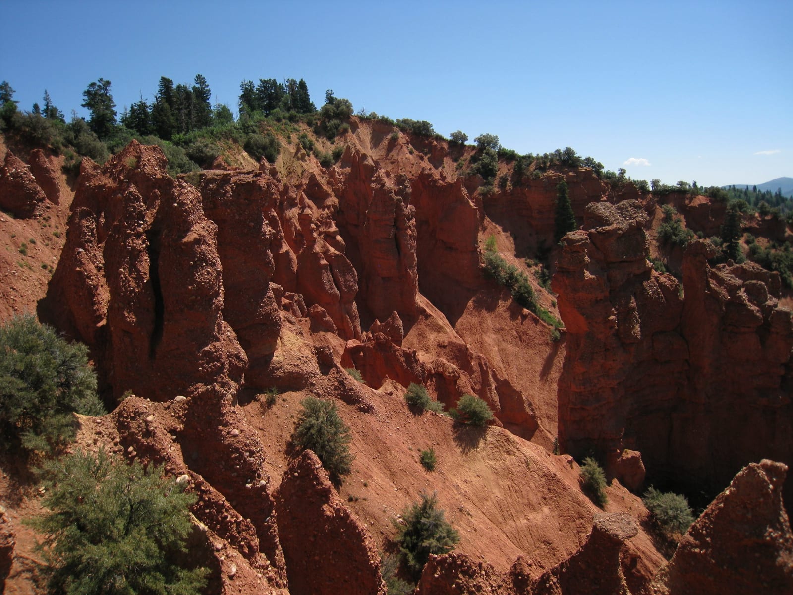
Devil's Kitchen is the surprise of the Nebo Loop: a small amphitheater of red spires and hoodoos — about seven hundred feet across — opening to the south at the head of Red Creek, surrounded on every side by aspen, fir, and the green bulk of the Wasatch. It looks like a fragment of Bryce Canyon that wandered two hundred miles north and got lost in an alpine forest, which is more or less why people call it Utah's "little Bryce." The resemblance is real. The kinship is not.
The rock here belongs to the Price River Formation, and it began near the end of the age of dinosaurs as gravel, sand, and mud carried by rivers draining a mountain range that no longer exists — the Sevier highlands, which stood to the west roughly seventy million years ago and shed their debris eastward toward an inland sea. Deep burial compressed and cemented that debris into conglomerate, sandstone, and mudstone, and iron oxide — the mineral hematite — stained it red. Look closely at the spires and you can still see the river gravel: rounded cobbles of the vanished range, suspended in red stone like fruit in a cake.
What raised it into the path of the weather was the Wasatch fault, which beginning roughly seventeen million years ago lifted the Wasatch Range — Devil's Kitchen along for the ride — high enough for erosion to excavate it. The carving is a conspiracy of structure and climate: vertical fractures called joints crack the rock into a grid, water works down the joints, and the freeze-thaw of long mountain winters pries them apart. The conglomerate and sandstone are just resistant enough to stand in cliffs and shield the softer mudstone beneath; any weaker, and there would be nothing here but rounded red hills.
Bryce, for the record, is a different rock entirely — the Claron Formation, tens of millions of years younger, laid down fine-grained in Eocene lakes and floodplains. The two look alike because the same physics carved them: soft red rock, vertical joints, and freezing nights doing the patient work. Devil's Kitchen is not a little Bryce so much as proof that Utah invented hoodoos more than once.
A short paved trail, an easy few hundred yards, leads from the parking area to a railed observation deck on the rim of the formation, with interpretive signs and a framed view of Mount Nebo off to the west. It is wheelchair- and stroller-friendly, shaded most of the way, and one of the most rewarding ten-minute walks in the state. The same weak cement that lets the spires stand also means they are constantly, quietly crumbling — the kitchen is forever remaking itself.
Visitor Info
On the Map
A story featuring this place
Go deeper into the history and character of this stop
Nearby
The closest stops worth working into your route
Historical markers nearby
Roadside plaques and monuments within a short detour