Home / South Dakota / Mount Rushmore & the Central Hills / Black Elk Peak
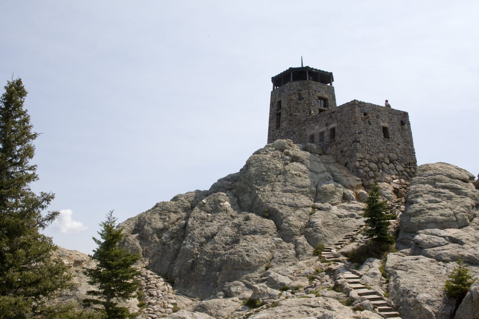
The stone fire lookout tower on the granite summit of Black Elk Peak, with stone steps leading up to itBlack Hills National Forest / public domain via Wikimedia Commons
🌲Natural

Black Elk Peak

Part ofMount Rushmore & the Central Hills
On this driveRushmore, the Needles and Wind Cave

The highest summit in the Black Hills, renamed in 2016 for an Oglala holy man after carrying, for 150 years, the name of the general who attacked a Sicangu camp in 1855.

Native American HeritageSummerPaid EntryHiking
⏱
Duration
Four to five hours round trip from Sylvan Lake.
🎟
Admission
Custer State Park license required at the Sylvan Lake trailhead.
📅
Best Season
June through October.

The Story

For a century and a half the summit carried the name of General William S. Harney, who in September 1855 led an army column against Little Thunder's Sicangu Lakota camp at Blue Water Creek in Nebraska and killed some eighty-six people, many of them women and children. Basil Brave Heart, an Oglala elder, asked for the name to be changed. The South Dakota board on place names heard him out at public meetings and voted to keep Harney, and the federal Board on Geographic Names overruled it on August 11, 2016, naming the peak for Black Elk.

At 7,242 feet it is the highest point in the state. The Civilian Conservation Corps built the stone fire lookout on its summit in the late 1930s, with stairs and a small dam cut into the granite, and rangers watched for smoke from it until 1967; it is open, and the views run across the whole of the hills. The ashes of Valentine McGillycuddy, the doctor and Indian agent at Pine Ridge who spent years in conflict with Red Cloud, are interred near the top under a plaque.

Most hikers start at Sylvan Lake in Custer State Park and climb Trail 9 through ponderosa pine and granite spires, about three and a half miles each way, returning by Trail 4 past Cathedral Spires and Little Devils Tower. The summit lies inside the Black Elk Wilderness, where no motors or bicycles are allowed.

Visitor Info

⏱
Time Needed
Four to five hours round trip from Sylvan Lake.
🎟
Admission
Custer State Park license required at the Sylvan Lake trailhead.
📅
Best Season
June through October.
🛣️
Highway
SD-87

On the Map

Nearby

The closest stops worth working into your route

historical3.7 mi away
Mount Rushmore National Memorial
Four faces blasted out of a sacred mountain by 400 workers in fourteen years, with a Jefferson that had to be dynamited off and a hall of records never finished.
cultural5 mi away
Crazy Horse Memorial
A Lakota elder's answer to Mount Rushmore, carved for more than seventy years by one family with private money, and still argued over by Crazy Horse's own relatives.
attraction5.1 mi away
1880 Train
A steam excursion on a mining branch line that hauled gear for Mount Rushmore, named for a decade it never ran in by a man who wanted steam to survive.
natural8 mi away
Needles Highway
Fourteen miles that Governor Peter Norbeck laid out on foot and horseback through the granite spires, threading a tunnel eight feet wide.
architectural10 mi away
State Game Lodge
The lodge where Calvin Coolidge spent the summer of 1927, fishing for trout, dedicating Mount Rushmore, and deciding not to run again.
natural18 mi away
Jewel Cave National Monument
A cave the prospectors who found it sold to the government for $750, thought to be two miles long until a climbing couple began to walk it in 1959.

Historical markers nearby

Roadside plaques and monuments within a short detour

Marker29 mi away
Cheyenne-Deadwood Trail
Wyoming
Marker30 mi away
The Jenney Stockade
Wyoming
Marker30 mi away
Camp Jenney
Wyoming