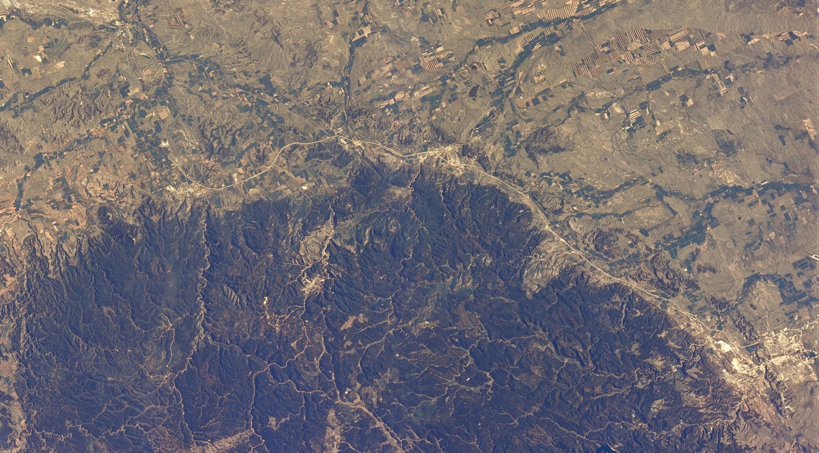
Seen from space, the Black Hills look like a target set down on the plains: a dark oval about 125 miles long and 60 wide, ringed by bands of red and tan. That is very nearly what they are. Around 65 to 70 million years ago, in the same long squeeze of the continent that raised the Rockies, the crust here bowed upward into a dome. Erosion has been planing off the top ever since, and the layers of rock that once lay flat across the region now stand around the dome's edges in rings, the oldest at the center and each younger one outside it.
The rings
The outermost ring is the hogback, a long ridge of hard Dakota Sandstone that encircles the whole uplift and that every road into the Hills has to cut through. Inside it lies the Red Valley, which geologists also call the Racetrack: a lowland of brick-red shale and white gypsum from the Spearfish Formation, laid down in the Triassic, that runs unbroken all the way around. Farmers and towns settled in it, and I-90 follows it between Spearfish and Sturgis.
Next comes the Limestone Plateau, Paleozoic sea-floor rock that covers much of the western half of the Hills and tilts outward on the other sides. Groundwater dissolved it into some of the longest caves on earth, Wind Cave and Jewel Cave among them, and Spearfish Creek has cut Spearfish Canyon straight down through it in walls of gray limestone.
At the center is the core, rock far older than the dome: schist and other metamorphic rock, and the Harney Peak granite, cooled from molten rock deep underground about 1.7 billion years ago and now exposed at the surface. Its highest point is Black Elk Peak, 7,242 feet, and its pale granite is what Mount Rushmore is carved from and the Needles are made of.
The northern cores
The northern Hills add a chapter of their own. In early Tertiary time, while the dome was rising, molten rock pushed up into the layers in a line running from east to west across the north, and cooled underground without, in most places, reaching the surface. Erosion has since stripped away the softer rock around these intrusions and left them standing as isolated peaks and buttes: Crow Peak, Elkhorn Peak, the Bear Lodge Mountains, Devils Tower in Wyoming at the west end, and Bear Butte at the east, alone on the plain north of Sturgis.
The gold
The gold that brought miners into the Hills in defiance of the 1868 treaty came from both ends of this history. Some of it was in the folded Precambrian rock of the core, where the ore at Lead became the Homestake, the largest gold mine in the United States. Some of it had weathered out of old rock into the gravels of the creeks, which is why the first strikes were placer claims in the gulches around Deadwood. More was carried and concentrated by the Tertiary intrusions. Every one of those deposits sat on land the Lakota call Pahá Sápa, which the dome had lifted and the treaty had promised them.