Home / South Dakota / Custer State Park & the Southern Hills / Needles Highway
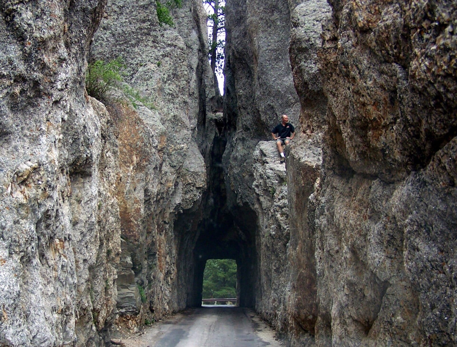
The narrow Needles Eye Tunnel cut through a wall of granite on SD-87Little Mountain 5 / CC BY-SA 3.0 via Wikimedia Commons
🌲Natural

Needles Highway

Part ofCuster State Park & the Southern Hills
On this driveRushmore, the Needles and Wind Cave

Fourteen miles that Governor Peter Norbeck laid out on foot and horseback through the granite spires, threading a tunnel eight feet wide.

Scenic DrivingPaid Entry
⏱
Duration
One hour without stops; half a day with hikes.
🎟
Admission
Custer State Park license.
📅
Best Season
April through the first snow; closed to cars in winter.

The Story

Peter Norbeck, the South Dakota governor who did more than anyone to make Custer State Park, wanted a road through the granite needles, and he marked the course himself on foot and on horseback. The road was finished in 1922. It runs about fourteen miles as SD 87, from near Legion Lake in the park north past Sylvan Lake to US-16/385, climbing through ponderosa pine and spruce and between the spires.

It was made for slow cars. Near the top the Needles Eye Tunnel is cut through the rock eight feet wide and nine feet nine inches high, and a line of cars waits at it most summer afternoons; just beyond, the Needle's Eye itself is a slit worn through a tall granite blade by water and frost, and most of the people who drive through the tunnel miss it. The Cathedral Spires stand off to the west, and turnouts give room to stop. The road closes to vehicles with the first snow and reopens in spring, when it can be walked or skied in the meantime.

The Needles Highway is one leg of the seventy-mile Peter Norbeck byway, which loops on over the Iron Mountain Road, built in the 1930s with pigtail bridges that curl over themselves and tunnels aimed to frame Mount Rushmore. Norbeck's advice for it stands: drive slowly, and better yet, get out and walk.

Visitor Info

⏱
Time Needed
One hour without stops; half a day with hikes.
🎟
Admission
Custer State Park license.
📅
Best Season
April through the first snow; closed to cars in winter.
🛣️
Highway
SD-87

On the Map

Nearby

The closest stops worth working into your route

architectural4.1 mi away
State Game Lodge
The lodge where Calvin Coolidge spent the summer of 1927, fishing for trout, dedicating Mount Rushmore, and deciding not to run again.
natural8 mi away
Black Elk Peak
The highest summit in the Black Hills, renamed in 2016 for an Oglala holy man after carrying, for 150 years, the name of the general who attacked a Sicangu camp in 1855.
historical8.1 mi away
Mount Rushmore National Memorial
Four faces blasted out of a sacred mountain by 400 workers in fourteen years, with a Jefferson that had to be dynamited off and a hall of records never finished.
cultural9.5 mi away
Crazy Horse Memorial
A Lakota elder's answer to Mount Rushmore, carved for more than seventy years by one family with private money, and still argued over by Crazy Horse's own relatives.
attraction13 mi away
1880 Train
A steam excursion on a mining branch line that hauled gear for Mount Rushmore, named for a decade it never ran in by a man who wanted steam to survive.
natural14 mi away
Wind Cave National Park
A cave that breathes through a hole the size of a dinner plate, lined with nearly all the boxwork known on Earth, under a prairie restocked with bison shipped from New York.