NV-28 — The Tahoe East Shore
The short, blue drive down Lake Tahoe's Nevada side — thirteen miles of granite coves and clear water on the shore the Comstock cut for timber and tapped for water, then sold back as scenery.
The Route at a Glance
Lake Tahoe's Nevada shoreline is essentially one road — U.S. 50 and then State Route 28 — running some eighteen miles up the east side of the lake, from Cave Rock in the south to Incline Village in the north. It is a short drive with a long memory. This is the shore the Comstock used up — cut for its timber, tapped for its water — and then, when the silver failed, sold back to the world as scenery. You can read the whole arc of it in an afternoon, if you can find a parking spot.
The east shore begins solemnly. Coming up U.S. 50, the highway passes straight through Cave Rock — De'ek wadapush to the Wašiw, one of their most sacred places, a worn volcano blasted through for two tunnels in the last century. It is a gateway, not a photo stop; the respectful way past is to notice the gray rock overhead and drive on. A few miles north the road reaches Glenbrook and Spooner Summit, the cove whose forests were sawn and flumed down to shore up the mines — the ghost of the great cut, grown back into second-growth pine. From the same trailhead the fittest visitors turn uphill instead of down: the five-mile climb to Marlette Lake and the Flume Trail, where the old water flume that once ran Virginia City's supply is now one of the country's great mountain-bike rides, a narrow bench of blue air above the lake.
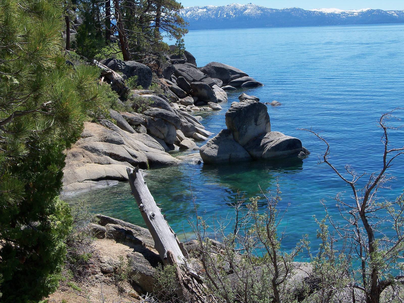
Then NV-28 bends north along the water to Sand Harbor, the payoff — car-sized granite boulders standing in turquoise shallows, the clearest and most crowded beach on the Nevada side, where the whole point of the drive finally lies still in front of you. Past it the road climbs on toward Incline Village and the California line.
It is a half-day at least, a full one if you swim or ride. Come in summer or fall, once the high country is clear of snow — and come early, because on this shore the hardest part of the drive is stopping.
The Drive, Stop by Stop
4 stops along the route, in driving order from Cave Rock to Incline Village.
- 1
- 2
- 3
- 4
A Story Along This Route
Go deeper into the history and character of this drive.
That's the drive. Take your time, pull over often, and let NV-28 — The Tahoe East Shore do what it does best.
← Explore more of Open Road Guide