Monument Valley & the Trail of the Ancients
Utah's remote far southeast — Monument Valley, the San Juan River canyons, and the Ancestral Puebloan country of the Trail of the Ancients.
This is the far corner — the deep southeast of Utah, where the state runs out at the Arizona line and the San Juan River, and the country empties into some of the most remote and least-crowded land in the Lower 48. It is high desert of red buttes, slickrock mesas, and Ancestral Puebloan ruins, much of it on the Navajo Nation and in the Bears Ears country, and it asks more of a traveler than the parks up north: longer drives, fewer services, and a slower, more deliberate pace. The reward is space, silence, and some of the most recognizable scenery on the planet.
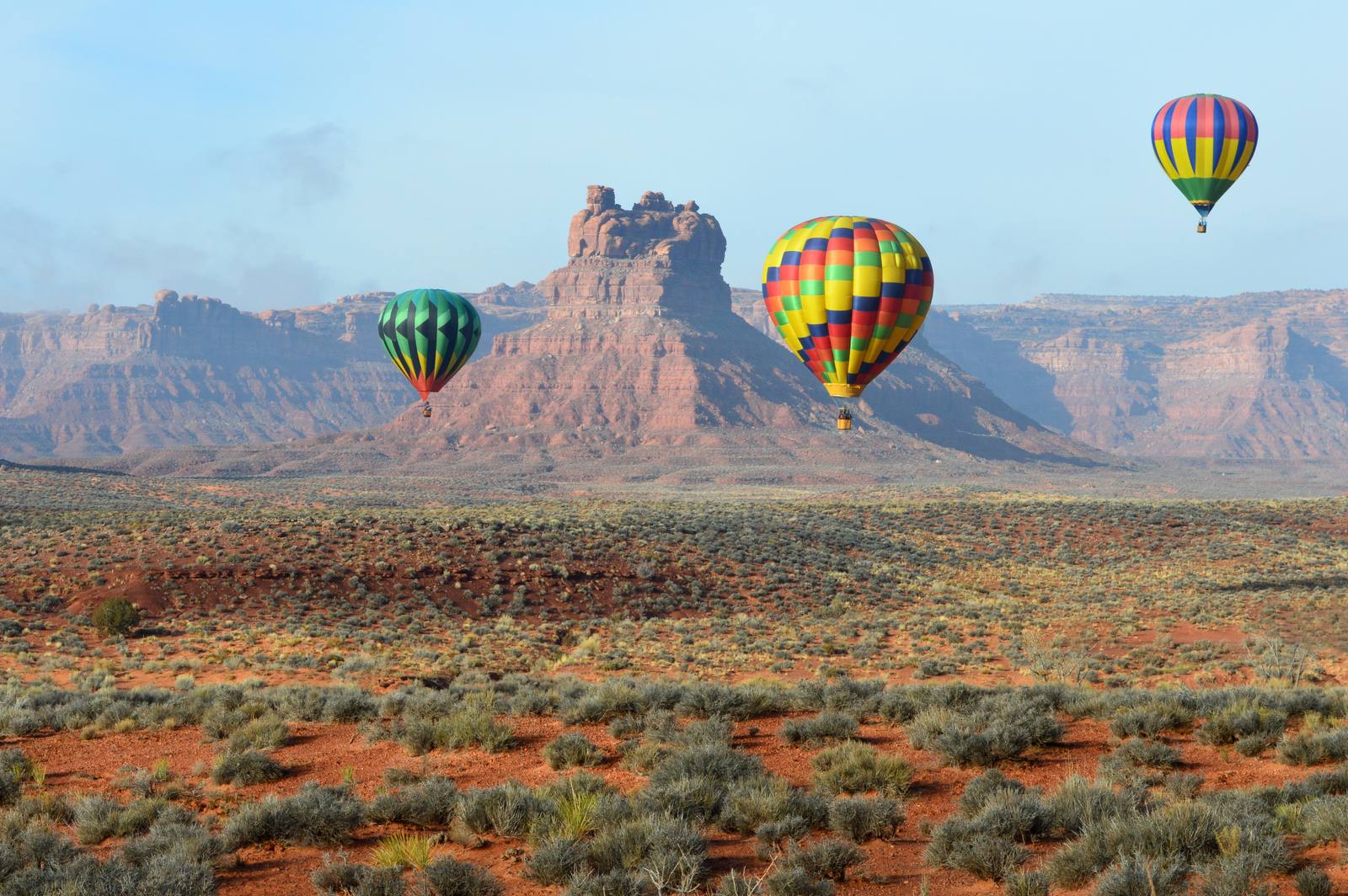
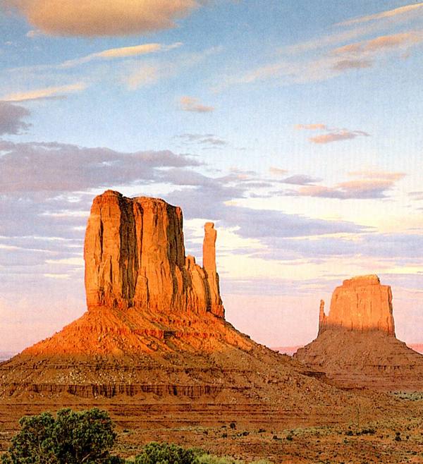
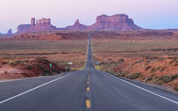
The icon is Monument Valley, the cluster of sandstone buttes and spires rising off the desert floor along the Utah–Arizona border. It is a Navajo Tribal Park rather than a national park, run by the Navajo Nation, and its mesas and mittens have stood in for "the West" in so many films — beginning with John Ford's Westerns — that the place can feel like a memory before you arrive. A seventeen-mile dirt loop carries you down among the formations; nearby, Forrest Gump Point marks the spot on US-163 where the highway runs arrow-straight at the buttes.
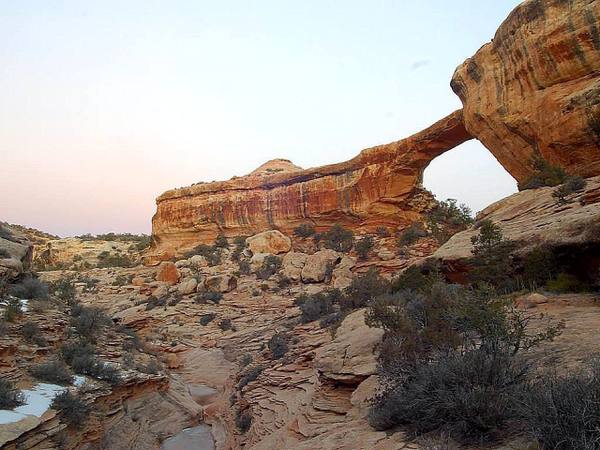
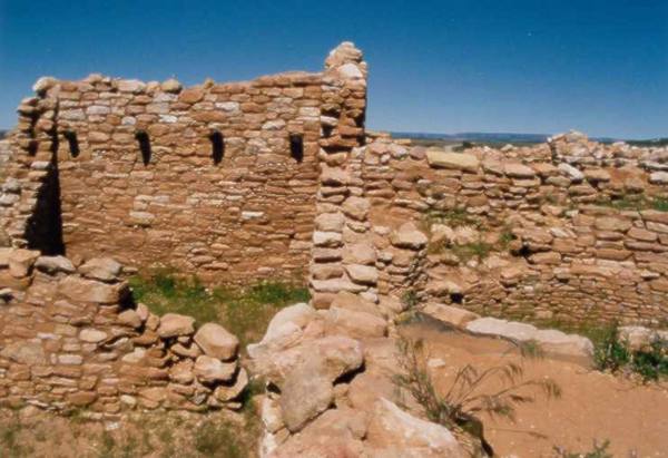
The other half of the region is older. The "Trail of the Ancients" — the scenic byway the area is named for — threads together one of the densest concentrations of archaeology in the country. Edge of the Cedars State Park Museum in Blanding preserves an Ancestral Puebloan great house and the largest collection of Ancestral Puebloan pottery in the Four Corners, and Natural Bridges National Monument protects three enormous stone bridges — and was the world's first certified International Dark Sky Park.
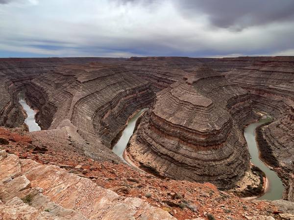
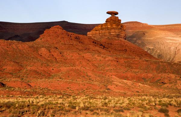
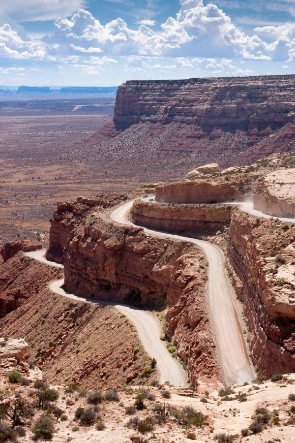
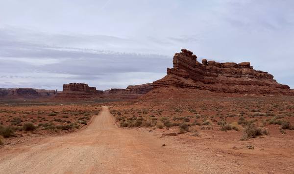
In between runs the San Juan River canyon country, and it is a road tripper's playground. Goosenecks State Park looks a thousand feet down on the river's tight, entrenched meanders; the Moki Dugway climbs the face of Cedar Mesa in a set of unpaved switchbacks; Valley of the Gods offers a free, empty loop among buttes that feels like Monument Valley with no one else around; and Mexican Hat Rock balances its improbable sombrero of stone above the highway.
Go in spring or fall — summers are punishing — fill the tank before you leave town, and give it time. This is the corner of Utah that rewards the traveler willing to drive the farthest.
What to See in Monument Valley & the Trail of the Ancients
8 places across the region, grouped by what they are.
Geology & Rock Formations
Historic Sites
Roadside Stops
Monument Valley & the Trail of the Ancients rewards the unhurried. Pick a base, fan out, and let the country between the headline stops surprise you.
← Explore more of Open Road Guide