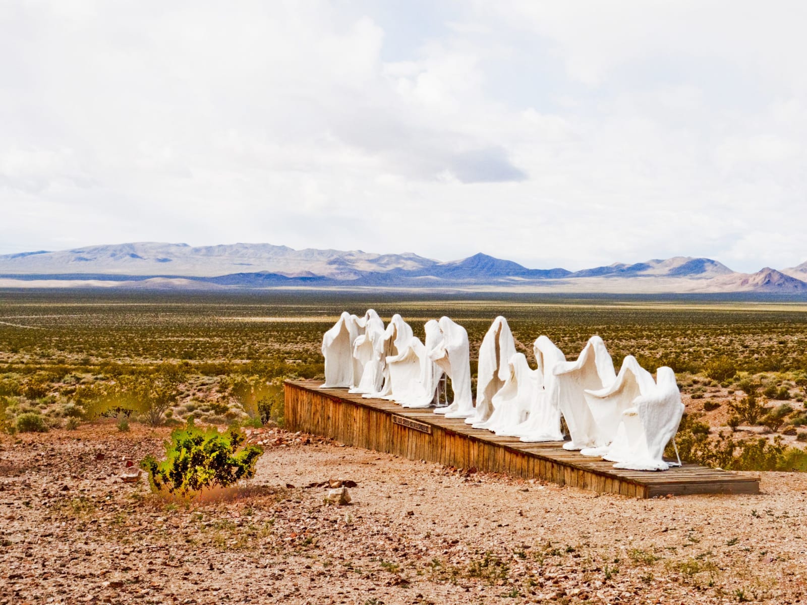
Albert Szukalski's sculpture The Last Supper, made at Rhyolite in 1984 and now the centrepiece of the Goldwell Open Air Museum, standing on a long low timber platform in open desert. The figures are hollow shrouds — burlap soaked in plaster draped over live models, then set hard and the models slipped out — grouped in a row after Leonardo's painting and brilliant white against the ground, with a small plaque fixed to the platform's side. Beyond them the Amargosa country runs flat and pale green to low blue ranges under a bright overcast, with gravel and scattered desert scrub across the foreground.
Hank Miller / CC BY-SA 3.0
Nevada · Region

Nevada Silver Trails

South-central Nevada's mining country — Tonopah and Goldfield, the ghost town of Rhyolite, Cathedral Gorge's clay spires, and the long straight run of the Extraterrestrial Highway.

8 places to explore

By the 1890s, Nevada was dying. The Comstock that had built the state was twenty years played out, the mines were flooding, the population had collapsed, and the rest of the country had begun to wonder aloud whether a place this empty deserved to keep its statehood at all. Nevada had been a silver rush that ran out — a sagebrush afterthought the Union had admitted in a hurry during the Civil War and might, some argued, simply take back. Then, in the spring of 1900, a rancher chasing a stray burro across the south-central desert picked up a heavy rock, and the whole thing started over.

What Jim Butler found at Tonopah was the second-richest silver strike in Nevada history, and it set off the state's improbable second act. Two years later gold turned up twenty-five miles south at Goldfield, and for a few delirious years that camp was the largest city in Nevada — some twenty thousand people, a stone courthouse, a luxury hotel, electric light, and a world-championship prizefight staged to put the place on the map. The men these camps made — George Wingfield above all — went on to run Nevada's banks, casinos, and politics for the next half-century. The state that had nearly been written off was, for the second time, built on a hole in the ground in the middle of nowhere.

It did not last, and that is the other half of the story. The ore pinched out, the booms collapsed about as fast as they had risen, fire and time did the rest, and the towns emptied — leaving behind the richest crop of ghost towns in the West. Rhyolite went from nothing to a city of stone and back to ruins inside a single decade. Goldfield, gutted by fire in 1923, still stands half-alive, more occupied building than ruin, its grand hotel shut since the Second World War. This is the country to come to if you want to see what a boom leaves when it leaves everything: courthouses with no county business, banks with no money, depots with no trains.

And then the desert itself became the draw. This is some of the emptiest land in the Lower 48 — basin after basin of creosote and distance, the loneliest stretches of the loneliest highways in America — and across the twentieth century the federal government found a use for all that nothing. The bombing ranges, the Test Site, the secret airfield at Groom Lake that the maps decline to name: a vast share of this quarter is closed, restricted, or simply unmarked, and the secrecy bred its own mythology. The Extraterrestrial Highway runs straight through the middle of it, past a town of a few dozen people and a bar full of alien kitsch, under skies so dark and clear they have become a destination in their own right.

It is not all mines and rumor. Off east, toward the Utah line, the desert softens into the banded clay cathedrals of Cathedral Gorge and the old rail-and-silver towns of Lincoln County — gentler, greener country than the bombing ranges to the west. But one thread runs through all of it: this is Nevada's second act and its long afterward, the quarter that saved the state, then emptied out, then turned its emptiness into the attraction. Come for the ghost towns and the boom that made them; stay for the silence, the dark, and the distances that swallow everything but the road.

What to See in Nevada Silver Trails

8 places across the region, grouped by what they are.

Geology & Rock Formations
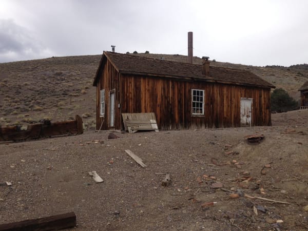
A weathered board-and-batten cabin at Berlin, its unpainted boards silvered and streaked rust-brown, with a shingled roof carrying two stovepipes, two white-framed windows and two plank doors. Loose boards lean against the wall, cut timber and broken firebrick lie scattered across the bare gravel in front, a low timber footing runs along the left edge, and a sagebrush hillside rises behind under flat grey overcast. The ichthyosaur quarry and its fossils are not in the frame.

Berlin-Ichthyosaur State Park

Gabbs

A gold camp frozen in "arrested decay" since 1911, beside a quarry of fifty-foot ichthyosaurs left in the rock where they died — the Silver Trails' long exhale into deep time.

View details →
The eroded clay walls of Cathedral Gorge State Park, a long buff and grey bank of soft lakebed sediment cut into close-packed vertical flutes, fins and spires running away down the length of the frame with narrow slots opening between them. The pale sand floor of the wash curves along their base and out to the right, low banded ridges close the far end, and the sun stands high and flaring in a clear sky.

Cathedral Gorge State Park

Panaca

A drained ancient lakebed eroded into buff-colored spires and narrow slot "caves" — one of Nevada's first state parks, and the gentle, otherworldly counterweight to the Silver Trails' ghost towns.

View details →

Historic Sites

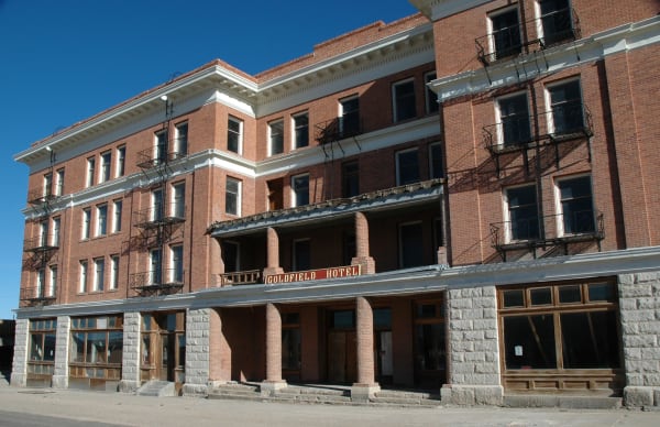
The Goldfield Hotel on its corner, four storeys of red brick above a rusticated grey stone ground floor, with a painted GOLDFIELD HOTEL board hung beneath the first-floor canopy and iron fire escapes zigzagging down the facade. Rows of tall windows stand blank or open to the dark, the ground-floor shopfronts are boarded behind their glass, bare concrete steps run up to the doorways, and empty pavement crosses the foreground under a hard blue sky.

Goldfield

Goldfield

Once the largest city in Nevada, now a few hundred souls — the purest boom-and-bust in the West, with a castle courthouse still in use, a grand hotel dark since the war, and a desert full of upended cars.

View details →
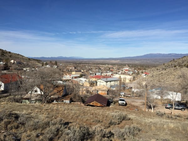
Pioche seen from the hillside above, the town running down the slope and out onto the valley floor — tin and shingle roofs, a red-roofed commercial block and a large pale two-storey building along the curve of the main street, houses and sheds among bare winter trees, and pickups parked on dirt turnouts in the near ground. Dry grass and sagebrush cover the foreground slope, and the valley runs flat and pale to a long snow-touched range on the horizon. Boot Hill, the courthouse and the aerial tramway are not identifiable in the frame.

Pioche

Pioche

The silver camp that, by legend, out-killed the Old West — Boot Hill's boots-on graves, the graft-ridden Million-Dollar Courthouse, and an aerial tramway still slung over Main Street.

View details →
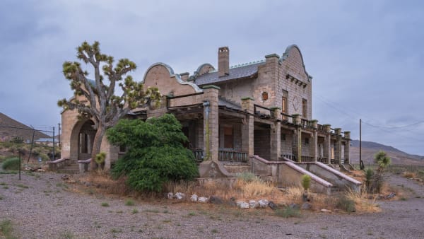
The 1908 Las Vegas and Tonopah Railroad depot at Rhyolite, a Mission Revival building of pale rock-faced concrete block with shaped curvilinear gables, green-trimmed parapets, a brick chimney and a deep arcaded veranda along its front, its window openings boarded or empty. A Joshua tree stands against the left gable and a large green shrub has grown across the porch steps; gravel, dry grass and scattered stone fill the foreground, and bare hills close the view under heavy overcast. The Cook Bank ruin and the opera house are not in the frame.

Rhyolite

Beatty

The most complete ghost town in Nevada — a stone city with an opera house and a marble-stepped bank that rose and died inside a decade, now the most photographed ruin in the West.

View details →

Towns & Gateways

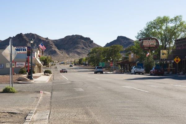
Beatty's main street, with US-95 running straight through town between low storefronts under bare rocky hills. On the left stand the Exchange Club Motel, a hardware store and a lamp standard with flags; on the right an oval Exchange Club Casino-Motel neon, a Sourdough Saloon sign, awnings and parked pickups. A yellow diamond sign warning of burros stands at the right kerb, one car comes up the highway, and empty asphalt fills the foreground.

Beatty

Beatty

The town that water built and water kept — the Bullfrog boom's lone survivor, now Nevada's gateway to Death Valley, with wild burros wandering Main Street.

View details →
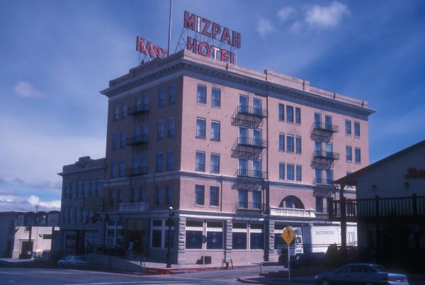
The Mizpah Hotel in Tonopah from the street corner, five storeys of pale brick above a rusticated stone ground floor, with iron balconies stepping down two faces, an arched entrance bay and a MIZPAH HOTEL sign in red letters carried on a steel frame above the roofline. A lower two-storey block with a cast-iron balcony adjoins it on the left, a pedestrian-crossing sign and parked cars stand at the kerb, and high cloud crosses the sky. The frame is scanned from a colour transparency and the whole image carries a strong blue cast.

Tonopah

Tonopah

The Queen of the Silver Camps — the 1900 strike that saved Nevada, and the one boom town that never became a ghost: a mine you can walk into, a grand hotel, a clown motel, and the darkest skies in America.

View details →

Roadside Stops

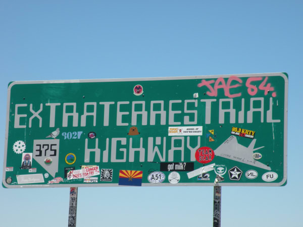
The Extraterrestrial Highway sign for Nevada State Route 375, filling the frame against a clear sky — a wide green sign with EXTRATERRESTRIAL HIGHWAY in white block letters, a route 375 shield set in the outline of Nevada at the lower left, and JAE 54 sprayed across the top right corner in pink. The lower half is layered with travellers' stickers and marker graffiti: an Arizona state flag, a hand-drawn grey flying wing, an alien head, radio-station and band decals, joke slogans and dozens of smaller labels. Both steel posts are wrapped in stickers down to the bottom edge, and nothing else stands in the frame.

Extraterrestrial Highway

Rachel

Ninety-eight lonely miles of State Route 375 past the back roads to Area 51 — with the Little A'Le'Inn in Rachel, the legend of the Black Mailbox, and some of the darkest skies in the country.

View details →

Scenic Drives through Nevada Silver Trails

Scenic Byway

US-95 — The Free-Range Art Highway

Ninety-nine miles of US-95 from Tonopah to the Death Valley line — four mining towns, the International Car Forest and the Goldwell sculptures, and some of the darkest skies in Nevada.

99 mi · 2 hrs

Stories from Nevada Silver Trails

Culture

A Second Living from the Ghosts

When the ore ran out, the Silver Trails was left with ruins, distance, and secrets — so it built a culture out of exactly those, from a desert full of planted cars to a highway named for aliens.

7 min read
Nature

Bitter Water

The Amargosa River crosses this desert almost entirely underground — and where it surfaces it holds creatures found nowhere else, and it decided which boomtowns lived and which died.

5 min read
Geology

The Fire Under the Silver

The Silver Trails run along the roots of an extinct volcanic arc — the gold and silver are cooled hot-spring plumbing, and one ghost town is named for the rock that carried it.

5 min read
History

Boom, Bust, and Back Again

A state founded on the richest silver strike in America, then abandoned, then saved by a second rush, then abandoned again — Nevada booms and busts in a rhythm so regular it might as well be weather, and the biggest boom of all is happening right now, out of sight.

6 min read

Nevada Silver Trails rewards the unhurried. Pick a base, fan out, and let the country between the headline stops surprise you.

← Explore more of Open Road Guide