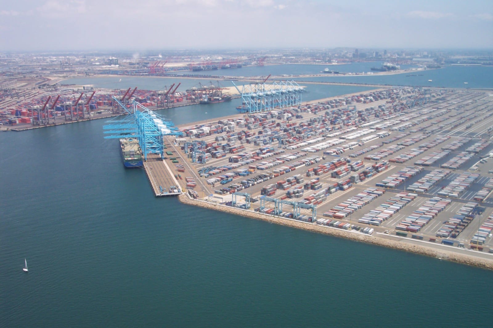
Aerial view of San Pedro Bay: container cranes and rows of stacked cargo standing on made ground, with the breakwater and the open Pacific beyond.
Zzyzx / CC BY 3.0 via Wikimedia Commons
California · Region

Los Angeles Harbor & the South Bay

Tongva sea country, where ti'ats crossed to Pimu — then the harbor Los Angeles won in Congress and built from nothing, the village it erased at Fish Harbor, and the beach towns that decided who belonged.

10 places to explore

Los Angeles has no natural harbor. Everything in San Pedro Bay that looks like one was argued for in Congress, then dredged and piled — a breakwater begun in 1899 and finished in 1912, and two more after it, until eight and a half miles of rock stood between the city and the open Pacific. The fight over where to put it ran seven years. Collis Huntington wanted the port at Santa Monica, where his railroad would own every ton that crossed it; the Los Angeles Chamber of Commerce and Senator Stephen M. White wanted it here. San Pedro won in 1897. Huntington's Long Wharf at Santa Monica carried freight until 1913.

Before any of that, this was working water. The Tongva crossed to Pimu — Santa Catalina — in ti'ats, plank canoes sealed with asphaltum, and traded soapstone and shell inland as far as the Pueblo country. Suangna stood on the rise above the harbor. Puvungna, on ground Cal State Long Beach now occupies, is where the world began, and the fight to keep it undisturbed is not finished. The first ti'at built since the 1800s launched at Catalina in 1995. It is named Moomat Ahiko, Breath of the Ocean.

What came after kept the same shape. Hide ships anchored off an open beach at Casa de San Pedro. Shore whalers rendered oil at Point Vicente. Phineas Banning dredged a channel to Wilmington and called himself Port Admiral. Three thousand Japanese Americans built a village at Fish Harbor they called Furusato, and in February 1942 were given forty-eight hours to leave it; the Navy demolished what they left behind. Longshoremen held the waterfront at Liberty Hill in 1923, and the police broke them.

The coast decided who belonged, too. Willa and Charles Bruce bought beachfront at Manhattan Beach in 1912 and ran a resort for Black families turned away everywhere else. The city condemned it in 1924 under the cover of building a park, then left the lot empty for forty years. The land went back to the Bruce family in 2022, and they sold it to the county the following January.

What to See in Los Angeles Harbor & the South Bay

10 places across the region, grouped by what they are.

Natural Areas
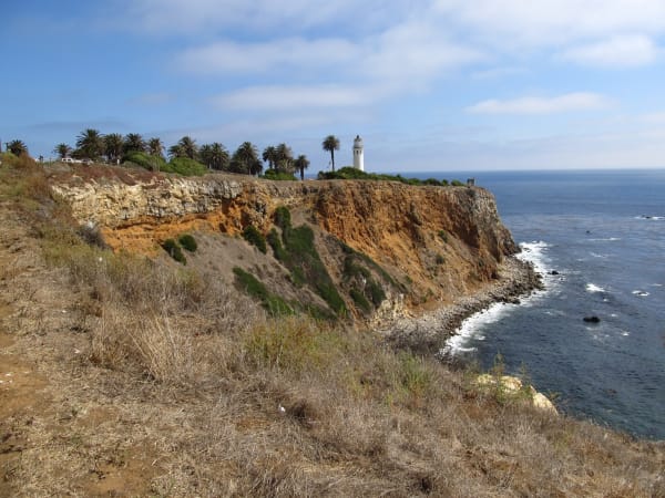
The Point Vicente headland dropping to the Pacific, the lighthouse small on the bluff above deep water close to shore.

Point Vicente

Rancho Palos Verdes

Volunteers have counted the gray whale migration from this bluff for four decades, over water where shore whalers nearly finished the same herds.

View details →

Historic Sites

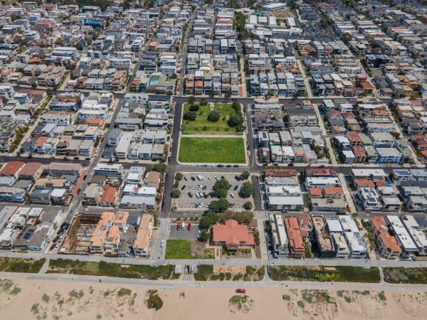
Bruce's Beach in Manhattan Beach from the air, a green park block cut into the grid of houses running down to the sand.

Bruce's Beach

Manhattan Beach

Willa and Charles Bruce ran a seaside resort here for Black families until the city took the land in 1924. It came back in 2022.

View details →

Domínguez Rancho Adobe

Compton

The first Spanish land grant in California contained the whole harbor, and in 1846 fifty Californio lancers turned back three hundred Marines on it.

View details →
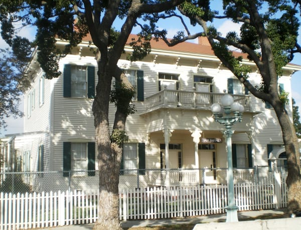
The surviving officers' quarters of Drum Barracks in Wilmington, a white two-storey building with green shutters behind a picket fence.

Drum Barracks

Wilmington

The Union Army built its Southern California headquarters in a county that had voted against Lincoln two to one, and stabled the Army camels here.

View details →
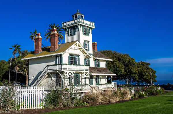
Point Fermin Lighthouse, a Stick Style Victorian house with a lantern room rising from its roof, on the bluff above San Pedro.

Point Fermin Lighthouse

San Pedro

The first light into San Pedro Bay, lit in 1874 by two sisters, dark since Pearl Harbor, on a bluff that is still sliding.

View details →
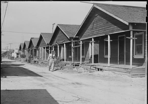
A row of wooden cottages along a dirt street at Terminal Island in 1942, photographed after its Japanese American residents were removed and before the village was demolished.

Terminal Island and Furusato

San Pedro

Three thousand Japanese Americans built a village here they called Furusato, and in February 1942 were given forty-eight hours to leave it.

View details →
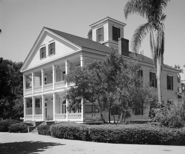
The Banning Residence in Wilmington, a two-storey house with a double veranda and a rooftop cupola, photographed for the Historic American Buildings Survey.

The Banning Museum

Wilmington

The man who made a harbor out of an open bay: freight, dredging, the first railroad in Southern California, and a cupola for watching ships.

View details →

Towns & Gateways

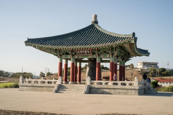
The Korean Friendship Bell hanging in its tiled stone pavilion on the bluff at Angels Gate, San Pedro.

Korean Friendship Bell

San Pedro

Seventeen tons of bronze given by Korea for the American bicentennial, on the bluff above the harbor its troops shipped out from.

View details →
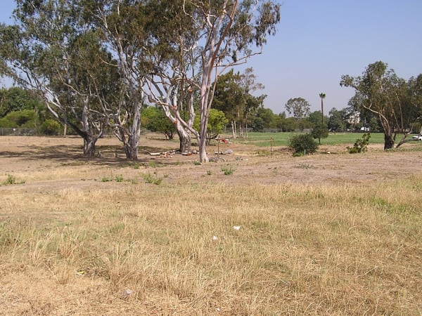
Open grassland and eucalyptus at Puvungna, on the western edge of the Cal State Long Beach campus.

Puvungna

Long Beach

The Acjachemen and Tongva place of creation: twenty-two acres of open ground on a university campus, still not in the hands of its people.

View details →

Industry & Mining

Old timber docks and a derrick in the foreground of the Port of Los Angeles, with container cranes and a berthed ship behind.

The Port of Los Angeles

San Pedro

The busiest container port in the country, sitting on ground that was dredged into existence: marsh, then landfill, then Pier 400.

View details →

Stories from Los Angeles Harbor & the South Bay

History

School Was Out

The 1933 Long Beach earthquake, and the law California wrote thirty days later

5 min read

Los Angeles Harbor & the South Bay rewards the unhurried. Pick a base, fan out, and let the country between the headline stops surprise you.

← Explore more of Open Road Guide