Home / California / Los Angeles Harbor & the South Bay / Drum Barracks
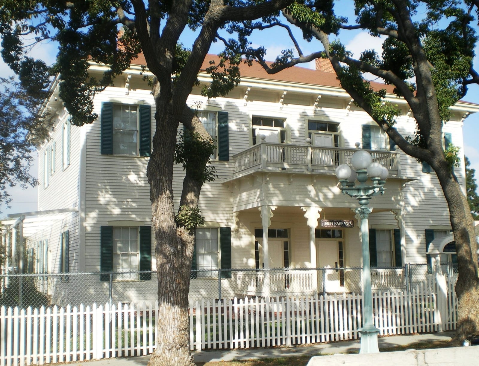
The surviving officers' quarters of Drum Barracks in Wilmington, a white two-storey building with green shutters behind a picket fence.Los Angeles / CC BY-SA 3.0 via Wikimedia Commons
🏛️Historical

Drum Barracks

Part ofLos Angeles Harbor & the South Bay

The Union Army built its Southern California headquarters in a county that had voted against Lincoln two to one, and stabled the Army camels here.

Duration
An hour for the guided tour, which is the only way inside.
🎟
Admission
Donation requested; guided tour only.
📅
Best Season
Year round; tours run Tuesday through Thursday and Saturday.

The Story

In the 1860 election Los Angeles County gave John Breckinridge about twice as many votes as Abraham Lincoln. A company of secessionists drilled openly in El Monte. Phineas Banning wrote to Lincoln to say that California could be lost without a federal force standing in it, and then he and Benjamin Wilson sold the government this ground for a dollar apiece.

The post is named for Lieutenant Colonel Richard Coulter Drum of the Department of the Pacific, and its lumber came around Cape Horn because there was no closer source. The California Column that formed here reached the Rio Grande in 1862 and found the Confederates already pulling back; the skirmishes at Picacho Pass and Apache Pass stand as the westernmost fighting of the war.

Then there are the camels. Thirty-one of them, brought to America in the 1850s at the direction of Secretary of War Jefferson Davis, who would shortly become president of the Confederacy. They were stabled at Fort Tejon, moved into Los Angeles, complained about, and pushed down here to a Union garrison. The Army tried running them as a courier line to Fort Mojave. It did not work. They were shipped to Benicia and auctioned in 1863, and the experiment was dropped.

A sculpture of a camel stands in front of the surviving building.

Visitor Info

Time Needed
An hour for the guided tour, which is the only way inside.
🎟
Admission
Donation requested; guided tour only.
📅
Best Season
Year round; tours run Tuesday through Thursday and Saturday.
🛣️
Highway
N. Banning Blvd. off I-110

On the Map

Nearby

The closest stops worth working into your route

historical0.4 mi away
The Banning Museum
The man who made a harbor out of an open bay: freight, dredging, the first railroad in Southern California, and a cupola for watching ships.
industrial3.4 mi away
The Port of Los Angeles
The busiest container port in the country, sitting on ground that was dredged into existence: marsh, then landfill, then Pier 400.
historical3.8 mi away
Terminal Island and Furusato
Three thousand Japanese Americans built a village here they called Furusato, and in February 1942 were given forty-eight hours to leave it.
cultural5.6 mi away
Korean Friendship Bell
Seventeen tons of bronze given by Korea for the American bicentennial, on the bluff above the harbor its troops shipped out from.
historical5.8 mi away
Point Fermin Lighthouse
The first light into San Pedro Bay, lit in 1874 by two sisters, dark since Pearl Harbor, on a bluff that is still sliding.
historical6.2 mi away
Domínguez Rancho Adobe
The first Spanish land grant in California contained the whole harbor, and in 1846 fifty Californio lancers turned back three hundred Marines on it.

Historical markers nearby

Roadside plaques and monuments within a short detour

Marker0 mi away
Drum Barracks
Wilmington
Marker0.3 mi away
Banning Park
Wilmington
Marker2.6 mi away
S.S. Catalina
San Pedro
Marker2.9 mi away
Site of Home of Diego Sepúlveda
San Pedro
Marker3.3 mi away
Liberty Hill Site
San Pedro
Marker4 mi away
Timms' Point and Landing
San Pedro