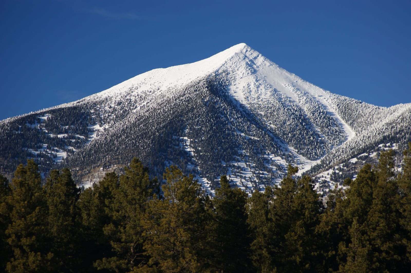
One of the snow-covered summits of the San Francisco Peaks north of Flagstaff, held sacred by the Hopi, the Diné and other tribal nations, standing against a deep blue winter sky. Fresh snow lies over the whole upper mountain and picks out a long ridge falling away to the left and a broad bowl of open slopes and chutes on the right, with dark conifers standing through the snow almost to the summit. A close wall of ponderosa fills the foreground in shadow. The Grand Canyon, the region's other namesake, is not in the frame.
Martin Ely / CC BY 2.0 via Wikimedia Commons
Arizona · Region

The Grand Canyon & the San Francisco Peaks

Arizona's high volcanic north — the South Rim of the Grand Canyon, the ponderosa city of Flagstaff, the San Francisco Peaks sacred to the Hopi and Diné, and the cinder cones and lava flows that built this country.

7 places to explore

Most people come for the hole in the ground, and it earns every superlative — a mile deep, ten miles across, the Colorado still cutting at the bottom of it, the whole history of the planet stacked and legible in its walls. But the Grand Canyon's South Rim is only the front door to a stranger country. This is Arizona's high, cold, volcanic north, built by fire rather than water: some six hundred vents of the San Francisco Volcanic Field, and at its center the San Francisco Peaks, the eroded stump of a stratovolcano that once stood far higher. Humphreys, at 12,633 feet, is the highest ground in the state.

The Peaks are not scenery. They are sacred to thirteen nations, and to lead with the mountain rather than the ski lift is the honest way to see them. The Diné know the western sacred mountain as Dook'o'oosłííd, the summit that never melts, a boundary marker of the Navajo homeland. To the Hopi it is Nuvatukya'ovi, the place of snow on the very top, where the katsina spirits live half the year and carry the rain back to the mesas. That the Arizona Snowbowl makes artificial snow on those slopes from reclaimed wastewater, over the sustained objection of the tribes who hold the mountain holy, is a live argument, not a settled one.

Around the Peaks the ground keeps its receipts. Sunset Crater erupted less than a thousand years ago, within memory of the people farming beneath it; their pueblos still stand at Wupatki and their cliff houses at Walnut Canyon. Flagstaff sits in the largest ponderosa forest on the continent, guards its darkness fiercely enough to have become the world's first Dark-Sky City, and was where Pluto was found in 1930. West of it, Williams was the last town on Route 66 bypassed by the interstate, and the Grand Canyon Railway has climbed from there to the rim since 1901. The Canyon is the reason you come. The rest is the reason you stay.

What to See in The Grand Canyon & the San Francisco Peaks

7 places across the region, grouped by what they are.

Geology & Rock Formations
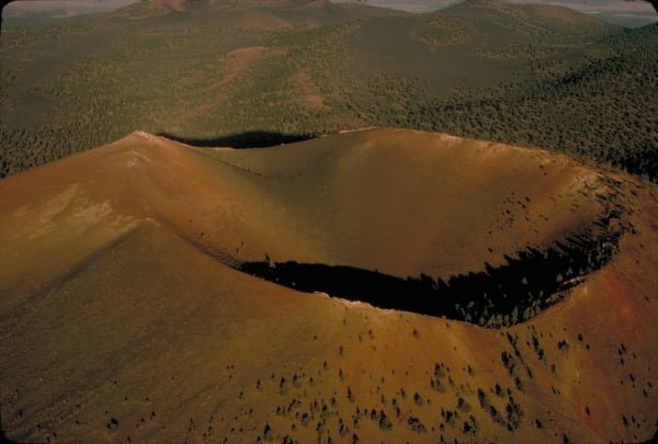
Sunset Crater's cinder cone from the air, looking down into the crater bowl — the summit rim curving across the middle of the frame with the bowl in deep shadow below it, the cone's flanks falling away in red, orange and dark brown cinder streaked with pale ash. Scattered ponderosa pines grow thinly up the slopes and stand denser along the rim. Beyond the cone the volcanic field runs back in low dark hills and green forest to a hazy horizon.

Sunset Crater Volcano

Flagstaff

The volcano northern Arizona watched erupt, around 1085

View details →

Natural Areas

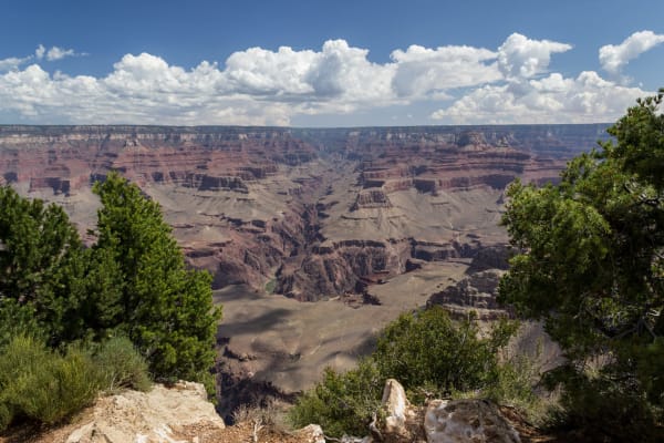
The Grand Canyon from the South Rim — layered red and grey terraces stepping down from the rim through the middle of the frame to a broad flat platform far below, with buttes and side canyons receding into blue haze toward the North Rim. Junipers and pale blocks of limestone frame the foreground at the rim edge, and towered white cumulus stands along the far skyline. The Colorado River is not visible from this angle.

Grand Canyon (South Rim)

Grand Canyon Village

A mile down through two billion years — and eleven nations' ground

View details →
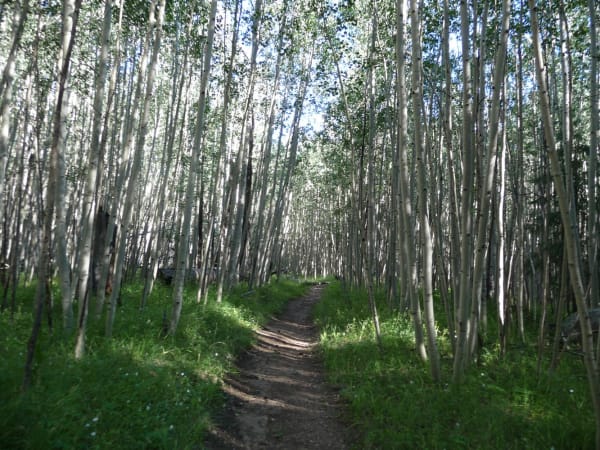
A footpath running away through a dense aspen grove on the San Francisco Peaks, the trail worn to bare earth between grass verges, with hundreds of pale slim trunks standing close together on both sides and their canopy closing overhead in summer green. Small patches of sky show through the leaves. The mountain itself — the summits, the alpine ground above the treeline, any view out — is not in the frame.

San Francisco Peaks

Flagstaff

The sacred mountain of the west — 12,633 feet, and a live argument

View details →

Historic Sites

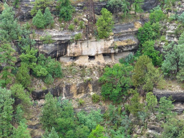
Cliff dwellings built by the Hisatsinom — the people archaeologists call Sinagua — set into a limestone overhang partway down the wall of Walnut Canyon. Three dark doorways stand in a row behind masonry front walls of thin flat stone, tucked back under a pale undercut ledge with the rock banded grey and cream above and below them. Pines, junipers and agave grow thickly across the slope on either side and below, and the whole frame is the opposite canyon wall seen from across the gorge.

Walnut Canyon National Monument

Flagstaff

Sinagua cliff dwellings in the limestone — the Hisatsinom

View details →
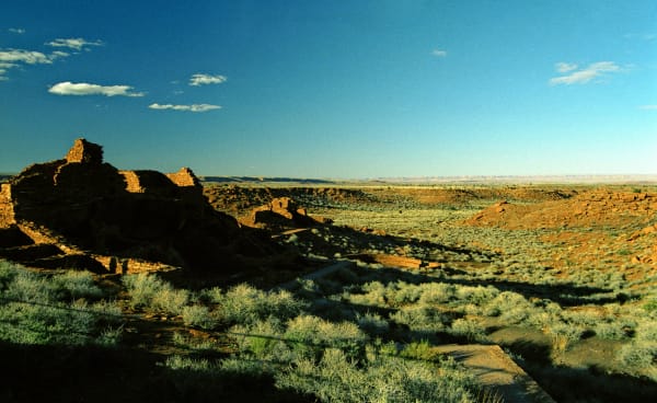
The masonry pueblo at Wupatki in low evening sun — red sandstone walls standing several courses high on a rise at the left of the frame, the room blocks stepping down the slope into shadow with a paved visitor path curving below them. Beyond, open grassland and dark red rock ledges run out to a far escarpment and a wide pale horizon under a deep blue sky. The building stone is the same red rock as the ground it stands on.

Wupatki National Monument

Flagstaff

The red pueblo the volcano built — remembered, not abandoned

View details →

Towns & Gateways

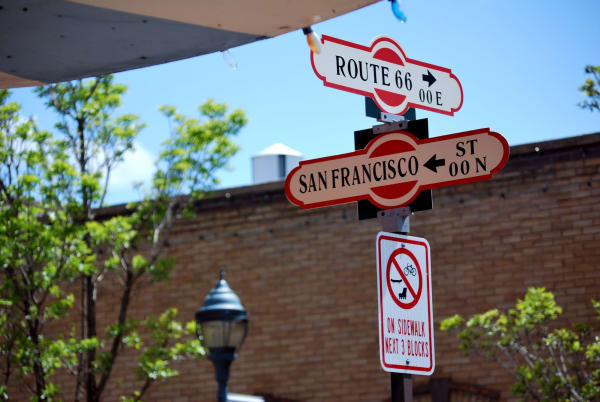
The Route 66 and San Francisco Street corner sign in downtown Flagstaff, shot close from below — two enamelled blade signs crossed on a single post, the upper lettered ROUTE 66 with a right arrow and 00 E, the lower SAN FRANCISCO ST with a left arrow and 00 N, both cream on red with a round Route 66 shield at each end. A regulatory sign beneath them prohibits cycling on the sidewalk for the next three blocks. A red brick wall, a green tree and the edge of a white awning fill the background. The town itself, the ponderosa forest and the observatory are all out of frame.

Flagstaff

Flagstaff

The ponderosa town where they found Pluto and saved the dark

View details →
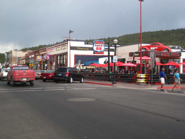
Route 66 through downtown Williams — a wide street with angled parking, a red pickup and a dark van at the kerb, and a row of low storefronts along the right under a wooded hill. Cruiser's Cafe 66 carries a large round Route 66 sign and a red car mounted above its entrance, with red patio umbrellas and a chrome-railed terrace in front, and neon signs run along the shopfronts beyond. Two people cross toward the camera at the right and diners sit out on the patio behind them.

Williams

Williams

The last town on Route 66 to lose its traffic to the interstate — a rail gateway to the Grand Canyon since 1901, bypassed only in 1984 after a court fight, and revived twice over.

View details →

Scenic Drives through The Grand Canyon & the San Francisco Peaks

Scenic Byway

Historic Route 66

Arizona's stretch of the Mother Road — the longest preserved run of Route 66 in the country, from the ponderosa high country down through Seligman and Kingman to the Oatman switchbacks and the Colorado River.

380 mi · 8 hrs

Stories from The Grand Canyon & the San Francisco Peaks

Geology

The Country That Builds and the Country That Cuts

Northern Arizona is where you can stand between the two opposite ways the earth makes a landscape — a mile of rock the river took away, and a field of six hundred volcanoes the earth pushed up, the youngest of them erupting inside living memory.

5 min read

The Grand Canyon & the San Francisco Peaks rewards the unhurried. Pick a base, fan out, and let the country between the headline stops surprise you.

← Explore more of Open Road Guide