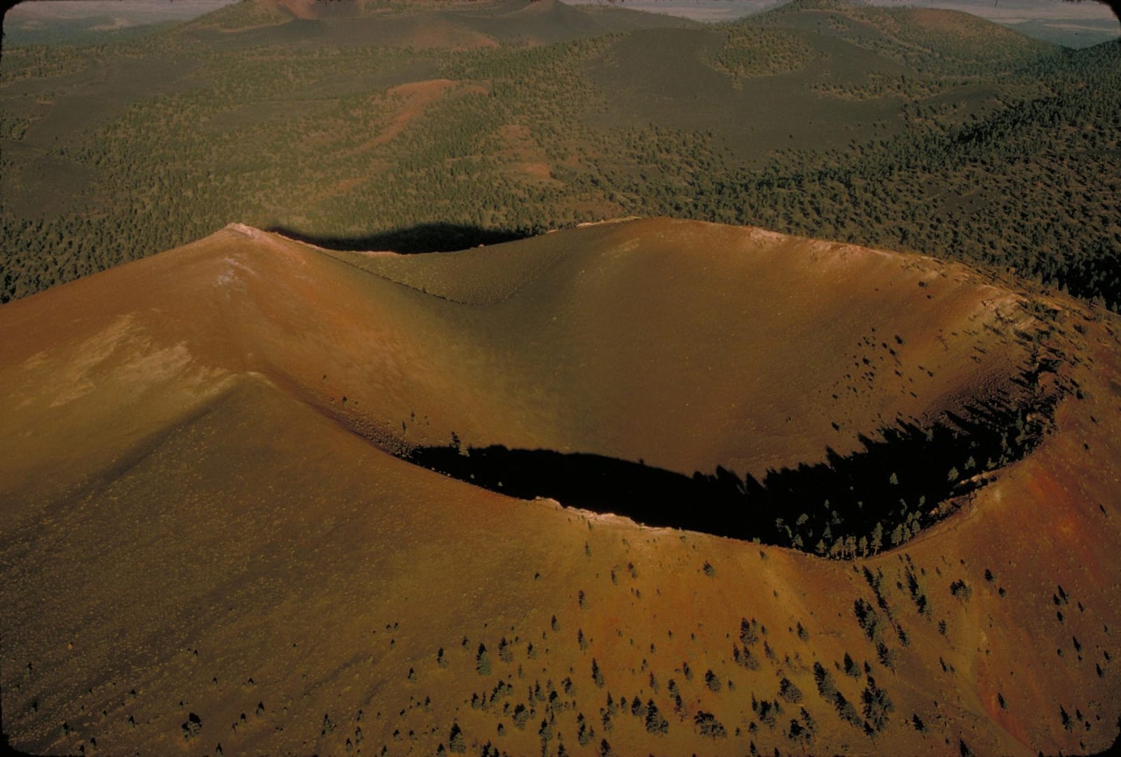
 NPS Photo / public domain via Wikimedia Commons
The Story
Most volcanoes are prehistory. This one is memory. Around the year 1085, along a fissure northeast of the San Francisco Peaks, the ground tore open and threw up fountains of molten rock, building a thousand-foot cinder cone in a landscape full of farms — and the ancestral Puebloan people living beneath it felt the earthquakes, saw the fire, and left. Sunset Crater is the youngest volcano in the whole six-hundred-vent field, and its eruption is one of the few in the continental United States to have happened within human memory, carried in the oral traditions of the Hopi and others whose ancestors watched it.
What it left is a black, brittle, otherworldly ground. The Bonito Lava Flow, only about nine hundred years old, spread in sharp a'a and ropy pahoehoe across the valley floor; the cone itself is banded red and gold at the rim, which is why John Wesley Powell, riding through in 1885, named it for a sunset — from a distance the colors look like the mountain is still burning. Cinders lie a hundred feet deep in places. Squeeze-ups, spatter cones, and lava tubes riddle the Bonito flow, and a few of the deepest hollows hold ice through the summer, cold air pooling where the sun never reaches.
The crater is protected today partly by accident of outrage. In 1928 a Hollywood film company proposed dynamiting the cone to stage a landslide on camera; Flagstaff residents fought it hard enough that President Hoover made the whole thing a national monument in 1930. The summit trail is closed now to let the scarred cinders recover, but the Lava Flow Trail loops through the wreckage at the base. And the eruption did one more thing: it reshaped the soil to the northeast, and a generation later drew farmers to build the pueblos at Wupatki — the ash's strange gift.
Visitor Info
On the Map
A story featuring this place
Go deeper into the history and character of this stop
Nearby
The closest stops worth working into your route
Historical markers nearby
Roadside plaques and monuments within a short detour