Home / North Carolina / The Outer Banks & the Albemarle / Wright Brothers National Memorial
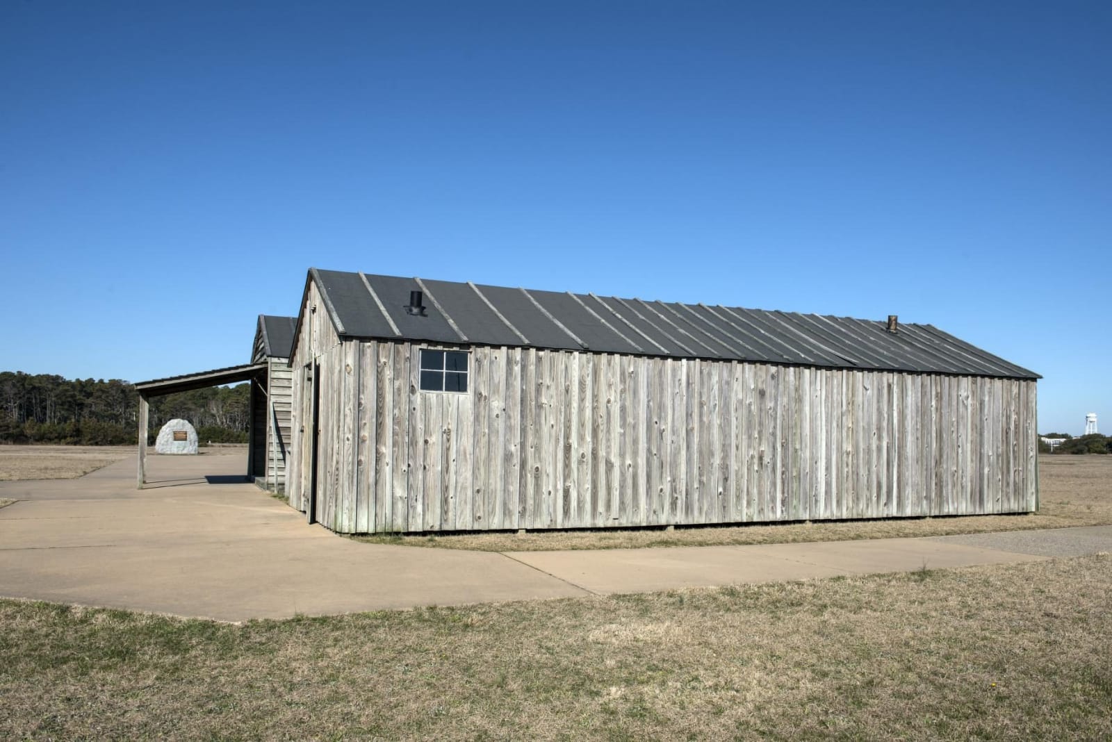
A long weathered wooden shed with a tin roof on a flat sandy field, a reconstruction of the brothers' 1903 hangar.Carol M. Highsmith / public domain via Library of Congress
🏛️Historical

Wright Brothers National Memorial

Part ofThe Outer Banks & the Albemarle
On this driveThe Outer Banks Scenic Byway: NC 12 from Kill Devil Hills through Hatteras to Ocracoke

The sand flat below Kill Devil Hill where Orville and Wilbur Wright flew the first powered, controlled airplane on December 17, 1903.

⏱
Duration
Two to three hours.
🎟
Admission
$10 per person, paid by card at the entrance kiosk; free on December 17 and August 19 (NPS, 2026).
📅
Best Season
Year round; open daily except December 25 (NPS, 2026). December 17 brings the anniversary of the first flight.

The Story

Wilbur and Orville Wright came to the Outer Banks from Dayton in 1900 for steady wind, soft sand and the privacy of a place far from any city. Over three seasons they made more than a thousand glides off the big dune called Kill Devil Hill and taught themselves to fly before they ever had an engine. For 1903 they designed their own motor and, from their wind-tunnel figures, the first efficient airplane propellers, and mounted them on a 40-foot, 605-pound Flyer.

Wilbur won a coin toss on December 14, oversteered off the launching rail and stalled into the sand. Three days later, in a 27-mile-an-hour wind, the brothers hung out a sheet to call the volunteers from the Kill Devil Hills lifesaving station. At 10:35 Orville left the rail and stayed up for about 120 feet, and John Daniels of the station tripped the camera they had set up, catching the machine in the air with Wilbur running beside it. They flew three more times that day. The last, Wilbur's, covered 852 feet in 59 seconds before a gust rolled the Flyer over and ended its flying for good.

Markers on the flat show where each flight began and ended, and two wooden buildings recreate the brothers' hangar and living quarters from period photographs. The dune was planted with grass to hold it in place for the 60-foot granite monument dedicated on its summit in 1932. The low modernist visitor center from the Park Service's Mission 66 program holds a full-size reproduction of the 1903 Flyer.

Visitor Info

⏱
Time Needed
Two to three hours.
🎟
Admission
$10 per person, paid by card at the entrance kiosk; free on December 17 and August 19 (NPS, 2026).
📅
Best Season
Year round; open daily except December 25 (NPS, 2026). December 17 brings the anniversary of the first flight.
🛣️
Highway
US 158

On the Map

Nearby

The closest stops worth working into your route

natural4.4 mi away
Jockey's Ridge State Park
The tallest living sand dune system on the Atlantic coast, saved from bulldozers in 1973, with sunset over Roanoke Sound and hang gliders on the slopes.
historical6.2 mi away
Fort Raleigh National Historic Site
The north end of Roanoke Island, where Wingina's people met the Roanoke voyages of 1584-1590 and a Freedmen's Colony of thousands grew up in the Civil War.
natural15 mi away
Alligator River National Wildlife Refuge
The pocosin wetlands of mainland Dare and Hyde, set aside in 1984, where the world's most endangered wolf was first returned to the wild in 1987.
natural23 mi away
Pea Island National Wildlife Refuge
The north end of Hatteras Island, a 1938 bird refuge on the old beat of the Pea Island Life-Saving Station and Richard Etheridge's all-Black crew.
natural44 mi away
Pettigrew State Park
Lake Phelps, a clear rain-fed Carolina bay where some thirty Algonquian dugout canoes have been found, the oldest about 4,400 years old.
historical44 mi away
Somerset Place State Historic Site
One of the Upper South's largest plantations, on Lake Phelps, told through the more than 861 enslaved people who lived and worked there from 1785 to 1865.

Historical markers nearby

Roadside plaques and monuments within a short detour

Marker3.6 mi away
Wreck of the U.S.S. 'Huron'
Nags Head
Marker6.4 mi away
Joachim Gans
Manteo
Marker7 mi away
R. A. Fessenden
Manteo
Marker7.3 mi away
Freedmen's Colony
Manteo
Marker7.3 mi away
Civil Air Patrol
Manteo
Marker9 mi away
Andrew Cartwright
Manteo