Home / North Carolina / The Outer Banks & the Albemarle / Jockey's Ridge State Park
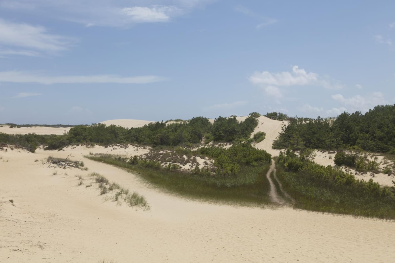
Pale sand dunes rising behind low green shrubs, with a footpath worn up the slope under a blue sky.Carol M. Highsmith / public domain via Library of Congress
🌲Natural

Jockey's Ridge State Park

Part ofThe Outer Banks & the Albemarle
On this driveThe Outer Banks Scenic Byway: NC 12 from Kill Devil Hills through Hatteras to Ocracoke

The tallest living sand dune system on the Atlantic coast, saved from bulldozers in 1973, with sunset over Roanoke Sound and hang gliders on the slopes.

⏱
Duration
One to three hours; stay for sunset over Roanoke Sound.
🎟
Admission
Free for day use (NC State Parks, 2026).
📅
Best Season
Year round; closed Christmas Day. Gate hours run from 8 a.m. to as late as 9 p.m. in summer, and the visitor center is open 9 a.m. to 4 p.m. (NC State Parks, 2026). Summer sand runs far hotter than the air; spring and fall are kinder.

The Story

Jockey's Ridge is a pile of sand still on the move, the tallest living dune system on the Atlantic coast. The quartz in it washed down from North Carolina's mountains to the sea, and storms and wind have been heaping it here for something like 7,000 years. Sailors in the sixteenth century used the ridge as a landmark, and a 1753 land grant already calls it Jockey's Hill. One story says Bankers raced wild horses on the flats below while crowds watched from the slopes.

In the summer of 1973 a bulldozer started cutting into the sound side of the ridge for development. Carolista Baum, a Nags Head resident whose children were playing nearby, walked out and made the operator stop. Petitions followed under the slogan Save Our Sand Dune, a group called People to Preserve Jockey's Ridge formed, and the dune was named a National Natural Landmark in 1974. With state and federal money, about 152 acres were bought in 1975 to start the park.

From the visitor center a boardwalk leads out to open sand, where you climb on foot and the wind does the rest. Hang gliding lessons run from a concession in the park, sandboarding needs no permit, and kites fill the air most afternoons. The soundside access to the west has a shallow beach on Roanoke Sound for wading and paddling, and the park is the eastern end of the Mountains-to-Sea State Trail. Bring water and shoes: there is none to drink on the dunes, and the sand can run thirty degrees hotter than the air.

Visitor Info

⏱
Time Needed
One to three hours; stay for sunset over Roanoke Sound.
🎟
Admission
Free for day use (NC State Parks, 2026).
📅
Best Season
Year round; closed Christmas Day. Gate hours run from 8 a.m. to as late as 9 p.m. in summer, and the visitor center is open 9 a.m. to 4 p.m. (NC State Parks, 2026). Summer sand runs far hotter than the air; spring and fall are kinder.
🛣️
Highway
US 158

On the Map

Nearby

The closest stops worth working into your route

historical4.4 mi away
Wright Brothers National Memorial
The sand flat below Kill Devil Hill where Orville and Wilbur Wright flew the first powered, controlled airplane on December 17, 1903.
historical4.6 mi away
Fort Raleigh National Historic Site
The north end of Roanoke Island, where Wingina's people met the Roanoke voyages of 1584-1590 and a Freedmen's Colony of thousands grew up in the Civil War.
natural15 mi away
Alligator River National Wildlife Refuge
The pocosin wetlands of mainland Dare and Hyde, set aside in 1984, where the world's most endangered wolf was first returned to the wild in 1987.
natural19 mi away
Pea Island National Wildlife Refuge
The north end of Hatteras Island, a 1938 bird refuge on the old beat of the Pea Island Life-Saving Station and Richard Etheridge's all-Black crew.
natural45 mi away
Pettigrew State Park
Lake Phelps, a clear rain-fed Carolina bay where some thirty Algonquian dugout canoes have been found, the oldest about 4,400 years old.
historical45 mi away
Somerset Place State Historic Site
One of the Upper South's largest plantations, on Lake Phelps, told through the more than 861 enslaved people who lived and worked there from 1785 to 1865.

Historical markers nearby

Roadside plaques and monuments within a short detour

Marker0.8 mi away
Wreck of the U.S.S. 'Huron'
Nags Head
Marker4.7 mi away
Joachim Gans
Manteo
Marker5.1 mi away
Freedmen's Colony
Manteo
Marker5.1 mi away
Civil Air Patrol
Manteo
Marker5.3 mi away
Dasemunkepeuc
Manns Harbor
Marker5.3 mi away
Andrew Cartwright
Manteo