Home / North Carolina / The Outer Banks & the Albemarle / Alligator River National Wildlife Refuge
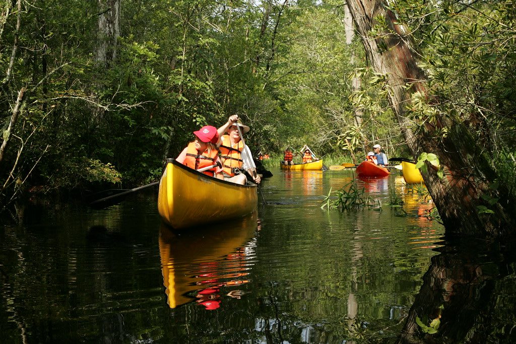
Paddlers in yellow and red canoes on a narrow dark creek walled in by dense green swamp forest.Steve Hillerbrand, USFWS / CC BY 2.0 via Flickr
🌲Natural

Alligator River National Wildlife Refuge

Part ofThe Outer Banks & the Albemarle

The pocosin wetlands of mainland Dare and Hyde, set aside in 1984, where the world's most endangered wolf was first returned to the wild in 1987.

⏱
Duration
Two to four hours.
🎟
Admission
Free (USFWS, 2026).
📅
Best Season
Year round during daylight; mornings and evenings are best for bears and other wildlife, and winter for waterfowl (USFWS, 2026).

The Story

West of Roanoke Island the land goes flat, wet and dark green for miles. This is pocosin, a wetland grown on thick layers of peat, its shrubs and pond pines stunted by soil that holds water and little else. The refuge was created on March 14, 1984, to protect it, and it now covers about 152,000 acres of the Dare and Hyde mainland between Albemarle Sound and the Alligator River, with swamp forest and marsh around the edges and a military bombing range inside its bounds.

The red wolf once ranged across the eastern and south-central United States. Predator control and lost habitat nearly finished it, and by the late 1970s the last wild animals lived on the coastal prairies of southeastern Texas and southwestern Louisiana; the species was then declared extinct in the wild. In 1987 the Fish and Wildlife Service released captive-bred red wolves here, and in 1988 the first pups were born in the wild on the refuge. The population has risen and fallen sharply since. Only a small number now roam eastern North Carolina, and seeing one is luck.

Black bears are far easier. Drive the Wildlife Drive off US 64 near sunset, slowly, and watch the field edges. The Creef Cut Wildlife Trail, a half-mile accessible path, starts nearby. More than fifteen miles of marked paddling trails wind through the swamp creeks. Exhibits and staff are at the Gateway Visitor Center on Roanoke Island, on the way in from the beaches.

Visitor Info

⏱
Time Needed
Two to four hours.
🎟
Admission
Free (USFWS, 2026).
📅
Best Season
Year round during daylight; mornings and evenings are best for bears and other wildlife, and winter for waterfowl (USFWS, 2026).
🛣️
Highway
US 64

On the Map

Nearby

The closest stops worth working into your route

historical9.9 mi away
Fort Raleigh National Historic Site
The north end of Roanoke Island, where Wingina's people met the Roanoke voyages of 1584-1590 and a Freedmen's Colony of thousands grew up in the Civil War.
natural15 mi away
Jockey's Ridge State Park
The tallest living sand dune system on the Atlantic coast, saved from bulldozers in 1973, with sunset over Roanoke Sound and hang gliders on the slopes.
historical15 mi away
Wright Brothers National Memorial
The sand flat below Kill Devil Hill where Orville and Wilbur Wright flew the first powered, controlled airplane on December 17, 1903.
natural23 mi away
Pea Island National Wildlife Refuge
The north end of Hatteras Island, a 1938 bird refuge on the old beat of the Pea Island Life-Saving Station and Richard Etheridge's all-Black crew.
natural31 mi away
Pettigrew State Park
Lake Phelps, a clear rain-fed Carolina bay where some thirty Algonquian dugout canoes have been found, the oldest about 4,400 years old.
historical31 mi away
Somerset Place State Historic Site
One of the Upper South's largest plantations, on Lake Phelps, told through the more than 861 enslaved people who lived and worked there from 1785 to 1865.

Historical markers nearby

Roadside plaques and monuments within a short detour

Marker9.1 mi away
R. A. Fessenden
Manteo
Marker9.5 mi away
Civil Air Patrol
Manteo
Marker9.6 mi away
Freedmen's Colony
Manteo
Marker9.8 mi away
Joachim Gans
Manteo
Marker11 mi away
Andrew Cartwright
Manteo
Marker11 mi away
Dasemunkepeuc
Manns Harbor