Home / Missouri / Ste. Genevieve, Cape Girardeau & the Bootheel / Trail of Tears State Park
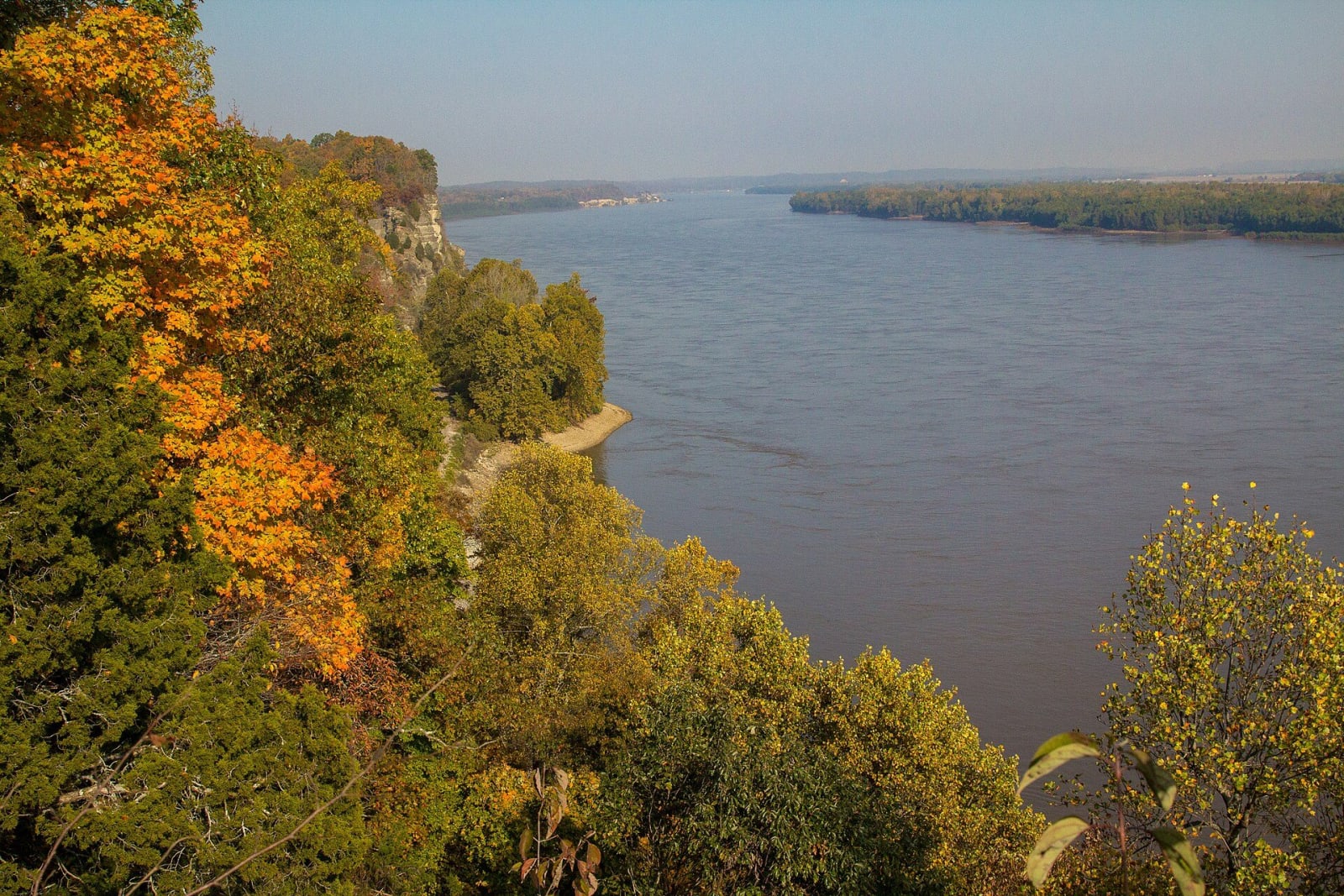
The broad Mississippi River below autumn-colored bluffs at Trail of Tears State Park.Missouri State Parks / public domain via Wikimedia Commons
🏛️Historical

Trail of Tears State Park

Part ofSte. Genevieve, Cape Girardeau & the Bootheel

Rugged river hills north of Cape Girardeau where nine of the thirteen Cherokee detachments crossed the Mississippi in the winter of 1838 and 1839, and where floating ice left them camped on both banks.

⏱
Duration
One hour for the visitor center; a day with the trails.
🎟
Admission
No entrance fee is listed by Missouri State Parks. The park is open 7 a.m. to 10 p.m. from April through October and 7 a.m. to 6 p.m. from November through March; the visitor center keeps shorter, seasonal hours.
📅
Best Season
Fall and winter for the river views and eagles; spring for wildflowers.

The Story

In 1838 the United States drove more than 16,000 Cherokee people from their homelands in the Southeast. The Indian Removal Act of 1830 had not required force, but after the Treaty of New Echota of 1835, signed by a minority faction with no authority to give up the Nation's land, it was carried out by force. In the winter of 1838 and 1839 the detachments went west toward Indian Territory and nine of the thirteen crossed the Mississippi into Missouri here, in Cape Girardeau County. Floating ice stopped the crossing. The detachments had to make camp on both sides of the river and wait in rain, snow and freezing cold, with disease among them.

The park, established in 1957, is a memorial to that crossing and a certified site on the Trail of Tears National Historic Trail. The visitor center on Moccasin Springs Road has exhibits on the removal, and a 23-minute National Park Service film plays on request. The Bushyhead Memorial is a tribute to all the Cherokee who died on the trail. It takes its name from Nancy Bushyhead Walker Hildebrand, sister of the Rev. Jesse Bushyhead, who led one of the detachments. By local tradition she died here; her two children went on to Indian Territory.

The rest of the park's 3,415 acres are steep river hills. Peewah Trail runs about 8 miles through the Indian Creek Wild Area to bluffs above the river, and Sheppard Point looks over the Mississippi and is a good place for eagles in winter.

Visitor Info

⏱
Time Needed
One hour for the visitor center; a day with the trails.
🎟
Admission
No entrance fee is listed by Missouri State Parks. The park is open 7 a.m. to 10 p.m. from April through October and 7 a.m. to 6 p.m. from November through March; the visitor center keeps shorter, seasonal hours.
📅
Best Season
Fall and winter for the river views and eagles; spring for wildflowers.
🛣️
Highway
MO-177

On the Map

Nearby

The closest stops worth working into your route

industrial18 mi away
Bollinger Mill State Historic Site
A four-story mill of 1867 on an 1825 stone foundation on the Whitewater River, beside Missouri's oldest covered bridge, where farmers broke down the toll gates in 1906.
historical48 mi away
Ste. Genevieve National Historical Park
Three National Park Service houses in Missouri's first permanent European town, built of upright logs in the 1790s and told through the French families who owned them and the people they enslaved.
natural49 mi away
Hawn State Park
A schoolteacher's bequest of sandstone canyons, shortleaf pine and clear sandy creeks west of Ste. Genevieve, with one of the state's best backpacking trails.
historical53 mi away
Towosahgy State Historic Site
A fortified Mississippian town in the Bootheel fields of Mississippi County, with seven earthen mounds around a plaza and a modern name meant to approximate the Osage and Quapaw words for old town.
natural55 mi away
Big Oak Tree State Park
The last piece of the Bootheel's old bottomland forest, saved in 1938 with schoolchildren's dimes, with a cypress swamp and trees that top 130 feet.
geological59 mi away
New Madrid Historical Museum
A river-town museum in the old Kendall Saloon at the foot of Main Street in New Madrid, centered on the earthquakes of 1811 and 1812 and the seismic risk the town still lives with.

Historical markers nearby

Roadside plaques and monuments within a short detour

Marker9 mi away
Cape Girardeau
Marker14 mi away
Altenburg
Marker24 mi away
Scott County
Marker28 mi away
Marble Hill