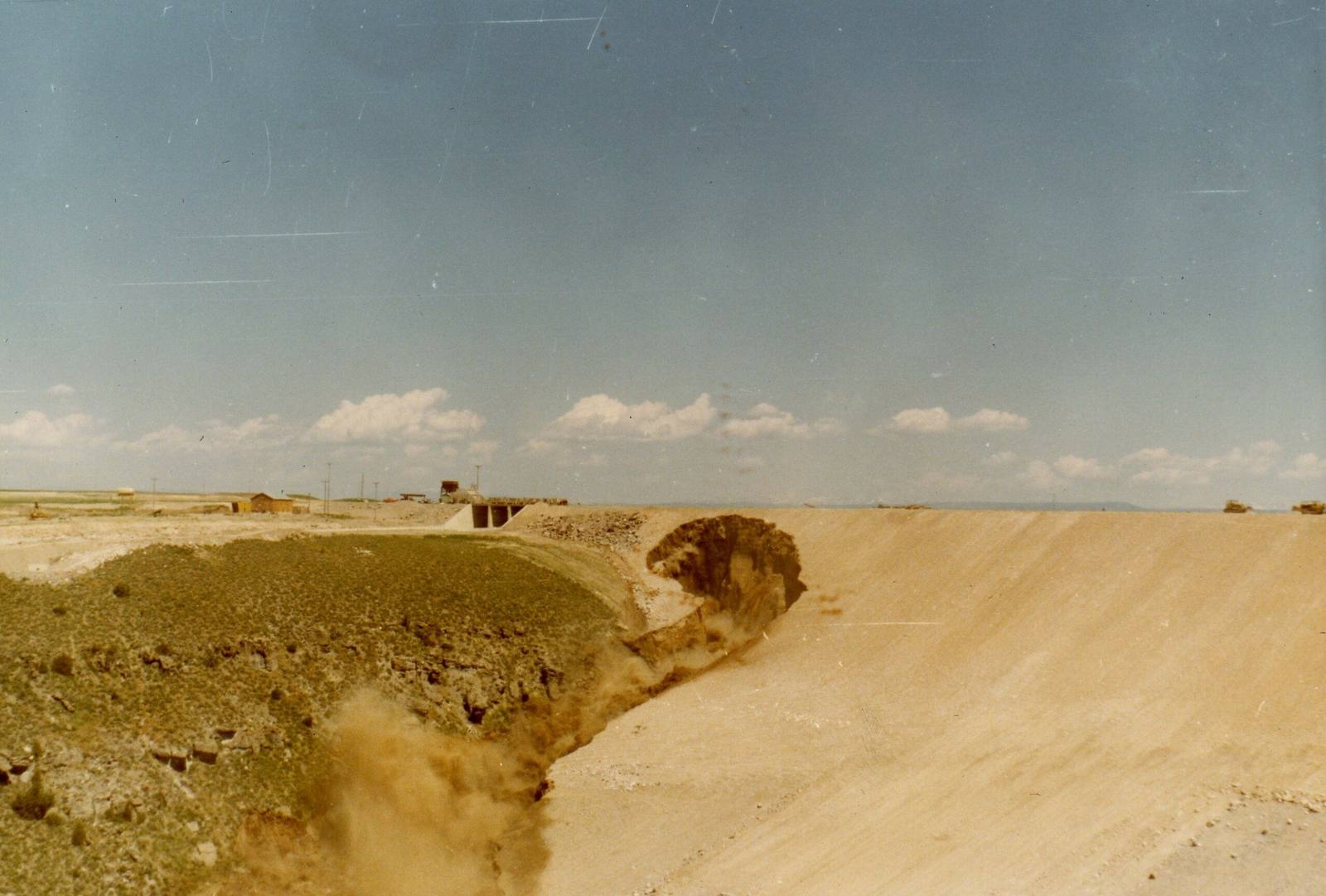
 Bureau of Reclamation / public domain via Wikimedia Commons
The Story
The canyon walls were the problem, and people said so before the dam was built. The rock here is welded ash from the Huckleberry Ridge eruption of the Yellowstone hotspot about 2.1 million years ago, and it is shot through with fissures; the Bureau of Reclamation's own test cores showed it. In December 1972, with construction under way, USGS geologist David Schleicher wrote that a failure at high water would make the valley's 1962 flood look like small potatoes. A USGS memo on the site's problems was softened over six months of redrafting before it reached the Bureau in July 1973, and that year a former Bureau geologist, Shirley Pytlak, testified that the reservoir would leak.
It did. The dam was finished in November 1975. On June 5, 1976, as its reservoir filled for the first time, water that had worked through the rock at the right abutment broke through, and the dam, more than three hundred feet high, gave way just before noon. It was the first and only failure of a major Reclamation dam. It had cost about $100 million to build; the government paid more than $300 million in claims. The Bureau strengthened its dam-safety program, and the dam was never rebuilt.
What stands now is the remnant: the left side of the embankment still reaching across the canyon, a gap where the right side was, and the Teton River running through as it did before. For the fiftieth anniversary, in June 2026, Reclamation opened a new overlook above the site with panels on the failure and the safety program that came out of it.
Visitor Info
On the Map
Nearby
The closest stops worth working into your route
Historical markers nearby
Roadside plaques and monuments within a short detour