Home / Kansas / Cheyenne Bottoms & the Great Bend / Santa Fe Trail Center
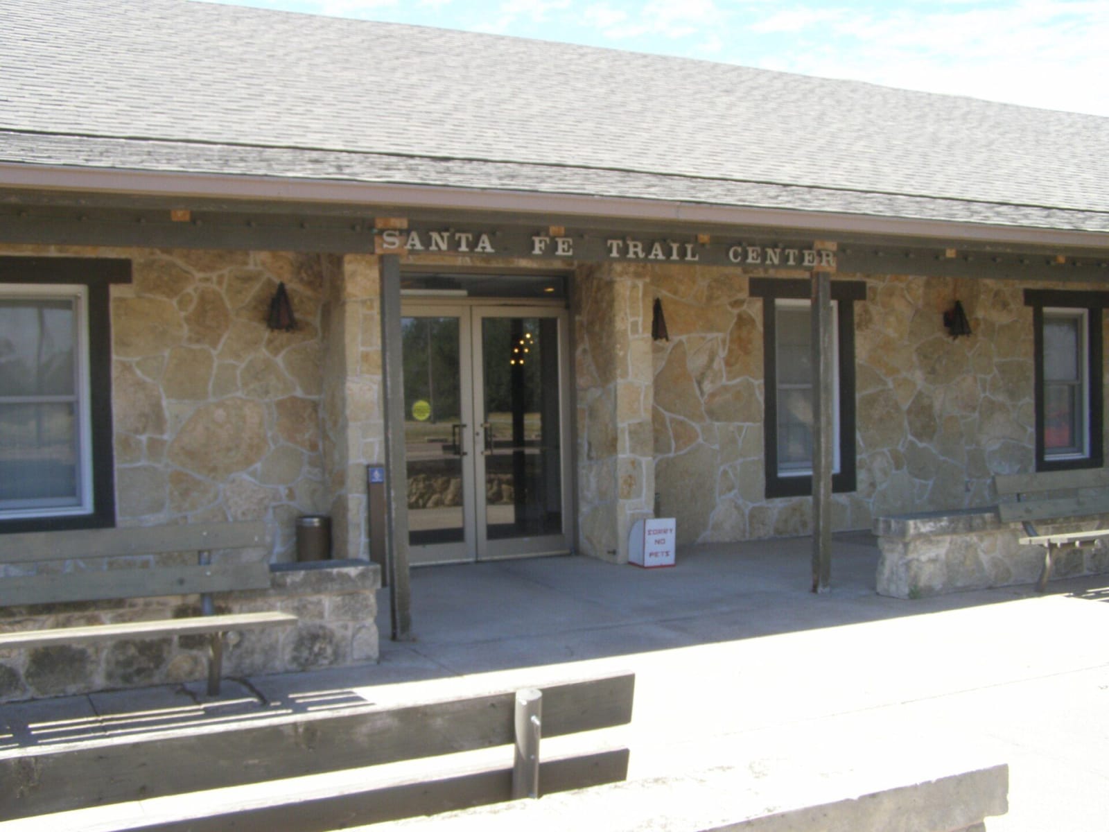
The stone front entrance of the Santa Fe Trail Center in Larned, its name lettered above the doors.Chris Light / CC BY-SA 4.0 via Wikimedia Commons
🎭Cultural

Santa Fe Trail Center

Part ofCheyenne Bottoms & the Great Bend
On this driveThe Santa Fe Trail: Council Grove to the Dodge City Ruts

Pawnee County's museum and archive two miles west of Larned, ten buildings on ten acres that carry the story from the trail years into the town that grew up beside Fort Larned.

⏱
Duration
At least two hours, the museum suggests.
🎟
Admission
Paid admission covers the main galleries, historic and reproduction buildings and exhibition halls; the research library is free by appointment.
📅
Best Season
Year-round. Tuesday through Saturday, 9 a.m. to 5 p.m.

The Story

The Fort Larned Historical Society, founded in 1957 to open the fort to visitors, started with a small curio shop and a few displays at the post. The museum it grew into now spreads across ten buildings on ten acres on K-156, two miles west of Larned and four from the fort. Inside, the galleries begin with a full-size mounted bison and move through the Plains nations, the trappers of the mountains and the Southwest, and the Santa Fe Trail trade to a 1919 frame house and a brick-paved main street.

The grounds hold the town's history. There is a reproduction sod house and a dugout, the Frizell depot of the Santa Fe railway, a limestone cooling house, and the L'Dora one-room schoolhouse. The Johnson Street CME Escue Chapel was the first church built by Larned's African American congregation, about a century ago. Larned itself began in April 1872 with a building from the fort: Henry Booth, the fort's postmaster and later its sutler, floated the old sutler's mess house down the Pawnee River, and it served in turn as church, school, saloon and post office.

The research library holds more than 3,500 books, and the archives are the official repository for Pawnee County records, with more than 700 linear feet of papers, some 7,000 photographs and 2,300 magic lantern slides of trail sites, dust storms and county businesses. The museum has no trail ruts of its own; the staff will direct you to the nearby sites, including Pawnee Rock ten miles east.

Visitor Info

⏱
Time Needed
At least two hours, the museum suggests.
🎟
Admission
Paid admission covers the main galleries, historic and reproduction buildings and exhibition halls; the research library is free by appointment.
📅
Best Season
Year-round. Tuesday through Saturday, 9 a.m. to 5 p.m.
🛣️
Highway
K-156

On the Map

Nearby

The closest stops worth working into your route

historical4.1 mi away
Fort Larned National Historic Site
Nine sandstone buildings of 1866-68 on the Pawnee Fork, a post that guarded the Santa Fe Trail and served as the agency where the Plains nations came for the annuities promised at Medicine Lodge.
historical23 mi away
Barton County Historical Society Museum and Village
A village of buildings brought in from around Barton County to a lot on US-281 just south of Great Bend, from an 1898 limestone church to a steel Lustron house of 1950.
historical32 mi away
Ellinwood Underground
The basement storefronts under the sidewalks of an 1880s German railroad town on US-56, where a harness maker padlocked his shop in 1920 and left everything behind.
natural33 mi away
Cheyenne Bottoms and the Kansas Wetlands Education Center
A 41,000-acre natural sink northeast of Great Bend, diked into shallow pools where a large share of the continent's migrating shorebirds stop to feed on the mudflats each spring and fall.
natural36 mi away
Quivira National Wildlife Refuge
A rare inland salt marsh on Rattlesnake Creek, fed by salty groundwater, where whooping cranes stop on migration and the refuge's senior water right keeps coming up short.
attraction41 mi away
Big Well Museum
Greensburg's hand-dug well of 1887 and 1888, 109 feet deep and 32 across, and the half-ton Brenham pallasite meteorite that was pulled from the rubble of the old museum after the 2007 tornado.

Historical markers nearby

Roadside plaques and monuments within a short detour

Marker2.2 mi away
Birthplace of Farm Credit
Marker9.6 mi away
Camp Criley 1872
Marker11 mi away
Pawnee Rock
Marker21 mi away
Discoverer of Pluto
Marker22 mi away
Battle of Coon Creek
Marker26 mi away
Fort Zarah